Long Compton / Cuntone
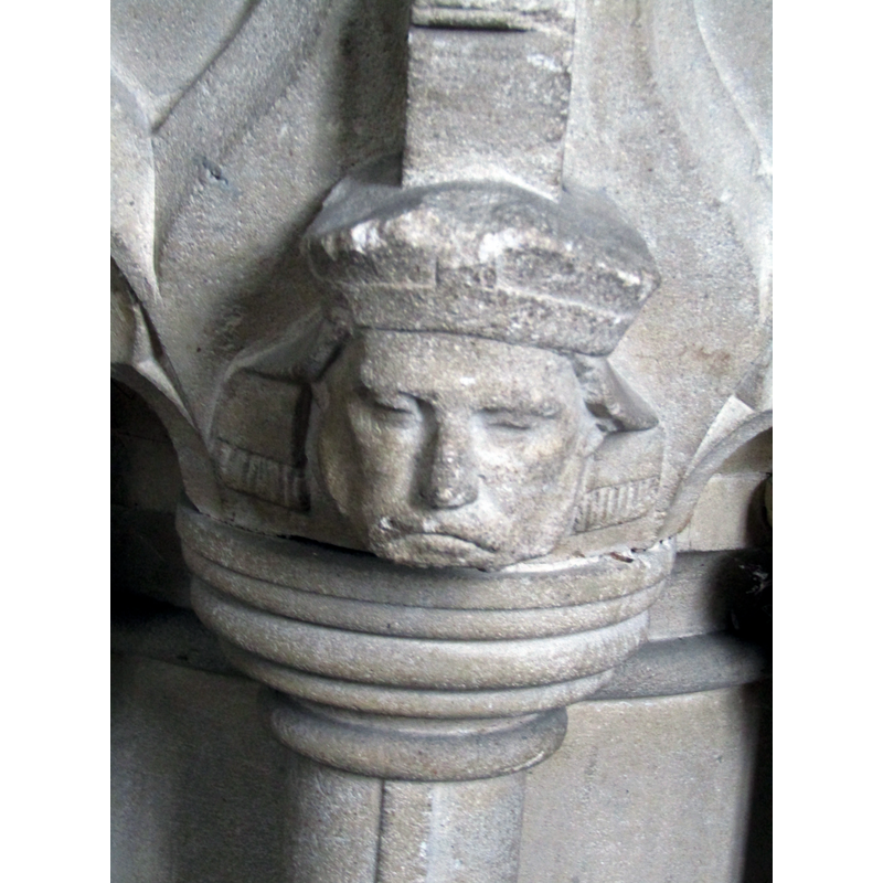
Image copyright © Colin Smith, 2024
Image and permission received from the author (e-mail of 12 May 2024}
Results: 7 records
view of basin - detail
Scene Description: the modern font
Copyright Statement: Image copyright © Colin Smith, 2024
Image Source: digital photograph 31 July 2024 by Colin Smith
Copyright Instructions: Image and permission received from the author (e-mail of 12 May 2024}
view of basin and cover
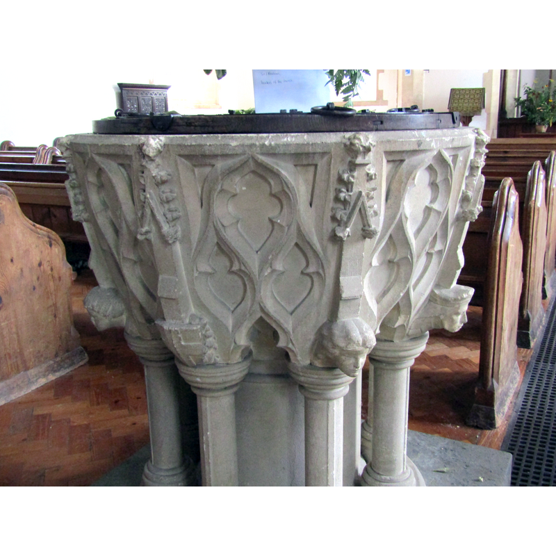
Scene Description: the modern font
Copyright Statement: Image copyright © Colin Smith, 2024
Image Source: digital photograph 31 July 2024 by Colin Smith
Copyright Instructions: Image and permission received from the author (e-mail of 12 May 2024}
view of church exterior - west view
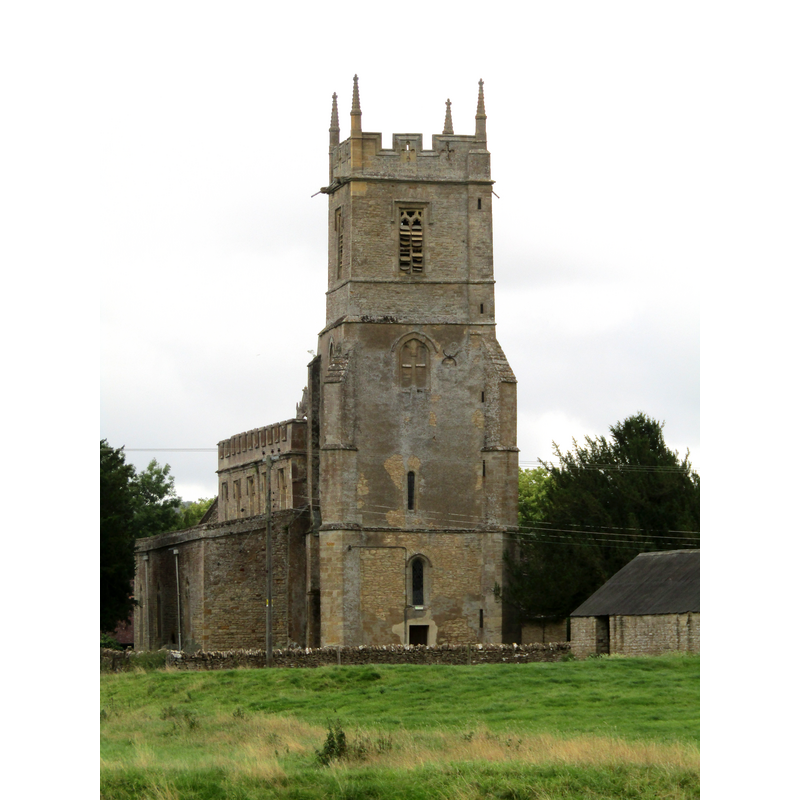
Copyright Statement: Image copyright © Colin Smith, 2024
Image Source: digital photograph 31 July 2024 by Colin Smith
Copyright Instructions: Image and permission received from the author (e-mail of 12 May 2024}
view of church exterior in context - southeast view
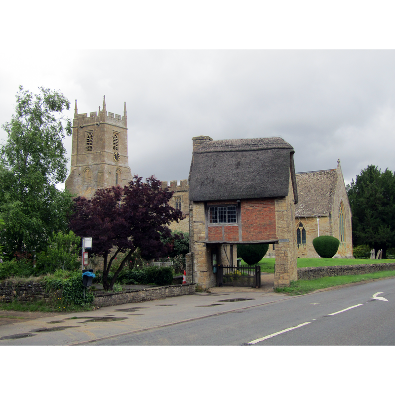
Copyright Statement: Image copyright © Colin Smith, 2024
Image Source: digital photograph 31 July 2024 by Colin Smith
Copyright Instructions: Image and permission received from the author (e-mail of 12 May 2024}
view of font and cover in context
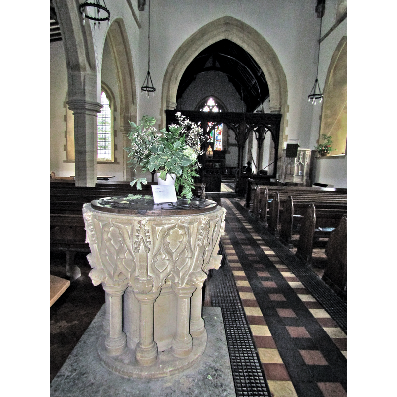
Scene Description: the modern font
Copyright Statement: Image copyright © Colin Smith, 2024
Image Source: digital photograph 31 July 2024 by Colin Smith
Copyright Instructions: Image and permission received from the author (e-mail of 12 May 2024}
view of font and cover in context
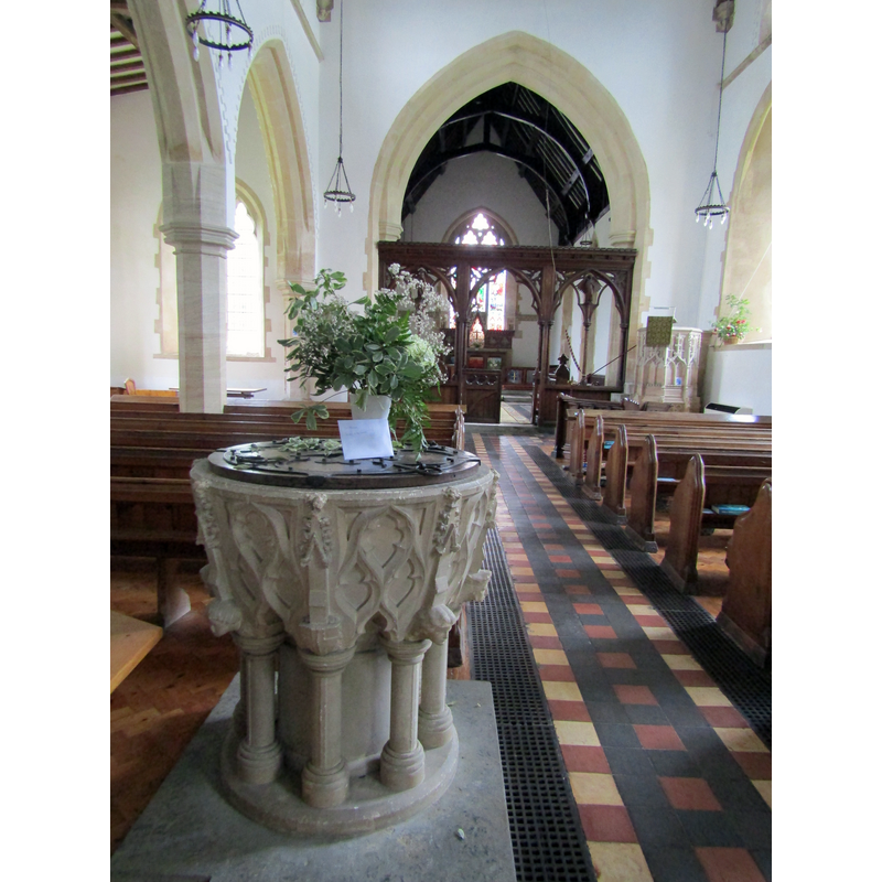
Scene Description: the modern font is visible in the foreground, left side
Copyright Statement: Image copyright © Colin Smith, 2024
Image Source: digital photograph 31 July 2024 by Colin Smith
Copyright Instructions: Image and permission received from the author (e-mail of 12 May 2024}
view of church interior - looking east
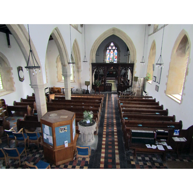
Scene Description: M/A
Copyright Statement: Image copyright © Colin Smith, 2024
Image Source: digital photograph 31 July 2024 by Colin Smith
Copyright Instructions: Image and permission received from the author (e-mail of 12 May 2024}
INFORMATION
Font ID: 13556COM
Object Type: Baptismal Font1
Font Century and Period/Style: 13th century, Early English
Church / Chapel Name: Parish Church of St. Peter and St. Paul
Church Patron Saint(s): St. Peter & St. Paul
Church Address: Long Compton, Warwickshire, CV36 5JJ
Site Location: Warwickshire, West Midlands, England, United Kingdom
Directions to Site: Located on the A3400, 6 km NN of Chipping Norton
Ecclesiastic Region: Diocese of Coventry
Historical Region: Hundred of Barcheston [in Domesday] -- Hundred of Kington
Additional Comments: disappeared font (the one from the original church here)
Font Notes:
Click to view
There is an entry for [Long] Compton [variant spelling] in the Domesday survey [http://domesdaymap.co.uk/place/SP2832/long-compton/] [accessed 6 January 2015], and it reports a priest, but not a church in it, though there probably was one there. A letter from "R.G." to the editor of The Gentleman's Magazine dated 10 January 1792 reports a hexagonal font in this church at the time. The Victoria County History (Warwick, vol. 5, 1949), however, notes: "There was a priest, indicating a church, here in 1086; (fn. 89) and a monastic legend of a miracle performed in the church of Compton by St. Augustine, [...] though of no historical value, does suggest that the site had traditionally been occupied by a church from early times. The church was given by Geoffrey de Mandeville in about 1140 to his foundation of Walden Abbey in Essex. [...] The building dates from the 13th century, the nave being probably early and the west tower later in the same century. [...] The font and other furniture are modern" [NB: the VCH reports renovations in the 19th century and in 1930, which obviously means that the old font disappeared some time after 1792]. A recent posting in A Church Near You [www.achurchnearyou.com/album.php?V=13099] [accessed 21 June 2008] shows pre- and post-2004 views of the church interior, both of which include a modern font and cover in the nave.
COORDINATES
UTM: 30U 597299 5761408
Latitude & Longitude (Decimal): 51.994799, -1.582828
Latitude & Longitude (DMS): 51° 59′ 41.27″ N, 1° 34′ 58.18″ W
MEDIUM AND MEASUREMENTS
Material: stone
Font Shape: hexagonal
Basin Exterior Shape: hexagonal
REFERENCES
- Victoria County History [online], University of London, 1993-. URL: https://www.british-history.ac.uk.