Bitton / Betone / Betune
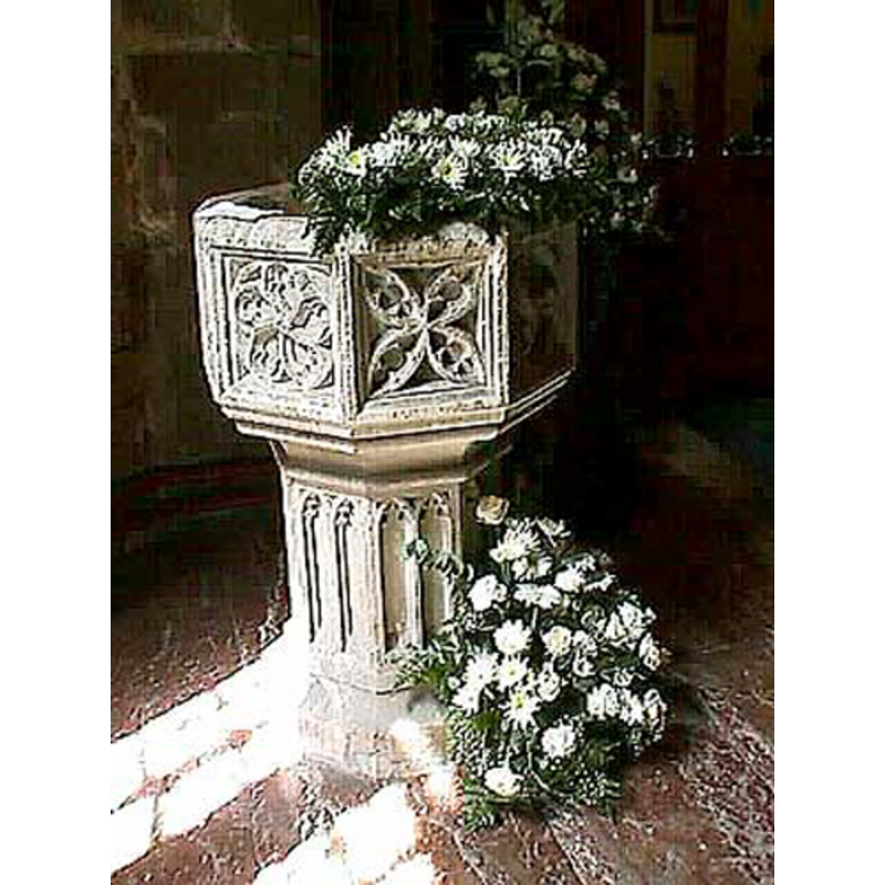
Image copyright © John Wilkes, 2008
Standing permission
Results: 6 records
view of font
Copyright Statement: Image copyright © John Wilkes, 2008
Image Source: digital photograph by John Wilkes [www.allthecotswolds.com]
Copyright Instructions: Standing permission
design element - patterns - tracery - varied
Copyright Statement: Image copyright © John Wilkes, 2008
Image Source: digital photograph by John Wilkes [www.allthecotswolds.com]
Copyright Instructions: Standing permission
view of church exterior - northeast view
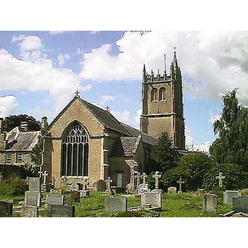
Copyright Statement: Image copyright © John Wilkes, 2008
Image Source: digital photograph by John Wilkes [www.allthecotswolds.com]
Copyright Instructions: Standing permission
view of church interior - nave - looking east
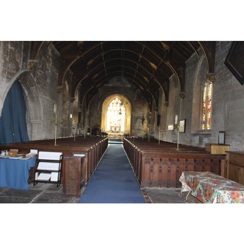
Copyright Statement: Image copyright © Ian at Cornish Churches, 2025
Image Source: digital photograph by Ian at Cornish Churches [http://cornishchurches.com/Bitton Church Gloucestershire-St. Mary/images/Bitton - The Nave.JPG] [accessed 29 January 2025]
Copyright Instructions: Standing permission
design element - architectural - arcade - trefoiled arches - 16
Copyright Statement: Image copyright © John Wilkes, 2008
Image Source: digital photograph by John Wilkes [www.allthecotswolds.com]
Copyright Instructions: Standing permission
view of font cover
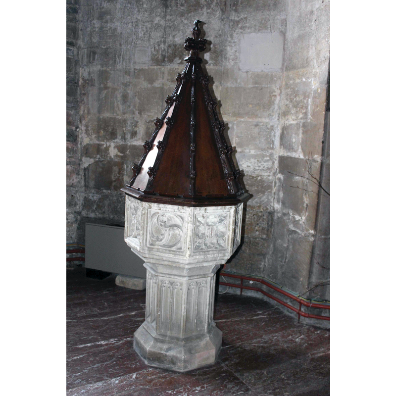
Copyright Statement: Image copyright © Ian at Cornish Churches, 2025
Image Source: digital photograph by Ian at Cornish Churches [http://cornishchurches.com/Bitton Church Gloucestershire-St. Mary/index.htm] [accessed 29 January 2025]
Copyright Instructions: Standing permission
INFORMATION
Font ID: 13522BIT
Object Type: Baptismal Font1, fragment
Font Century and Period/Style: 11th century (?), Pre-Norman
Church / Chapel Name: Parish Church of St. Mary the Virgin
Font Location in Church: [cf. FontNotes]
Church Patron Saint(s): St. Mary the Virgin
Church Address: Church Rd, Bitton, Bristol BS30 6LJ, United Kingdom -- Tel.: +44 7547 815731
Site Location: Somerset, South West, England, United Kingdom
Directions to Site: Located off the A431 [aka Bath Rd], 10 km E of Bristol
Historical Region: Hundred of Swineshead [in Domesday]
Additional Comments: disappeared font? (the one from the Domesday-time church) -- fragment og a font? (inside the new font?) e-mailed the parish about the claim in the FontNotes about a basin fragment inside the new font 20 Jan 2025
Font Notes:
Click to view
There are two entries for Bitton [variant spellings] in the Domesday survey [https://opendomesday.org/place/ST6869/bitton/] [accessed 29 Jamuary 2025], one of which reports "1 church. 1.0 church lands" in it. A font here is noted in Verey & Brooks (1999-2002): "Font. Caen stone, of 1846, carved in Perp[endicular] style." Baptismal font consisting of an octagonal basin the sides of which are decorated with varied tracery, raised on an octagonal pedestal base decorated with pairs of Ogee-style arches or windows, the lower base moulded. Wooden cover of octagonal pyramidal shape, with decorated arrises. Same date? The entry for this church in Historic England [Listing NGR: ST6819169336] notes: "Anglo-Saxon origins on an earlier British site. Norman remodelling with inserted Decorated and Perpendicular style windows. St Catherine's Chapel (north side) added 1298-9. West tower 1370s. Late C14 chancel. Transept removed C15. Restored in C19; it mentions no font in it. The entry for this church in St Mary's web site [https://www.stmarysbitton.org.uk/heritage/707-2/] [accessed 29 January 2025] informs that inside the bowl of the modern font is located the nasin of the earlier font; it cites as source a booklet [...] written and devised by Joy Gerrish in 1970, which has been updated; it reports: "The font, carved of Caen stone was made in 1846. The bowl of the previous font was placed inside it. It has a conical pointed cover, most likely of yew dating from a similar period." [NB: we have no other information or evidence on the earlier basin; the original church was already reported in the 1086 Domesday survey [cf. supra]]
Credit and Acknowledgements: We are grateful to John Wilkes, of www.allthecotswolds.com, and to Ian at ian@cornishchurches.com for their photographs of this church and font
COORDINATES
UTM: 30U 536321 5698046
Latitude & Longitude (Decimal): 51.432447, -2.477502
Latitude & Longitude (DMS): 51° 25′ 56.81″ N, 2° 28′ 39.01″ W
LID INFORMATION
Date: modern?
Material: wood
Apparatus: yes
Notes: [cf. FontNotes
REFERENCES
- Verey, David, Gloucestershire, London: Penguin Books, 1999-2002, vol. 2: 194