Fladbury / Fladbyrig / Fladdebir / Flanderbund / Fledanburth / Fledanbyrig / Fledeberie / Fledebirie / Fleodanglyng
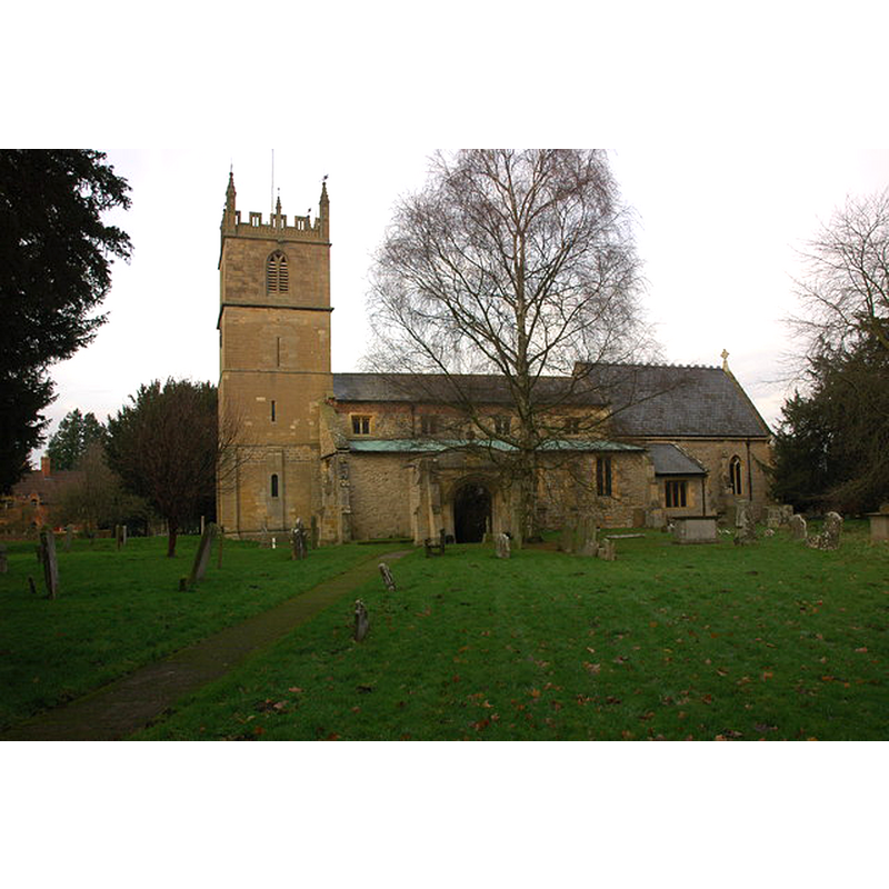
Image copyright © Philip Halling, 2008
CC-BY-SA-2.0
Results: 3 records
view of church exterior - south view
Copyright Statement: Image copyright © Philip Halling, 2008
Image Source: digital photograph taken 30 November 2008 by Philip Halling [www.geograph.org.uk/photo/1068782] [accessed 24 September 2014]
Copyright Instructions: CC-BY-SA-2.0
view of church interior - nave - looking west
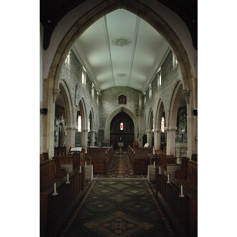
Scene Description: the modern font at the west end
Copyright Statement: Image copyright © Philip Halling, 2008
Image Source: digital photograph taken 30 November 2008 by Philip Halling [www.geograph.org.uk/photo/1068784] [accessed 24 September 2014]
Copyright Instructions: CC-BY-SA-2.0
view of font in context
![the modern font [cf. FontNotes]](/static-50478a99ec6f36a15d6234548c59f63da52304e5/others/image_not_available.jpg)
Scene Description: the modern font [cf. FontNotes]
![the modern font [cf. FontNotes]](/static-50478a99ec6f36a15d6234548c59f63da52304e5/bsi-testing-site/others/image_not_available.jpg)
INFORMATION
Font ID: 13514FLA
Object Type: Baptismal Font1?
Font Century and Period/Style: 11th - 12th century, Pre-Conquest? / Norman?
Church / Chapel Name: Parish Church of St. John the Baptist
Church Patron Saint(s): St. John the Baptist
Church Address: Station Road, Fladbury, Worcestershire, WR10 2QB
Site Location: Worcestershire, West Midlands, England, United Kingdom
Directions to Site: Located off (S) the A4538, 4-5 km NW of Eversham
Ecclesiastic Region: Diocese of Worcester
Historical Region: Hundred of Oswaldslow [in Domesday] -- Hundred of Halshire
Additional Comments: disappeared font? (the one from the Domesday-time church here)
Font Notes:
Click to view
There is an entry for Faldbury [variant spelling] in the Domesday survey [http://domesdaymap.co.uk/place/SO9946/fladbury/] [accessed 24 September 2014]; it reports a priest and church lands in it. Miller (1890) notes the Norman base of the tower, but mentions no font in this church. The Victoria County History (Worcester, vol. 3, 1913) notes: "There was possibly a church at Fladbury in 1086, as there was then a priest there. [...] The advowson has always belonged to the see of Worcester. [...] A church stood here in the 12th century, but of this building only the tower remains [...] The altar table, marble reredos, stone pulpit and font are all of recent date." English Heritage (1965) reports a "a Perpendicular-style font of c1850". Brooks & Pevsner (2007) give the date of the modern font as "c. 1848". There appear to be two 19th-century fonts in this church [cf. Images area]. [NB: we have no information on the earlier font(s) of this church]
COORDINATES
UTM: 30U 568027 5774267
Latitude & Longitude (Decimal): 52.114752, -2.006526
Latitude & Longitude (DMS): 52° 6′ 53.11″ N, 2° 0′ 23.5″ W
REFERENCES
- Victoria County History [online], University of London, 1993-. URL: https://www.british-history.ac.uk.
- Brooks, Alan, Worcestershire, New Haven; London: Yale University Press, 2007, p. 316
- Miller, George [Revd.], The Parishes of the Diocese of Worcester, Birmingham: Hall & English, 1890, vol. 2: 188