Morton Bagot / Moreton Bagot / Mortone [Domesday]
![Main image for Morton Bagot / Moreton Bagot / Mortone [Domesday]](/static-50478a99ec6f36a15d6234548c59f63da52304e5/compressed/1141213004_compressed.png)
Image copyright © [in the public domain]
Released by its author into the public domain
Results: 6 records
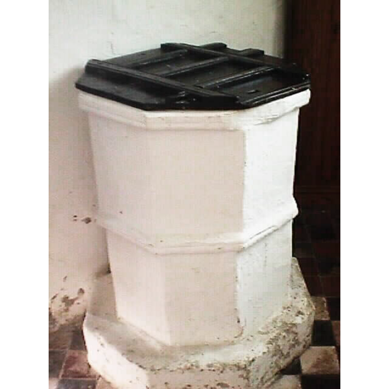
view of font and cover in context
Copyright Statement: Image copyright © [in the public domain]
Image Source: digital photograph taken 12 September 2009 by Argrogan [http://commons.wikimedia.org/wiki/File:Morton_Bagot_Holy_Trinity_Font_021.jpg] [accessed 24 November 2014]
Copyright Instructions: Released by its author into the public domain
design element - motifs - moulding
Copyright Statement: Image copyright © John Wilkes, 2008
Image Source: digital photograph taken by John Wilkes 20 September 2008
Copyright Instructions: Standing permission
design element - motifs - moulding
Copyright Statement: Image copyright © John Wilkes, 2008
Image Source: digital photograph taken by John Wilkes 20 September 2008
Copyright Instructions: Standing permission
view of church exterior - south view
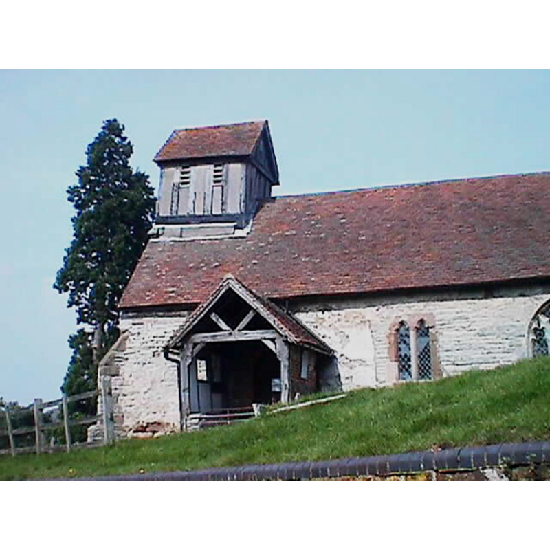
Copyright Statement: Image copyright © John Wilkes, 2008
Image Source: digital photograph taken by John Wilkes 20 September 2008
Copyright Instructions: Standing permission
view of church exterior - southeast view
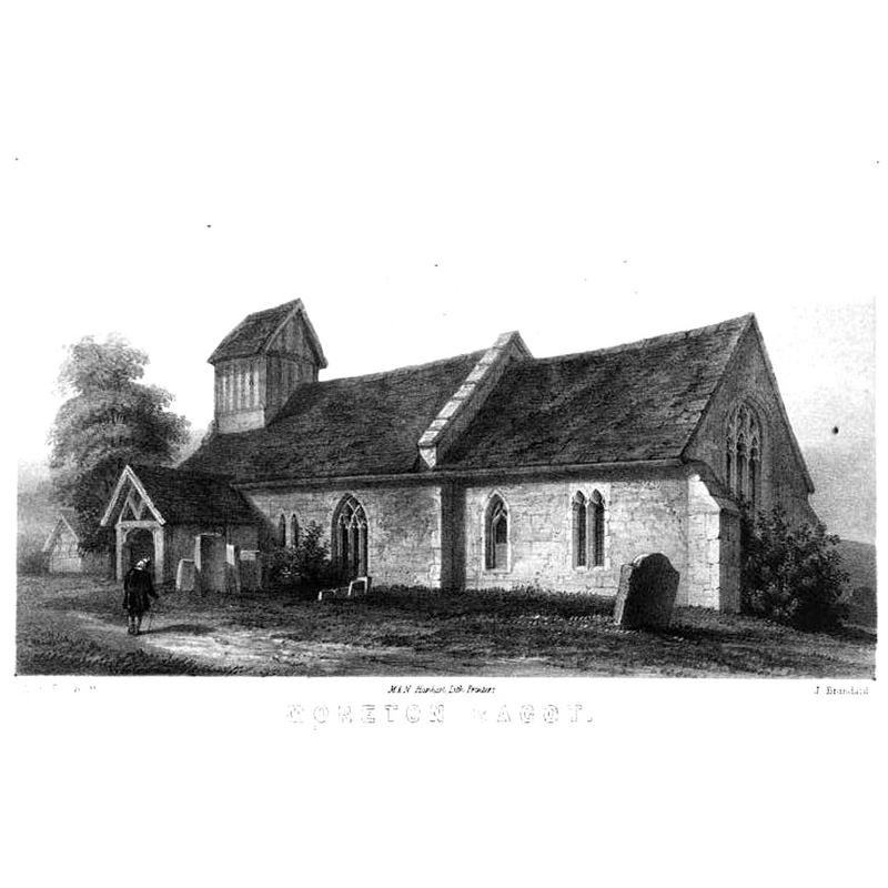
Copyright Statement: Image copyright © [in the public domain]
Image Source: engraving in Notices of the churches of Warwickshire (vol. 2, 1858)
Copyright Instructions: PD
view of church interior - detail
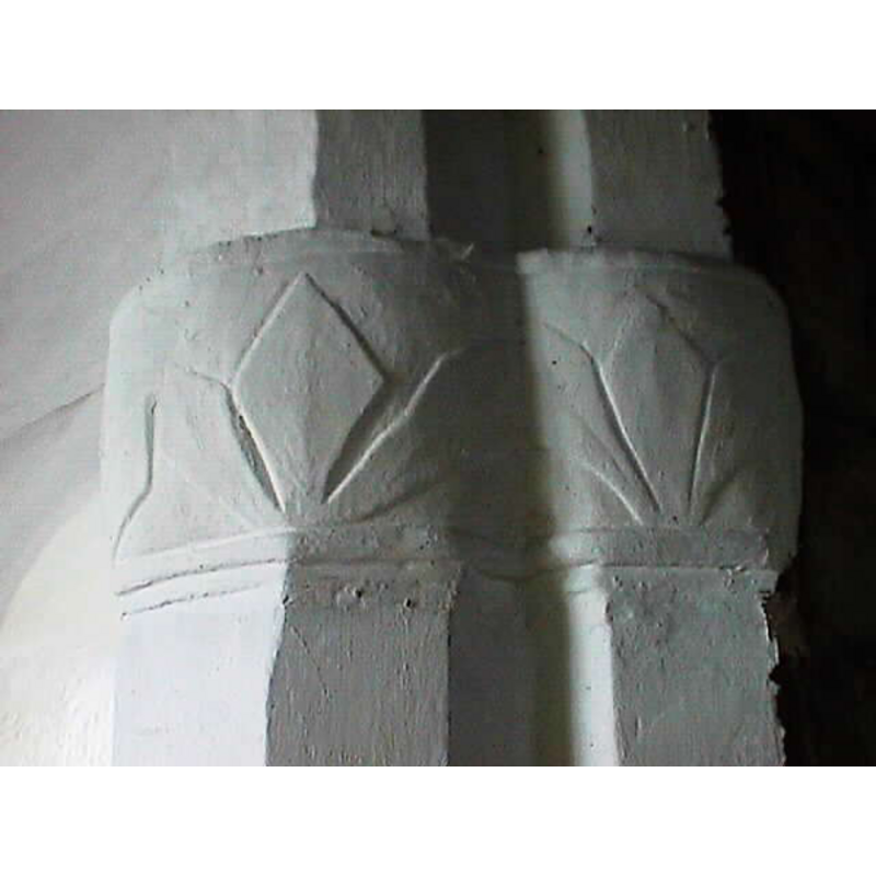
Copyright Statement: Image copyright © John Wilkes, 2008
Image Source: digital photograph taken by John Wilkes 20 September 2008
Copyright Instructions: Standing permission
INFORMATION
Font ID: 13512MOR
Object Type: Baptismal Font1
Font Century and Period/Style: 13th century, Early English
Church / Chapel Name: Parish Church of the Holy Trinity
Font Location in Church: Inside the church, W end, S side, by the S entranceway
Church Patron Saint(s): The Holy Trinity
Church Address: Morton Bagot, Warwickshire B80 7EJ
Site Location: Warwickshire, West Midlands, England, United Kingdom
Directions to Site: Located off the A4189, between Oldberrow (NE) and Spernall (SW), E of Studley, 10 km N of Alcester, 15 km from Stratord-upon-Avon
Ecclesiastic Region: Diocese of Coventry
Historical Region: Hundred of Ferncombe [in Domesday times] -- Hundred of Barlichway
Font Notes:
Click to view
There is an entry for Morton [Bagot] [variant spelling] in the Domesday survey [http://domesdaymap.co.uk/place/SP1164/morton-bagot/] [accessed 24 November 2014], but it mentions neither cleric nor church in it. The entry for this church in Notices of the churches of Warwickshire (vol. 1, 1847) notes: "The recess formed by the north doorway, now blocked up, is, internally, two feet deep; partly within it stands the font. This consists of a plain octagonal-shaped basin, 2 feet 11 1/2 inches high, placed on a raised basement, 4 inches high. The hollow of the basement is 12 inches deep, the diameter of the basin is 21 1/2 inches. On it is a plain boarded font cover composed of pieces of wood crossing on the top; this appears to be one of the numerous font covers of the seventeenth century." The Victoria County History (Warwick, vol. 3, 1945) notes: "The font is a plain octagonal stone, thickly colourwashed, with a moulding of the 13th century at the top and another at half height. It has a 16th-century flat wood cover with moulded cross-framing and pierced by two holes for the former staples."
Credit and Acknowledgements: We are grateful to John Wilkes, of www.allthecotswolds,com, for his photographs of church and font
COORDINATES
UTM: 30U 579322 5792855
Latitude & Longitude (Decimal): 52.280333, -1.837253
Latitude & Longitude (DMS): 52° 16′ 49.2″ N, 1° 50′ 14.11″ W
MEDIUM AND MEASUREMENTS
Material: stone
Font Shape: octagonal, mounted
Basin Exterior Shape: octagonal
Diameter (includes rim): 53.75 cm*
Basin Depth: 30 cm*
Font Height (less Plinth): 88.75 cm*
Font Height (with Plinth): 98.75 cm*
Notes on Measurements: * in feet/inches in Notices of the churches of Warwickshire (vol. 1, 1847)
LID INFORMATION
Date: 16th-17th century?
Material: wood, oak?
Apparatus: no
Notes: [cf. FontNotes]
REFERENCES
- Victoria County History [online], University of London, 1993-. URL: https://www.british-history.ac.uk.
- Warwickshire Natural History and Archaeological Society. Architectural Committee, Notices of the churches of Warwickshire, Rivington, London; [etc.]: Henry T. Cooke, 1847-, vol. 1: 162ff