Shalfleet / Chaldflut / Eskaudfflete / Scaudeflete / Scealdanfleot / Schaldeflet / Scheldflute / Seldeflet
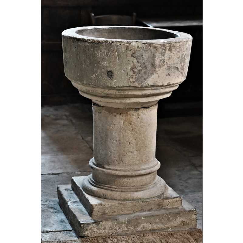
Image copyright © Michael Garlick, 2019
CC-BY-SA-2.0
Results: 12 records
view of font
Scene Description: said to be a late-16thC basin on a later pedestal base
Copyright Statement: Image copyright © Michael Garlick, 2019
Image Source: digital photograph taken 15 August 2019 by Michael Garlick [www.geograph.org.uk/photo/6239662] ]accessed 20 February 2020]
Copyright Instructions: CC-BY-SA-2.0
design element - motifs - moulding - graded
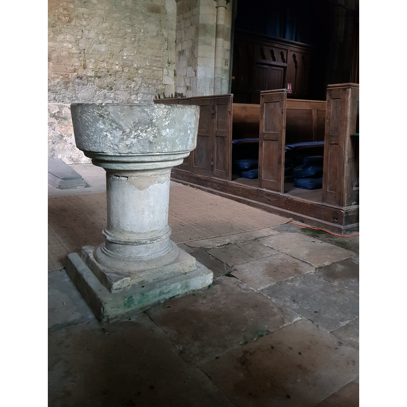
Scene Description: the pedestal base is said to be of a later date
Copyright Statement: Image copyright © Rhod Powell, 2020
Image Source: digital photograph taken 25 February 2020 by Rhod Powell
Copyright Instructions: Image and permission received from the author (e-mail of 27 February 2020)
view of object in context
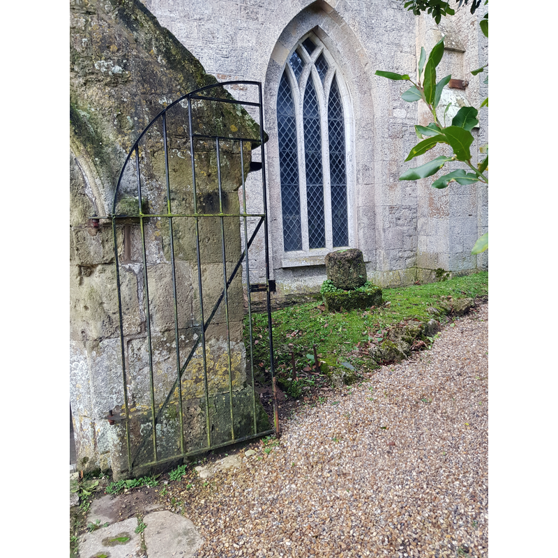
Copyright Statement: Image copyright © Rhod Powell, 2020
Image Source: digital photograph taken 25 February 2020 by Rhod Powell
Copyright Instructions: Image and permission received from the author (e-mail of 27 February 2020)
view of object
![captioned "Redundant font" by the photographer [cf. FontNotes]](/static-50478a99ec6f36a15d6234548c59f63da52304e5/compressed/1200222009_compressed.png)
Scene Description: captioned "Redundant font" by the photographer [cf. FontNotes]
Copyright Statement: Image copyright © John Salmon, 2009
Image Source: digital image of a photograph taken 12 August 1999 by John Salmon [www.geograph.org.uk/photo/1173613] [accessed 20 February 2020]
Copyright Instructions: CC-BY-SA-2.0
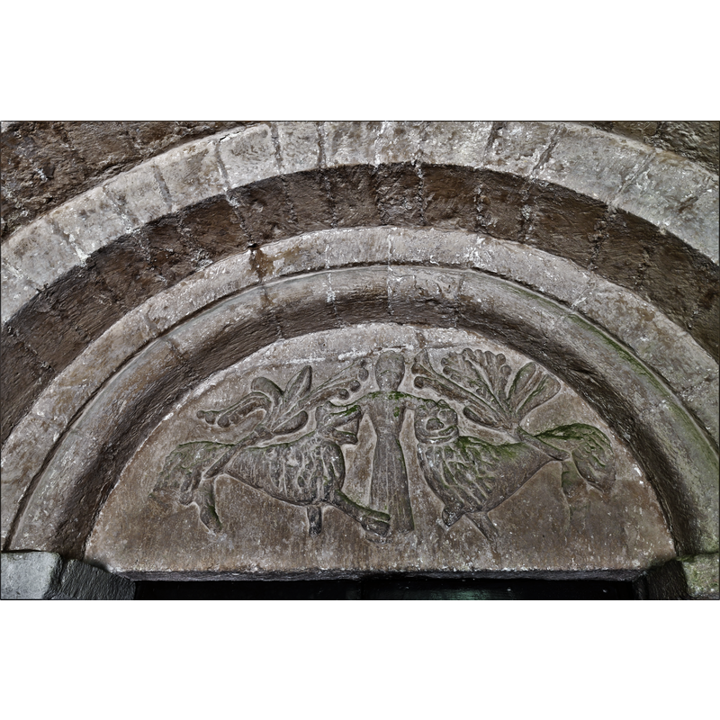
view of church exterior - north portal - tympanum
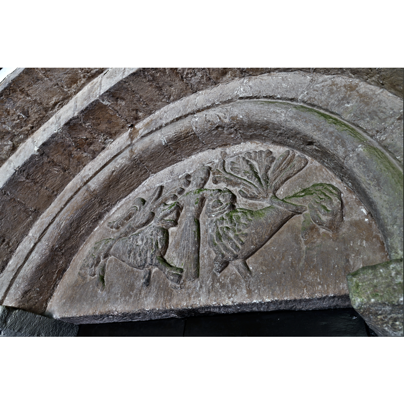
Copyright Statement: Image copyright © Michael Garlick, 2019
Image Source: digital photograph taken 15 August 2019 by Michael Garlick [www.geograph.org.uk/photo/6239638] ]accessed 20 February 2020]
Copyright Instructions: CC-BY-SA-2.0
view of church exterior - north portal - tympanum
Copyright Statement: Image copyright © Michael Garlick, 2019
Image Source: digital photograph taken 15 August 2019 by Michael Garlick [www.geograph.org.uk/photo/6239637] ]accessed 20 February 2020]
Copyright Instructions: CC-BY-SA-2.0
view of church exterior - north portal
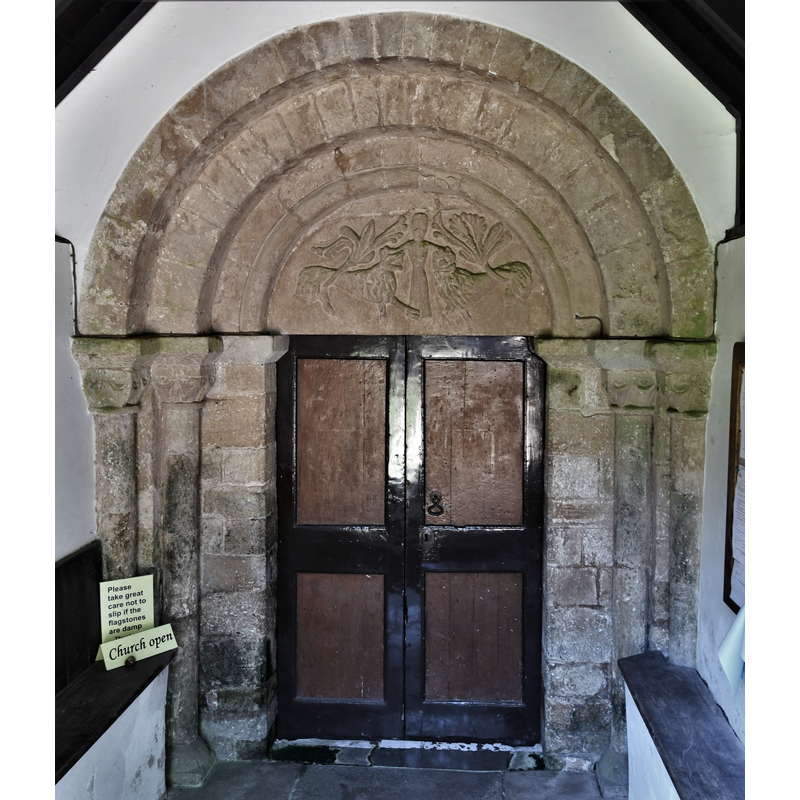
Copyright Statement: Image copyright © Michael Garlick, 2019
Image Source: edited detail of a digital photograph taken 15 August 2019 by Michael Garlick [www.geograph.org.uk/photo/6239635] ]accessed 20 February 2020]
Copyright Instructions: CC-BY-SA-2.0
view of church exterior - north porch and portal
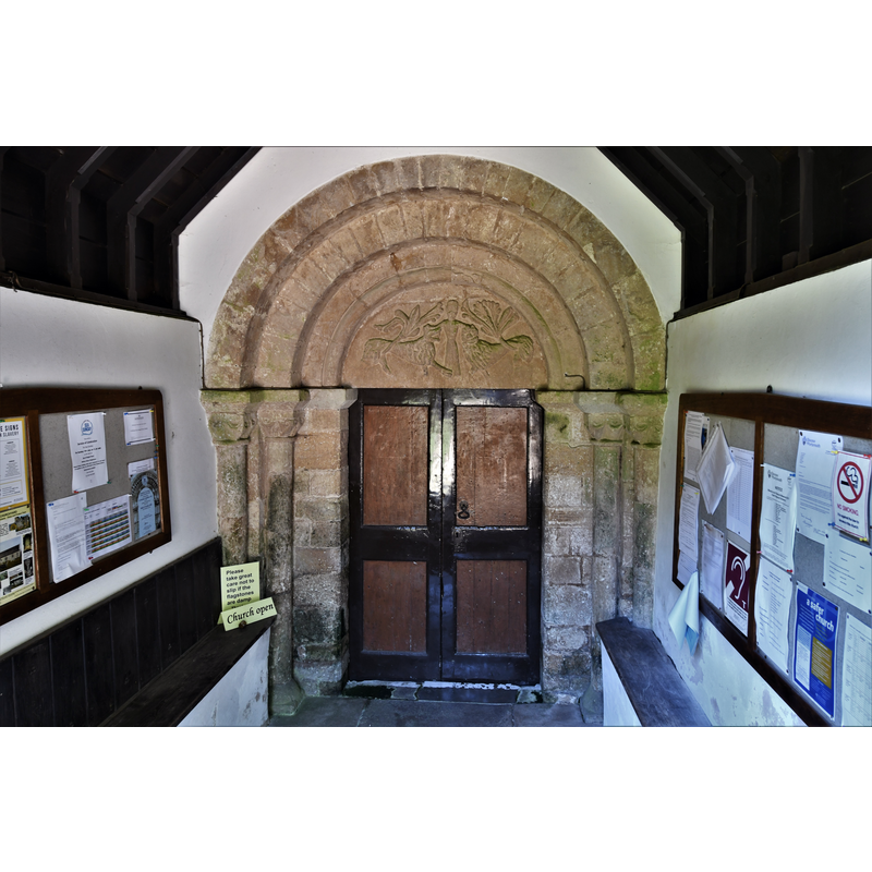
Copyright Statement: Image copyright © Michael Garlick, 2019
Image Source: digital photograph taken 15 August 2019 by Michael Garlick [www.geograph.org.uk/photo/6239635] ]accessed 20 February 2020]
Copyright Instructions: CC-BY-SA-2.0
view of church exterior - northeast view
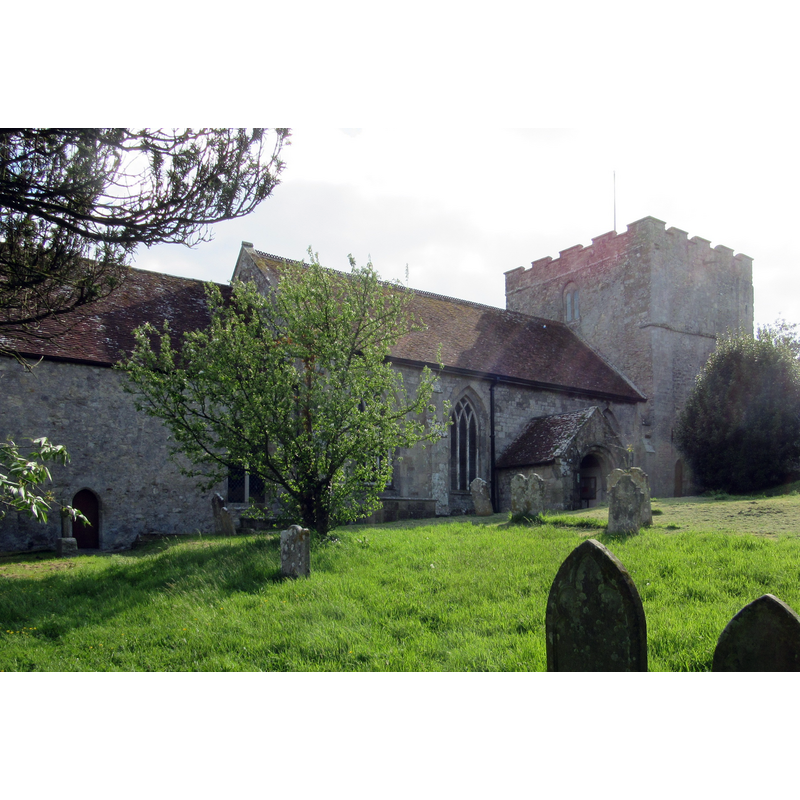
Copyright Statement: Image copyright © [in the public domain]
Image Source: photograph taken 15 May 2016 by Hassocks5489 [https://commons.wikimedia.org/wiki/File:St_Michael_the_Archangel's_Church,_Main_Road_(A3054),_Shalfleet_(May_2016)_(1).JPG] [accessed 20 February 2020]
Copyright Instructions: CC-Zero
view of church interior - looking west
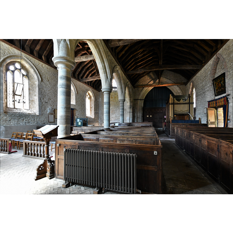
Scene Description: only the upper rim of the font is visible here, at the west end of the south aisle, by the green/teal cabinet next to the south entranceway
Copyright Statement: Image copyright © Michael Garlick, 2019
Image Source: digital photograph taken 15 August 2019 by Michael Garlick [www.geograph.org.uk/photo/6239650] ]accessed 20 February 2020]
Copyright Instructions: CC-BY-SA-2.0
view of church interior - looking east
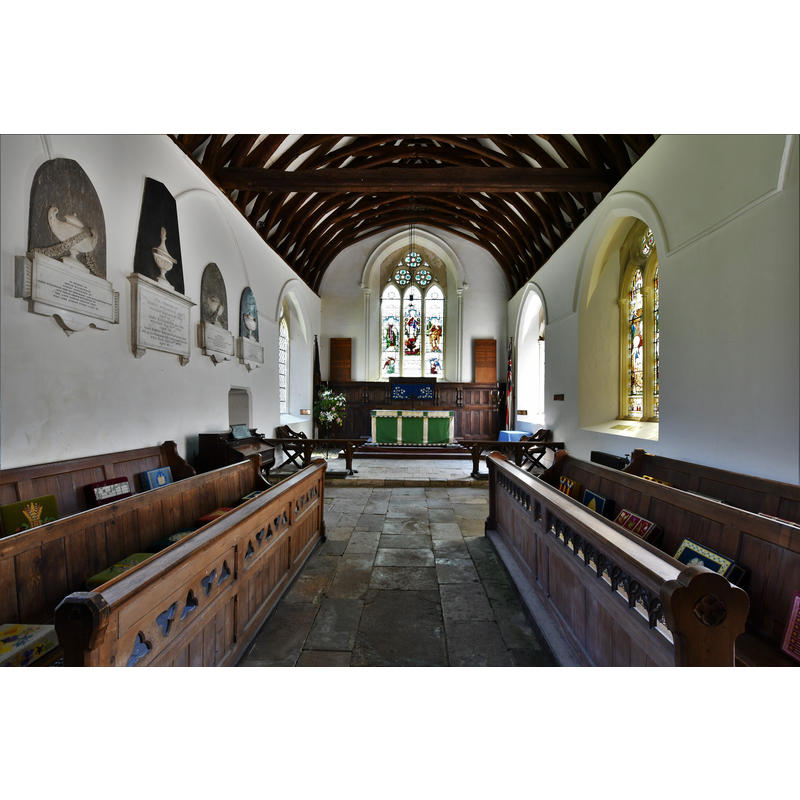
Copyright Statement: Image copyright © Michael Garlick, 2019
Image Source: digital photograph taken 15 August 2019 by Michael Garlick [www.geograph.org.uk/photo/6239645] ]accessed 20 February 2020]
Copyright Instructions: CC-BY-SA-2.0
view of object
![the original church here was pre-1986; is this any part of it? a font even? [cf. FontNotes]](/static-50478a99ec6f36a15d6234548c59f63da52304e5/compressed/1200326002_compressed.png)
Scene Description: the original church here was pre-1986; is this any part of it? a font even? [cf. FontNotes]
Copyright Statement: Image copyright © Rhod Powell, 2020
Image Source: digital photograph taken 25 February 2020 by Rhod Powell
Copyright Instructions: Image and permission received from the author (e-mail of 27 February 2020)
INFORMATION
Font ID: 13493SHA
Object Type: Baptismal Font1
Font Century and Period/Style: 16th century(late?) [basin only] [composite font], Elizabethan [basin only] [compositefont]
Cognate Fonts: font at Carisbrooke
Church / Chapel Name: Parish Church of St. Michael the Archangel
Font Location in Church: Inside the church, in the W end of the S aisle
Church Patron Saint(s): St. Michael
Church Address: 1 Church Ln, Shalfleet, Newport PO30 4NF, UK
Site Location: Isle of Wight, South East, England, United Kingdom
Directions to Site: Located off the A3054, 12 km ENE of Freshwater
Ecclesiastic Region: Diocese of Portsmouth
Historical Region: Hundred of West Medine / Hundred of Bowcombe [in Domesday] -- formerly Hampshire
Additional Comments: composite font (the current font) -- disappeared font? (the original 11th-century (?) font; or, is it the object located now outside the church? RFI sent to local Friends of... asking for hrlp in sorting out this - email of 20 Feb 220)
Font Notes:
Click to view
There is an entry for Shalfleet [variant spelling] in the Domesday survey [https://opendomesday.org/place/SZ4189/shalfleet/] [accessed 20 February 2020]; it reports a church in it. Cox (1911) notes: "In this aisle [i.e., the south aisle] stands the font of plain design, and apparently of like date ; the circular bowl has a diameter of 27 in. ; but Mr. Stone assures us that it is " a made-up affair." The Victoria County History (Hampshire, vol. 5, 1912) notes: "Shalfleet Church, of which the invocation has been lost, is one of the most interesting in the Island. The original church was built before the Great Survey [1086], as it is there mentioned"; the VCH further notes that the registers start in 1604, but mentions no font in this church. Both font and cover are described in Lloyd & Pevsner (2006), the cover "has tapering panels with circle and dagger patterns, a text around the rim and the figure of a dove at the top -- quintessentially early C17". Described and illustrated in Brian Meade (2002) [http://www.shalfleet.net/shalfleet/shalfleet_church_guide.htm] [accessed 8 April 2008]: "The font is a made-up affair with a late sixteenth century bowl placed upon a Doric cap, and is similar to one at Carisbrooke." The entry for this church in Historic England [Listing NGR: SZ4137489234] notes: "Parish church. Saxo-Norman tower of c.1070 and north doorway of c.1150, south arcade, north aisle and chancel C13 but south windows probably replaced c.1630, south porch C15, north porch added 1754 and minor renovations of 1890 [...] North aisle has C13 column-shaped font." [NB: the listing dates from 1967, ammended in 1994, but the font described in it does not seem to match the present one either in appearance or location; the composite font now in use has a late-16th century cylindrical basin on a modern pedestal base, and it is located at the west end of the south aisle; there is, however, an object outside the church, that some have identified as a font: it consists of a plain cylindrical upper half mounted on a quadrangular base or plinth; the upper part may be a font basin if it is now upside down [cf. ImagesArea]]. [NB: a church existed here in the 11th century and has a 12th century a beautiful tympanum, but we have no information of its original font]
A query was sent on 20 February 2020 by BSI to a local contact [rhodpowell@btopenworld.com] at Shalfleet. Mr Powell confirmed the presence of the object on the west side of the north door, and consulted with the County Archeologist, who wrote: "[...] Yes the stone outside the church is certainly a fascination. The central hole betrays its function but the question seems to be whether it is a simple font bowl, now inverted, or simply the shaft of either a font or a free-standing stoup. In the past have tried to ease my fingers underneath it to see if I could feel a rim leading to a bowl cavity, but not with any success! I think a simple cleaning out of the central hole might help. If it is the shaft of a font, rather than a stoup, then it seems well suited to either a monopod font or cinque-form tabular font with a thick central shaft and four slender corner shafts. See my pictures at Arreton's present font. Calbourne's font offers a very interesting comparison. This has started out as a tabular monopod font with a circular shaft that looks like our Shalfleet stone. (We must check the diameter). The tabular bowl has had its corners sawn off, presumably a tasteful touch of restrained Reformation iconoclasm! Perhaps we should take another look at St Michael's font at Shalfleet; has it, perhaps, been remodelled after losing its corners? If the stone we see is actually the inverted bowl of a font, it would be particularly interesting. I expect the only way we are going to find out is to gently tilt it for a few centimetres and then glimpse or feel underneath. A task for a sunny day perhaps? The stone is typical local Bembridge Limestone and the nearest source is the inter-tidal coastal outcrop on Hamstead Ledge, some 3km to the north. A relatively easy transporting task if aided by a boat. If we are only seeing a font shaft then we are prompted to consider what may have happened to the bowl. If the bowl was ornate then it may have been removed during the Reformation. The garden of the manor house just across the road seems a good place to start! Also the old vicarage garden perhaps? Shalfleet church is a prestigious medieval building so perhaps the original font resembled the decorated tympanum over the north door. I am still puzzled about the petrology of the tympanum. - it hardly looks local. Dorset Oolite perhaps? Sometime in the past Arreton lost both its earlier font and its circular stoup. The Arreton font had a 13th century bowl. Portions of this were found in the churchyard sometime in the 19th century. The fragments show that it this was a tabular bowl composed of imported Purbeck 'marble'. Perhaps the same may once have graced Shalfleet.” Mr Powell added: "I feel that the best was forward may be to follow his suggestion and do a bit of exploration. I’ll discuss that with the Church Warden and see if we can find a way forward."
A query was sent on 20 February 2020 by BSI to a local contact [rhodpowell@btopenworld.com] at Shalfleet. Mr Powell confirmed the presence of the object on the west side of the north door, and consulted with the County Archeologist, who wrote: "[...] Yes the stone outside the church is certainly a fascination. The central hole betrays its function but the question seems to be whether it is a simple font bowl, now inverted, or simply the shaft of either a font or a free-standing stoup. In the past have tried to ease my fingers underneath it to see if I could feel a rim leading to a bowl cavity, but not with any success! I think a simple cleaning out of the central hole might help. If it is the shaft of a font, rather than a stoup, then it seems well suited to either a monopod font or cinque-form tabular font with a thick central shaft and four slender corner shafts. See my pictures at Arreton's present font. Calbourne's font offers a very interesting comparison. This has started out as a tabular monopod font with a circular shaft that looks like our Shalfleet stone. (We must check the diameter). The tabular bowl has had its corners sawn off, presumably a tasteful touch of restrained Reformation iconoclasm! Perhaps we should take another look at St Michael's font at Shalfleet; has it, perhaps, been remodelled after losing its corners? If the stone we see is actually the inverted bowl of a font, it would be particularly interesting. I expect the only way we are going to find out is to gently tilt it for a few centimetres and then glimpse or feel underneath. A task for a sunny day perhaps? The stone is typical local Bembridge Limestone and the nearest source is the inter-tidal coastal outcrop on Hamstead Ledge, some 3km to the north. A relatively easy transporting task if aided by a boat. If we are only seeing a font shaft then we are prompted to consider what may have happened to the bowl. If the bowl was ornate then it may have been removed during the Reformation. The garden of the manor house just across the road seems a good place to start! Also the old vicarage garden perhaps? Shalfleet church is a prestigious medieval building so perhaps the original font resembled the decorated tympanum over the north door. I am still puzzled about the petrology of the tympanum. - it hardly looks local. Dorset Oolite perhaps? Sometime in the past Arreton lost both its earlier font and its circular stoup. The Arreton font had a 13th century bowl. Portions of this were found in the churchyard sometime in the 19th century. The fragments show that it this was a tabular bowl composed of imported Purbeck 'marble'. Perhaps the same may once have graced Shalfleet.” Mr Powell added: "I feel that the best was forward may be to follow his suggestion and do a bit of exploration. I’ll discuss that with the Church Warden and see if we can find a way forward."
Credit and Acknowledgements: We are grateful to Rhod Powell, of Shalfleet, and to the County Archeologist for their help in investigating the object here
COORDINATES
UTM: 30U 611909 5617786
Latitude & Longitude (Decimal): 50.701111, -1.415278
Latitude & Longitude (DMS): 50° 42′ 4″ N, 1° 24′ 55″ W
MEDIUM AND MEASUREMENTS
Material: stone
Font Shape: round, mounted
Basin Interior Shape: round
Basin Exterior Shape: round
Diameter (includes rim): 67.5 cm*
Notes on Measurements: * [in inches in Cox (1911)]
LID INFORMATION
Date: early-17th century?
Material: wood
Apparatus: no
Notes: [cf. FontNotes]
REFERENCES
- Victoria County History [online], University of London, 1993-. URL: https://www.british-history.ac.uk.
- Cox, John Charles, Isle of Wight: its churches and religious houses, London: G. Allen & Sons, 1911, p. 141
- Lloyd, David W., The Isle of Wight, New Haven: Yale University Press, 2006, p. 272