Thurloxton
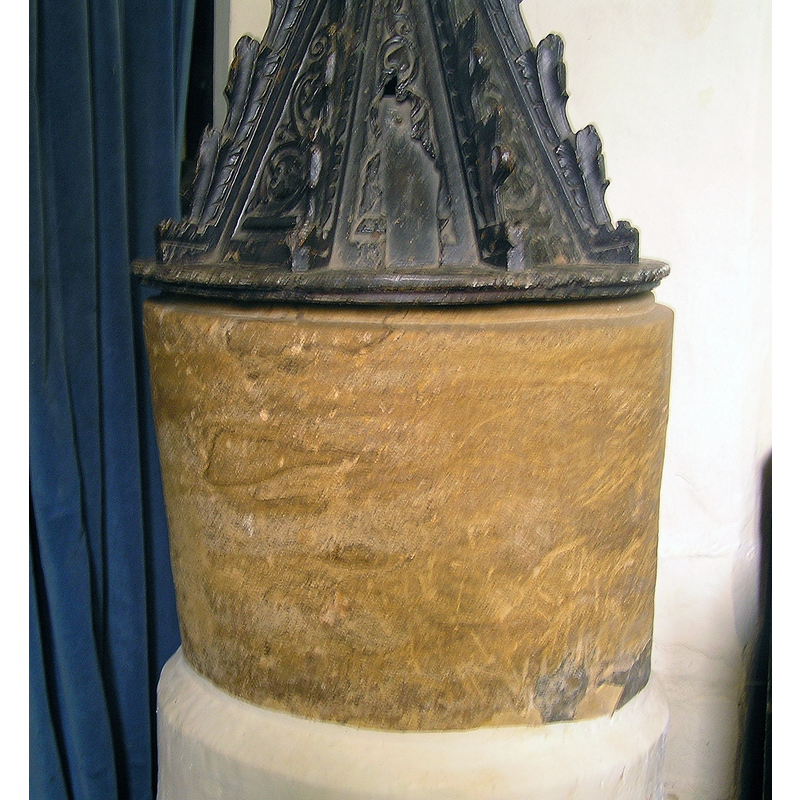
Image copyright © Tony Ethridge, 2009
Standing permission
Results: 3 records
view of basin and cover
Copyright Statement: Image copyright © Tony Ethridge, 2009
Image Source: digital photograph taken 25 April 2007 by Tony Ethridge
Copyright Instructions: Standing permission
view of church exterior - southeast view
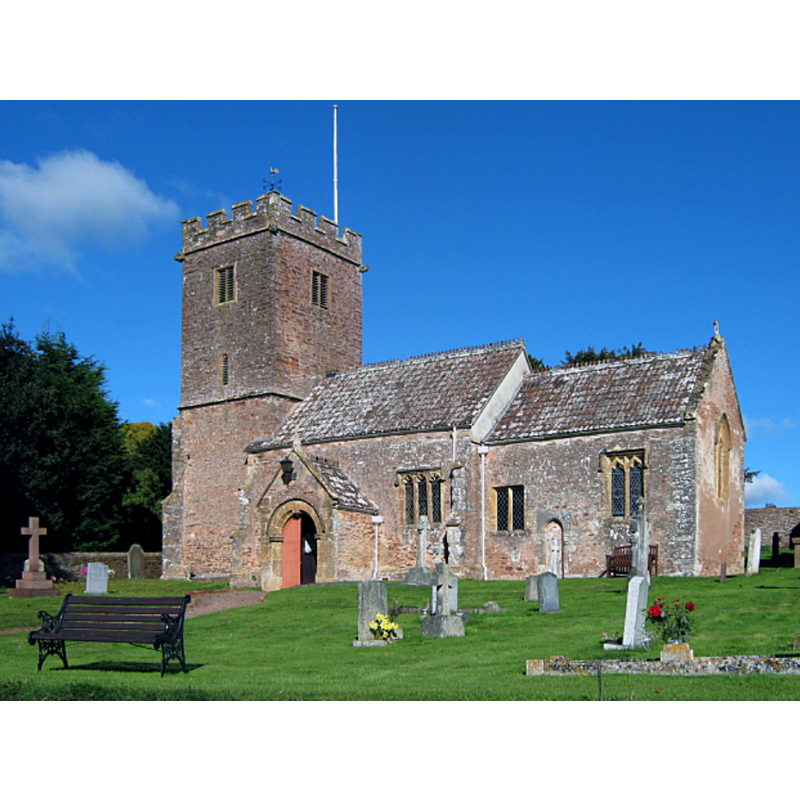
Copyright Statement: Image copyright © Ken Grainger, 2010
Image Source: digital photograph taken 24 October 2010 by Ken Grainger [www.geograph.org.uk/photo/2126654] [accessed 11 April, 2018]
Copyright Instructions: CC-BY-SA-2.0
view of church interior - nave - looking west
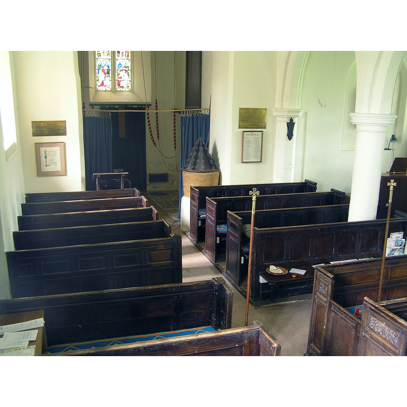
Scene Description: the font and cover by the north side of the tower arch
Copyright Statement: Image copyright © Tony Ethridge, 2009
Image Source: digital photograph taken 25 April 2007 by Tony Ethridge
Copyright Instructions: Standing permission
INFORMATION
Font ID: 13488THU
Object Type: Baptismal Font1
Font Date: ca. 1100?
Font Century and Period/Style: 11th - 12th century, Norman
Church / Chapel Name: Parish Church of St. Giles
Font Location in Church: Inside the church
Church Patron Saint(s): St. Giles [aka Aegidus, Egidus, Gilles]
Church Address: 54 Mill Ln, Thurloxton, Taunton TA2 8RJ, UK -- Tel.: +44 1278 662429
Site Location: Somerset, South West, England, United Kingdom
Directions to Site: Located off (W) the A38, equidistant [8 km] from Bridgwater (NE) and Taunton SW
Ecclesiastic Region: Diocese of Bath & Wells
Historical Region: Hundred of North Petherton
Font Notes:
Click to view
No entry for Thurloxton found in the Domesday survey. Wade & Wade (1929) report an "old tub font" in this church. The Victoria County History (Somerset, vol. 6, 1992) notes: "The church of Thurloxton may have been one of the daughter churches and chapels of the minster church of North Petherton, in which residuary rights were granted to Buckland priory before 1176. [...] By 1195 and probably much earlier it had become an independent rectory, and by that year a temporary vicarage had been established [...] The plain font, perhaps of c. 1100, has an octagonal, crocketted cover of the 14th century." The round tapering basin is raised on a modern base. Pevsner (1958) does not mention the font but reports a wooden font cover of the 1630s in this church. [NB: the 14th-century dating assigned to the cover in the VCH is quite unlikely; the octagonal pyramidal font is most likely 17th-century]. The entry for this church in Historic England [Listing NGR: ST2745830425] reports a "Norman tub font with a C17 cover" in it.
Credit and Acknowledgements: We are grateful to Tony Ethridge, of Somerset Villages, for the photograph of this font
COORDINATES
UTM: 30U 497429 5657443
Latitude & Longitude (Decimal): 51.0685, -3.0367
Latitude & Longitude (DMS): 51° 4′ 6.6″ N, 3° 2′ 12.12″ W
MEDIUM AND MEASUREMENTS
Material: stone
Font Shape: tub-shaped
Basin Interior Shape: round
Basin Exterior Shape: round
LID INFORMATION
Date: 17th-century?
Material: wood, oak?
Apparatus: no
Notes: [cf. FontNotes]
REFERENCES
- Victoria County History [online], University of London, 1993-. URL: https://www.british-history.ac.uk.
- Pevsner, Nikolaus, South and West Somerset, Harmondsworth: Penguin Books, 1958, p. 323
- Wade, G.H., Somerset, London: Methurn & Co., 1929, [http://www.gutenberg.org/files/12287/12287-h/12287-h.htm] [accessed 6 April 2008]