Stockland Bristol / Stocheland / Stockland Gaunts
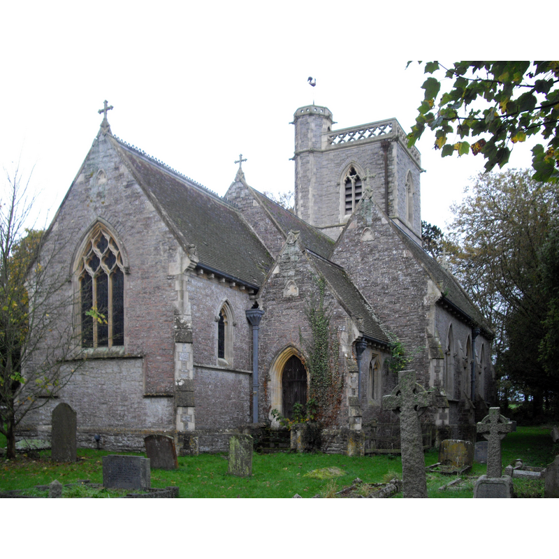
Image copyright © John Lord, 2011
CC-BY-SA-2.0
Results: 1 records
view of church exterior - northeast view
Scene Description: St Mary Magdalene's, the 19thC replacement church [the earlier Church of All Saints was demolished in 1885]
Copyright Statement: Image copyright © John Lord, 2011
Image Source: digital photograph taken 5 November 2011 by John Lord [www.geograph.org.uk/photo/2682842] [accessed 9 April 2018]
Copyright Instructions: CC-BY-SA-2.0
INFORMATION
Font ID: 13480STO
Object Type: Baptismal Font1
Font Century and Period/Style: 15th century, Perpendicular
Church / Chapel Name: Parish Church of St. Mary Magdalene [originally from the old church of All Saints]
Font Location in Church: Originally in All Saints' -- later moved to the new church dedicated to St. Mary Magdalene [cf. FontNotes]
Church Patron Saint(s): St. Mary Magdalene
Church Notes: new church built 1865; orig. church dedicated to All Saints was demolished 1885
Church Address: Stockland Bristol, Bridgwater TA5 2PZ, UK -- Tel.: +44 1278 652953
Site Location: Somerset, South West, England, United Kingdom
Directions to Site: Located just NW of Otterhampton, 11 km NW of Bridgwater
Ecclesiastic Region: Diocese of Bath & Wells
Historical Region: Hundred of Cannington
Additional Comments: re-cycled font (from the orig. church to the new one) -- disappeared font? (the one from the church documented 1259)
Font Notes:
Click to view
No entry found for Stockland Bristol in the Domesday survey. Wade & Wade (1929) note: "Its church has been entirely rebuilt (1865), but retains its Perp[endicular] font." Described in Pevsner (1958): "Octagonal, Perp[endicular], with frieze of pointed quatrefoils." The Victoria County History (Somerset, vol. 7, 1999) informs: "The former church, dedicated to All Saints in 1316 [...] In 1865-6 Thomas Daniel, lay rector and patron, rebuilt the church [...] on the site of the old and dedicated to St. Mary Magdalene [...] Original fittings from the earlier church include the 15th-century font and fragments of the screen." The VCH entry notes that "St. Mark's hospital, Bristol, had acquired the advowson by 1259", but we have no iknformation on the font of that period here.
COORDINATES
UTM: 30U 493792 5670604
Latitude & Longitude (Decimal): 51.186823, -3.088826
Latitude & Longitude (DMS): 51° 11′ 12.56″ N, 3° 5′ 19.78″ W
MEDIUM AND MEASUREMENTS
Material: stone
Font Shape: octagonal, mounted
Basin Interior Shape: round
Basin Exterior Shape: octagonal
REFERENCES
- Victoria County History [online], University of London, 1993-. URL: https://www.british-history.ac.uk.
- Victoria County History [online], University of London, 1993-. URL: https://www.british-history.ac.uk.
- Pevsner, Nikolaus, South and West Somerset, Harmondsworth: Penguin Books, 1958, p. 297
- Wade, G.H., Somerset, London: Methurn & Co., 1929, [http://www.gutenberg.org/files/12287/12287-h/12287-h.htm] [accessed 6 April 2008]