Farnham nr. Guildford / Ferneham
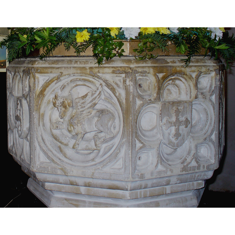
Image copyright © Colin Smith, 2008
Image and permission received (e-mail of 31 March 2008)
Results: 4 records
view of basin
Scene Description: [cf. Font notes]
Copyright Statement: Image copyright © Colin Smith, 2008
Image Source: detail of a digital photograph by Colin Smith, March 2008
Copyright Instructions: Image and permission received (e-mail of 31 March 2008)
view of church exterior - northeast view
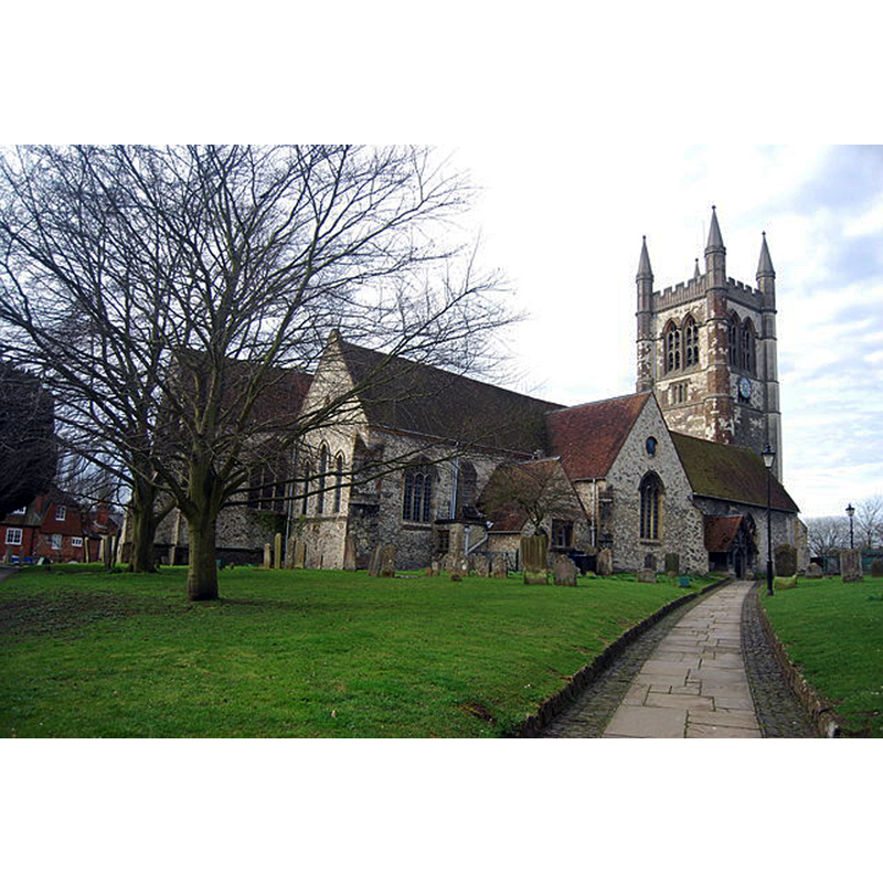
Copyright Statement: Image copyright © N Chadwick, 2013
Image Source: digital photograph taken 14 April 2013 by N Chadwick [www.geograph.org.uk/photo/3614758] [accessed 15 October 2015]
Copyright Instructions: CC-BY-SA-2.0
view of font in context
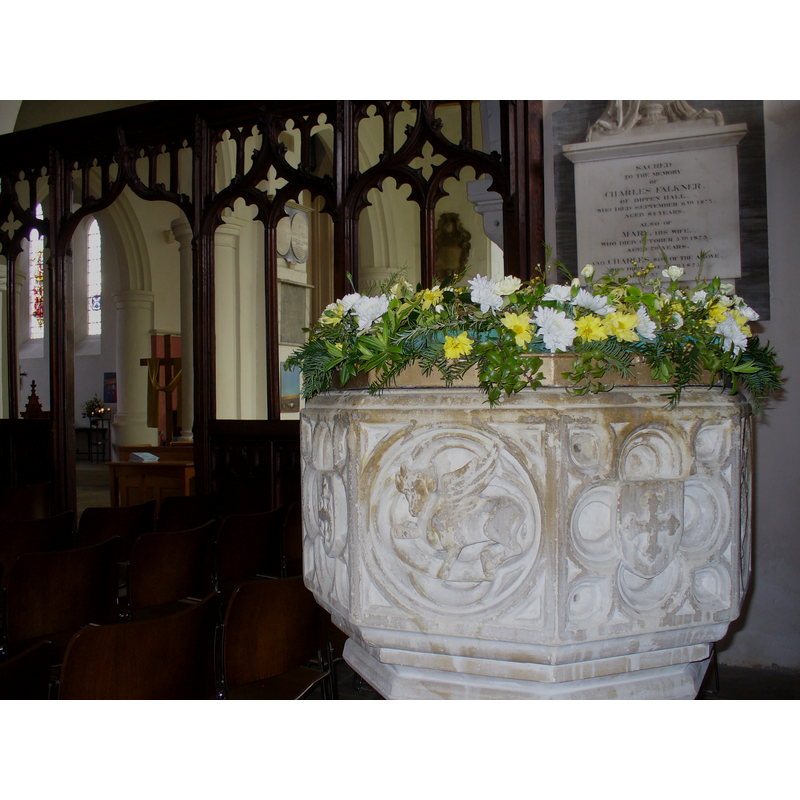
Copyright Statement: Image copyright © Colin Smith, 2008
Image Source: digital photograph by Colin Smith, March 2008
Copyright Instructions: Image and permission received (e-mail of 31 March 2008)
view of font and cover

INFORMATION
Font ID: 13465FAR
Object Type: Baptismal Font1?
Font Century and Period/Style: 11th century, Pre-Conquest? / Norman
Church / Chapel Name: Parish Church of St. Andrew
Church Patron Saint(s): St. Andrew
Church Address: Church Lane, Farnham, Surrey, GU9 7PW
Site Location: Surrey, South East, England, United Kingdom
Directions to Site: Located off (S) the A31, 16 km WSW of Guilford
Ecclesiastic Region: Diocese of Guildford
Historical Region: Hundred of Farnham
Additional Comments: disappeared font? (the one from the Domesday-time church here)
Font Notes:
Click to view
There is an entry for this Farnham [variant spelling] in the Domesday survey [http://opendomesday.org/place/SU8446/farnham/] [accessed 15 October 2015]; it mentions a church in it. Brayley (1850) writes: "The font (of the date 1767) is of veined white marble, standing on a platform in the south aisle. The font consists of an octagonal basin the sides of which are decorated with symbols of the four Evangelists alternating with other symbols or emblems (a shield charged with a trefoiled cross, Agnus Dei, etc.) inscribed in quatrefoil or octafoil panels; the underbowl chamfer is decorated with graded mouldings; the octagonal pedestal base is decorated with mouldings. It stands on an octagonal plinth. The shape of the cover is traditional, but the guilding, the colourful angels climbing the sides and the Baby Jesus finial are rather garish; it has a counterweight lifting system; probably modern. [NB: Brayley (ibid.) notes that the east end of the church dates probably from the early 12th century, but we have no information on the medieval font]
Credit and Acknowledgements: We are grateful to Colin Smith for the photograph of the modern font.
COORDINATES
UTM: 30U 653582 5675809
Latitude & Longitude (Decimal): 51.212999, -0.801075
Latitude & Longitude (DMS): 51° 12′ 46.79″ N, 0° 48′ 3.87″ W
LID INFORMATION
Date: modern / 20th-century?
Material: wood
Apparatus: yes; pulley system with counterweight
Notes: [cf. FontNotes]
REFERENCES
- Brayley, Edward Wedlake, A topographical history of Surrey, London: G. Willis, 1850, vol. 5: 273