Huish Episcopi / Huish Episcopi Langport
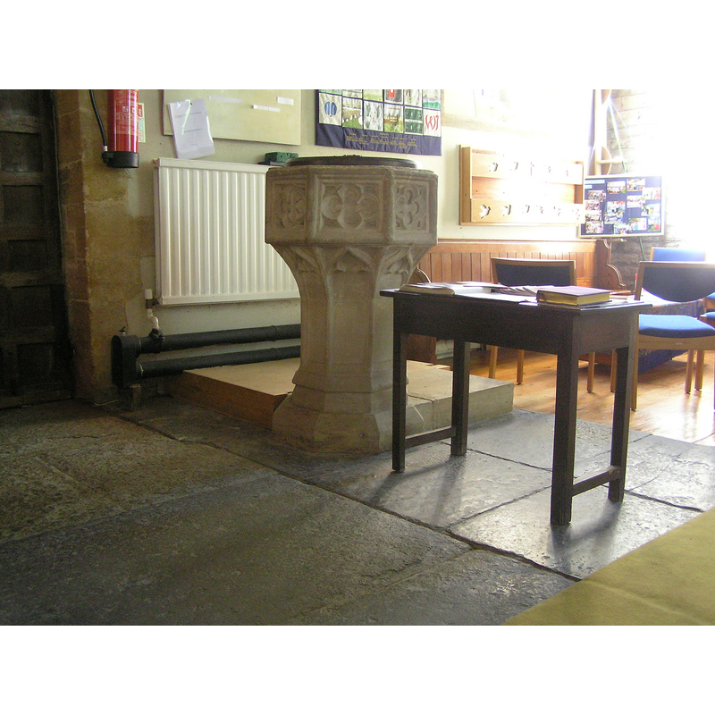
Image copyright © Tony Ethridge, 2009
Standing permission
Results: 8 records
view of font and cover in context
Scene Description: at the west end, by the south door
Copyright Statement: Image copyright © Tony Ethridge, 2009
Image Source: digital photograph taken 11 September 2009 by Tony Ethridge
Copyright Instructions: Standing permission
design element - motifs - quatrefoil - 8
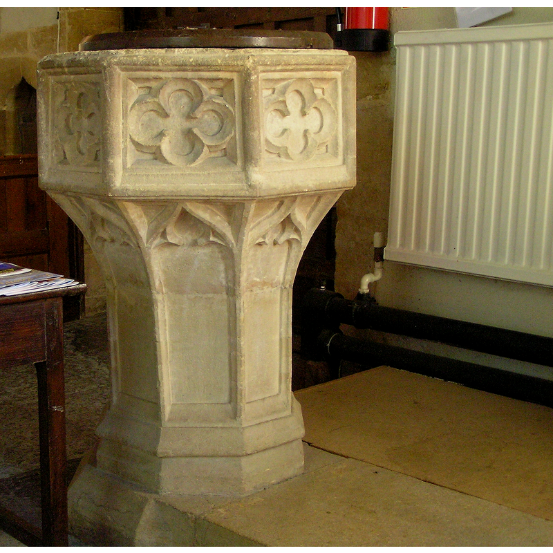
Copyright Statement: Image copyright © Tony Ethridge, 2009
Image Source: digital photograph taken 11 September 2009 by Tony Ethridge
Copyright Instructions: Standing permission
design element - architectural - arch-head - trefoiled - 8
Scene Description: the sides continuing down the stem angles
Copyright Statement: Image copyright © Tony Ethridge, 2009
Image Source: digital photograph taken 11 September 2009 by Tony Ethridge
Copyright Instructions: Standing permission
view of church exterior - south portal
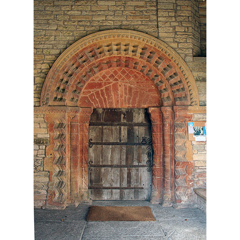
Scene Description: Source caption: "Huish Episcopi: south door, St Mary’s church. A splendid 12th century Norman doorway, said to be reddened by fire damage in the 13th century. The fire destroyed much of the early church and the present structure is largely Perpendicular Gothic."
Copyright Statement: Image copyright © Martin Bodman, 2008
Image Source: digital photograph taken 10 October 2008 by Martin Bodman [www.geograph.org.uk/photo/1002603] [accessed 6 February 2018]
Copyright Instructions: CC-BY-SA-2.0
view of church exterior - southeast view
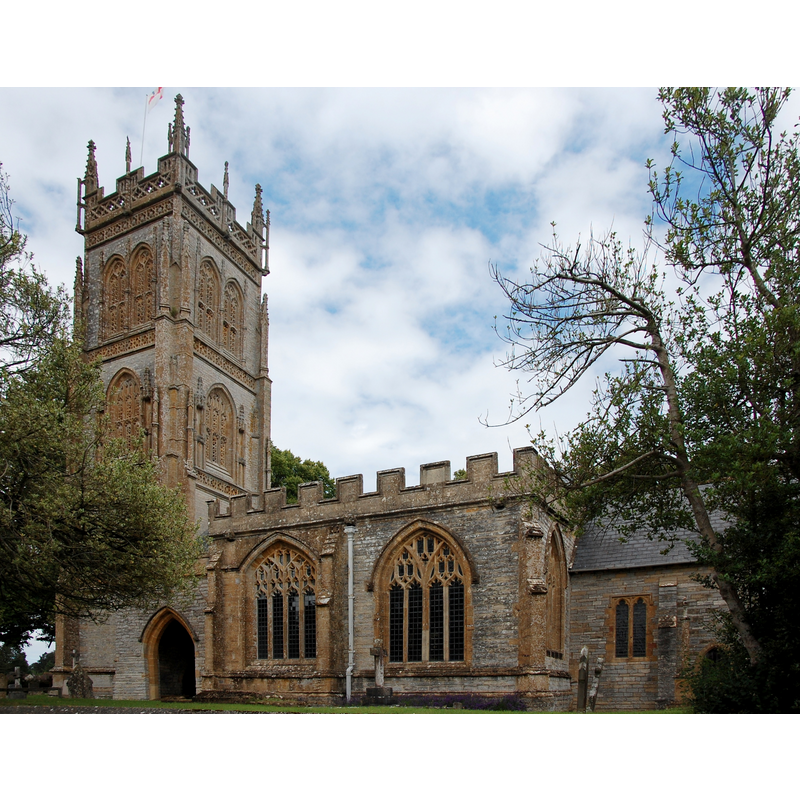
Copyright Statement: Image copyright © Bill Harrison, 2016
Image Source: digital photograph taken 12 July 2016 by Bill Harrison [www.geograph.org.uk/photo/5603781] [accessed 6 February 2018]
Copyright Instructions: CC-BY-SA-2.0
view of church exterior in context - east view
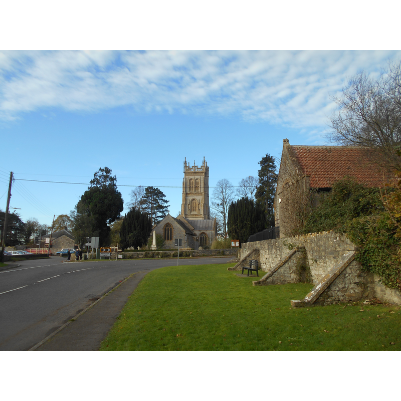
Copyright Statement: Image copyright © Simon Burchell, 2017
Image Source: digital photograph taken 13 November 2017 by Simon Burchell [https://commons.wikimedia.org/wiki/File:St._Mary's_Church,_Huish_Episcopi_01.jpg] [accessed 6 February 2018]
Copyright Instructions: CC-BY-SA-4.0
view of church interior - nave - looking east
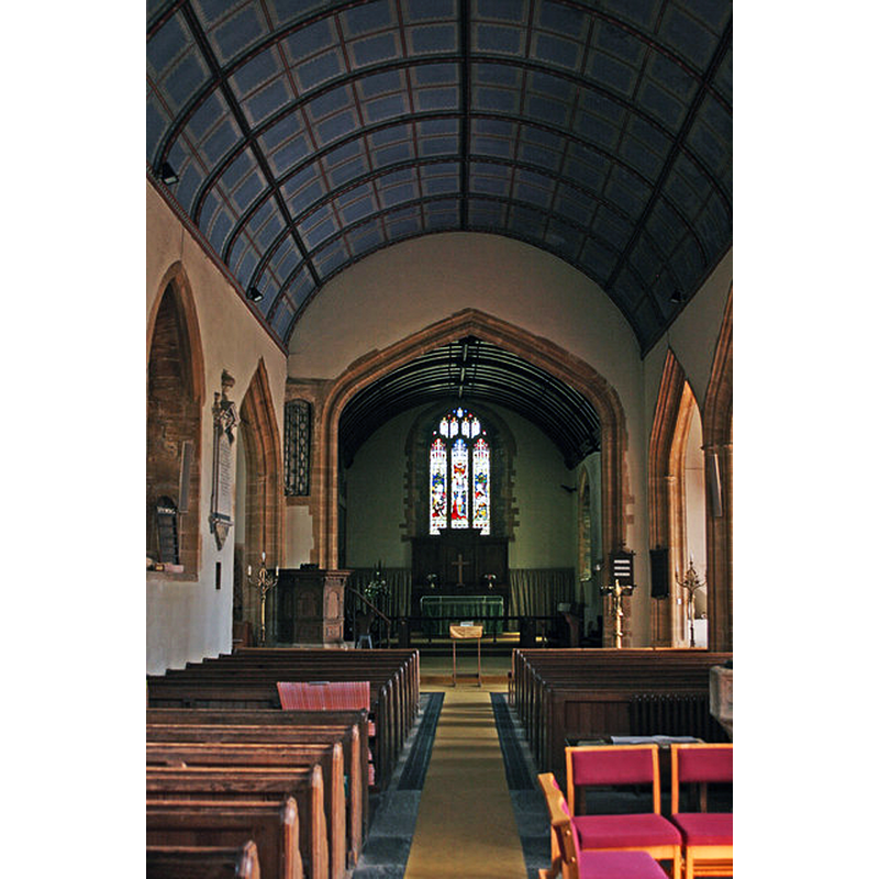
Copyright Statement: Image copyright © Nick Chipchase, 2013
Image Source: digital photograph taken 2 August 2013 by Nick Chipchase [www.geograph.org.uk/photo/3581095] [accessed 6 February 2018]
Copyright Instructions: CC-BY-SA-2.0
design element - motifs - moulding
Copyright Statement: Image copyright © Tony Ethridge, 2009
Image Source: digital photograph taken 11 September 2009 by Tony Ethridge
Copyright Instructions: Standing permission
INFORMATION
Font ID: 13452HUI
Object Type: Baptismal Font1
Font Century and Period/Style: 15th century, Perpendicular
Church / Chapel Name: Parish Church of the Blessed Virgin Mary
Font Location in Church: Inside the church, at the W end, by the S doorway
Church Patron Saint(s): St. Mary the Virgin
Church Notes: 12thC church damaged [almost destroyed] by fire; re-built 13thC, with later modifications
Church Address: Huish Episcopi Langport, Somerset TA10 9QR, UK
Site Location: Somerset, South West, England, United Kingdom
Directions to Site: Located off the A372, just E of Langport
Ecclesiastic Region: Diocese of Bath & Wells
Historical Region: Hundred of Kingsbury (East) [principally]
Additional Comments: disappeared font? (the font of the original 12thC church)
Font Notes:
Click to view
No entry found for Huish Episcopi in the Domesday survey. Pevsner (1958) writes: "Octagonal, Perp[endicular], with quatrefoil frieze." The Victoria County History (Somerset, vol. 3, 1974) notes: "The elaborately decorated south doorway is of the 12th century and apparently in situ, but no other part of the building can be attributed to such an early date", and reports "a Perpendicular font" here. The font is octagonal, of the type where the curve of the undebowl chamfer continues down the stem without a break; the lower base and plinth may be modern, as is the wooden cover, round anf flat. Wade & Wade (1929) do not mention the font, but report "the stoup near S[outh] door" without mention of a date [NB: the original building was a Norman church which the VCH [cf. supra] dates to at least 1179, but we have no information on the earlier font of that church; it may have been destroyed in the fire that damaged much of the church]
Credit and Acknowledgements: We are grateful to Tony Ethridge, of Somerset Villages, for the photographs of this font
COORDINATES
UTM: 30U 512757 5653825
Latitude & Longitude (Decimal): 51.035833, -2.818056
Latitude & Longitude (DMS): 51° 2′ 9″ N, 2° 49′ 5″ W
MEDIUM AND MEASUREMENTS
Material: stone
Font Shape: octagonal, mounted
Basin Interior Shape: round
Basin Exterior Shape: octagonal
LID INFORMATION
Date: modern?
Material: wood
Apparatus: no
Notes: [cf. FontNotes]
REFERENCES
- Victoria County History [online], University of London, 1993-. URL: https://www.british-history.ac.uk.
- Pevsner, Nikolaus, South and West Somerset, Harmondsworth: Penguin Books, 1958, p. 202
- Wade, G.H., Somerset, London: Methurn & Co., 1929, [http://www.gutenberg.org/files/12287/12287-h/12287-h.htm] [accessed 26 March 2008]