Kilve / Clive / Mynsterculve
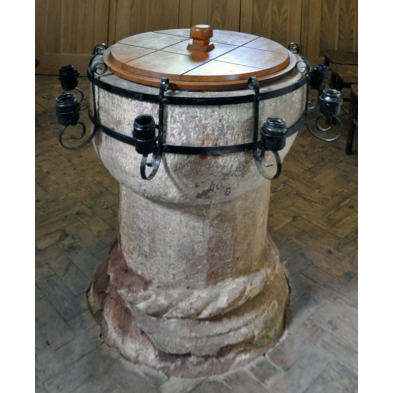
Image copyright © Ashley Dace, 2011
CC-BY-SA-2.0
Results: 8 records
view of font and cover
Copyright Statement: Image copyright © Ashley Dace, 2011
Image Source: digital photograph taken 20 June 2011 by Ashley Dace [www.geograph.org.uk/photo/2504958] [accessed 6 March 2018]
Copyright Instructions: CC-BY-SA-2.0
view of basin
![note the metal contraption to hold candles [cf. Font notes]](/static-50478a99ec6f36a15d6234548c59f63da52304e5/compressed/1090509002_compressed.png)
Scene Description: note the metal contraption to hold candles [cf. Font notes]
Copyright Statement: Image copyright © Tony Ethridge, 2009
Image Source: detail of a digital photograph by Tony Ethridge
Copyright Instructions: Standing permission
view of church exterior - chantry - ruins
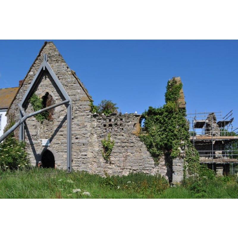
Scene Description: Source caption: "The old chantry is a real ruin, the support is all that is keeping that wall up. From side view you can see the lean. It was founded in 1329 by Sir Simon Furneaux for five monks to pray for his soul. The buildings were gutted by fire in the 1850s."
Copyright Statement: Image copyright © Ashley Dace, 2011
Image Source: digital photograph taken 20 June 2011 by Ashley Dace [www.geograph.org.uk/photo/2455385] [accessed 6 March 2018]
Copyright Instructions: CC-BY-SA-2.0
view of church exterior - southeast view
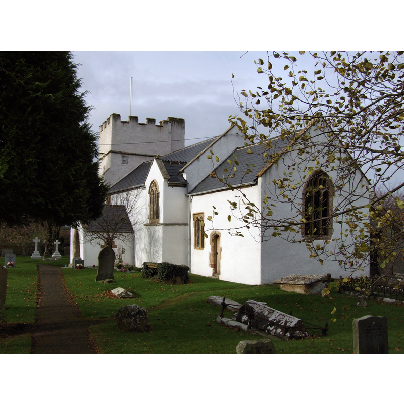
Copyright Statement: Image copyright © Robert Cutts, 2008
Image Source: digital photograph taken 17 November 2008 by Robert Cutts [https://flickr.com/photos/21678559@N06/4450637398] [accessed 6 March 2018]
Copyright Instructions: CC-BY-SA-2.0
view of church exterior - south view
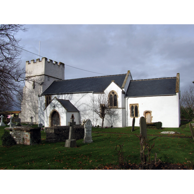
Copyright Statement: Image copyright © Robert Cutts, 2008
Image Source: digital photograph taken 17 November 2008 by Robert Cutts [https://flickr.com/photos/21678559@N06/4450636524] [accessed 6 March 2018]
Copyright Instructions: CC-BY-SA-2.0
view of church interior - nave - looking east
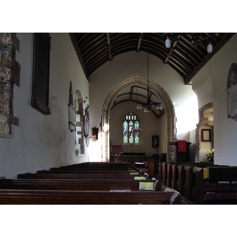
Copyright Statement: Image copyright © Robert Cutts, 2008
Image Source: digital photograph taken 17 November 2008 by Robert Cutts [https://flickr.com/photos/21678559@N06/4450635720] [accessed 6 March 2018]
Copyright Instructions: CC-BY-SA-2.0
design element - motifs - rope moulding
![[cf. Font notes]](/static-50478a99ec6f36a15d6234548c59f63da52304e5/compressed/1090509003_compressed.png)
Scene Description: [cf. Font notes]
Copyright Statement: Image copyright © Tony Ethridge, 2009
Image Source: detail of a digital photograph by Tony Ethridge
Copyright Instructions: Standing permission
design element - motifs - moulding
Scene Description: badly damaged, especially below the rope moulding -- [cf. Font notes]
Copyright Statement: Image copyright © Tony Ethridge, 2009
Image Source: detail of a digital photograph by Tony Ethridge
Copyright Instructions: Standing permission
INFORMATION
Font ID: 13439KIL
Object Type: Baptismal Font1
Font Century and Period/Style: 12th century, Late Norman
Church / Chapel Name: Parish Church of St. Mary
Font Location in Church: Inside the church
Church Patron Saint(s): St. Mary the Virgin
Church Address: Kilve, West Somerset, Somerset, TA5, UK
Site Location: Somerset, South West, England, United Kingdom
Directions to Site: Located off (N) the A39, 8 ENE of Williton, 17 km ENE of Bridgwater, between the Quantocks and the Bristol Channel coast
Ecclesiastic Region: Diocese of Bath & Wells
Historical Region: Hundred of Williton and Freemanors (eastern)
Font Notes:
Click to view
There is an entry for Kilve [variant spelling] in the Domesday survey [http://opendomesday.org/place/ST1442/kilve/] [accessed 6 March 2018], but it mentions neither cleric nor church in it. Wade & Wade (1929) report and "ancient font" in this church. Noted in Pevsner (1958) as Norman. The entry for this parish in the Victoria County History (Somerset, vol. 5, 1985) notes: "A rector of Kilve was named between 1265 and 1273 [...] The font is probably 12th century, with a plain bowl and cable-moulded base." Noted in the Somerset Historic Environmental Record (No. 33279) (1983, updated 2002) [http://webapp1.somerset.gov.uk/her/details.asp?prn=33279] [accessed 16 March 2008]: "The font is probably C12". The entry for this church in English Heritage [Listing NGR: ST1467143942] reports: "C12 font, cable moulded base". The font consists of a roughly hemispherical basin raised on a cylindrical pedestal; both are plain but there is a large rope moulding followed down by one other moulding on the lower base, the latter damaged. The wooden cover is flat and round, with knob handle; modern. There is a curious metal ring around the basin; it appears to have a set of candle holders all around; a modern addition.
Credit and Acknowledgements: We are grateful to Tony Ethridge, of Somerset Villages, for his photograph of this font
COORDINATES
UTM: 30U 484457 5670755
Latitude & Longitude (Decimal): 51.188, -3.2224
Latitude & Longitude (DMS): 51° 11′ 16.8″ N, 3° 13′ 20.64″ W
MEDIUM AND MEASUREMENTS
Material: stone
Font Shape: hemispheric, mounted
Basin Interior Shape: round
Basin Exterior Shape: round
LID INFORMATION
Date: modern
Material: wood, oak?
Apparatus: no
Notes: [cf. FontNotes]
REFERENCES
- Victoria County History [online], University of London, 1993-. URL: https://www.british-history.ac.uk.
- Pevsner, Nikolaus, South and West Somerset, Harmondsworth: Penguin Books, 1958, p. 211
- Wade, G.H., Somerset, London: Methurn & Co., 1929, [http://www.gutenberg.org/files/12287/12287-h/12287-h.htm] [accessed 16 March 2008]