Churchill in Oswaldslow / Cercehille / Cershull-juxta-Humelbrok / Cherchull / Chirchehull / Churchill nr. Bredicot / Churchill nr. Worcester / Churchill-in-Oswaldslow / Circehill / Corishull / Sarishill
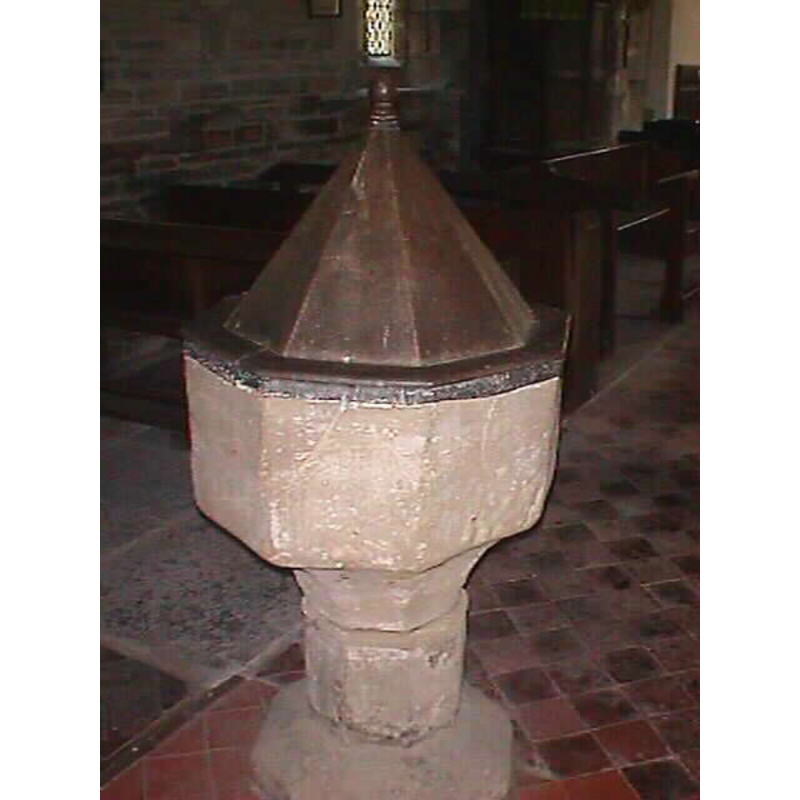
Image copyright © John Wilkes, 2008
Standing permission
Results: 2 records
view of font and cover
Copyright Statement: Image copyright © John Wilkes, 2008
Image Source: digital photograph taken by John Wilkes September 2008 [www.allthecotswolds.com]
Copyright Instructions: Standing permission
view of church exterior - south view
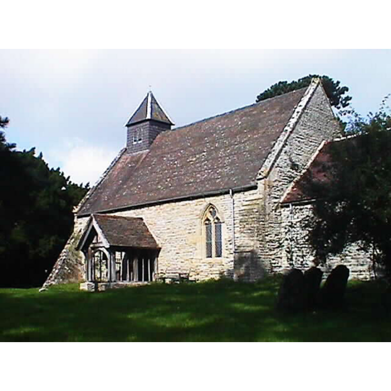
Copyright Statement: Image copyright © John Wilkes, 2008
Image Source: digital photograph taken by John Wilkes September 2008 [www.allthecotswolds.com]
Copyright Instructions: Standing permission
INFORMATION
Font ID: 13410CHU
Object Type: Baptismal Font1
Font Century and Period/Style: 15th century, Perpendicular
Church / Chapel Name: Parish Church of St. Michael [originally a chapel-of-ease to Worcester St. Helen's]
Font Location in Church: Inside the church, in the W end
Church Patron Saint(s): St. Michael
Church Notes: originally a chapel-of-ease to Worcester St. Helen's
Church Address: Edwards Lane, Churchill, Worcester, Worcestershire, WR7 4QE
Site Location: Worcestershire, West Midlands, England, United Kingdom
Directions to Site: Located off (E) the A44, 1 km S of Broughton Hackett, 8 km E of Worcester
Ecclesiastic Region: Diocese of Worcester
Historical Region: Hundred of Oswaldslow [Domesday] -- Hundred of Halfshire
Additional Comments: disappeared font? (the one from the original chapel/church here)
Font Notes:
Click to view
There is an entry for this Churchill [variant spelling] in the Domesday survey [http://domesdaymap.co.uk/place/SO9253/churchill/] [accessed 23 September 2014]; it reports a priest but mentions no church in it, though there probably was one here. Miller (1890) writes: "The church is chiefly of the 13th century [...] The font is ovtagonal, probably of the 14th century", and gives the first recorded rector as "Robert Baret", sine data, the next one down the list being "Joh. de Farley ... 1269". The Victoria County History (Worcester, vol. 3, 1913) notes: "In the 11th century Churchill was a chapelry of the church of St. Helen, Worcester. [...] It seems to have become separated from St. Helen's before 1269, for it is then called a church [...] It appears to have replaced an earlier structure, probably of the 12th century, as a few worked stones of that date were re-used in the 14th-century walling. [...] The stone font is octagonal and appears to be of 15th-century date". Not mentioned in Pevsner (1968). The font consists of an octagonal basin with plain vertical sides, the underbowl slightly concave and plain as well; short octagonal stem and splaying lower base, all plain. The octagonal pyramidal cover is topped with a knob finial, otherwise plain; perhaps 17th century. Brooks & Pevsner (2007) suggest C15 for the font and C18 for the cover. [NB: the VCH notes another ancient 'Churchill' civil parish in Hereford & Worcester, 6 km NE of Kidderminster, usually referred to as 'Churchill in Halfshire', or, 'Churchill near Kidderminster' (in the Middle Ages: Cercehalle / Chirhulle); its church, adds the VCH (Worcester, vol. 3, 1913), "is a modern building [...] in the style of the early 14th century. In the nave is a modern octagonal font", not listed separately in this Index on account it its age]
Credit and Acknowledgements: We are grateful to John Wilkes, of www.allthecotswolds.com, for his photographs of church and font
COORDINATES
UTM: 30U 560559 5781440
Latitude & Longitude (Decimal): 52.1801, -2.1143
Latitude & Longitude (DMS): 52° 10′ 48.36″ N, 2° 6′ 51.48″ W
MEDIUM AND MEASUREMENTS
Material: stone
Font Shape: octagonal, mounted
Basin Interior Shape: round
Basin Exterior Shape: octagonal
Drainage Notes: lead lining
LID INFORMATION
Date: 17th - 18th century?
Material: wood
Apparatus: no
Notes: [cf. FontNotes]
REFERENCES
- Victoria County History [online], University of London, 1993-. URL: https://www.british-history.ac.uk.
- Victoria County History [online], University of London, 1993-. URL: https://www.british-history.ac.uk.
- Brooks, Alan, Worcestershire, New Haven; London: Yale University Press, 2007, p. 225
- Miller, George [Revd.], The Parishes of the Diocese of Worcester, Birmingham: Hall & English, 1890, vol. 2: 98-99