Charlton Horethorne / Ceorlatune / Charlton Camville / Charlton Kanville / South Charlton / Cerletone
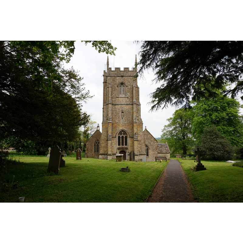
Image copyright © Ian S, 2016
CC-BY-SA-2.0
Results: 1 records
view of church exterior in context - west view
Copyright Statement: Image copyright © Ian S, 2016
Image Source: digital photograph taken 27 May 2016 by Ian S [www.geograph.org.uk/photo/5095815] [accessed 18 April 2018]
Copyright Instructions: CC-BY-SA-2.0
INFORMATION
Font ID: 13398CHA
Object Type: Baptismal Font1
Font Century and Period/Style: 12th century [re-cut], Norman [altered]
Church / Chapel Name: Parish Church of St. Peter and St. Paul [originally St. Peter's]
Font Location in Church: Inside the church, at the W end, beneath the tower arch
Church Patron Saint(s): St. Peter & St. Paul [originally dedicated to St. Peter]
Church Address: 22 Manor Cl, Charlton Horethorne, Sherborne DT9 4PF, UK -- Tel.: +44 1963 250248
Site Location: Somerset, South West, England, United Kingdom
Directions to Site: Located off (E) the B3145, 10 km NNE of Sherborne
Ecclesiastic Region: Diocese of Bath & Wells
Historical Region: Hundred of Horethorne
Additional Comments: re-cut font / re-cycled font / altered font
Font Notes:
Click to view
No entry for Charlton Horethorne or Charlton Camville found in the Domesday survey. Phelps (1836) writes: "The font is large and antient, standing on a circular base." Wade & Wade (1929) mentions a "heavy cylindrical font" in this church. Not mentioned in Pevsner (1958). The entry for this parish in the Victoria County History (Somerset, vol. 7, 1999) notes: "Charlton was probably within the parochia of the minster at Milborne Port in the mid 10th century, [...] but by 1140 a separate parish had evidently been formed and in that year Gerard de Camville gave two parts of the tithe of the manor demesne to the monks of Bermondsey (Surr.) [...] church of ST. PETER AND ST PAUL, dedicated to St. Peter in the 12th century but to both by the mid 19th century [...] Furnishings include a re-cut tub font". Drawing of a font here is part of the Harvey Pridham Drawings of English Fonts (MS 56). [Folder Number, Item Description]. University of Colorado at Boulder Libraries. Special Collections Dept., done by Harvey Pridham July 1888 accompanied by the following description: "Circular throughout, very rude. Circular bowl, lead lined, vertical sides, flat plan, 9 3/4 deep, 5 1/4 margin; position, under open West Tower Arch. No cover." The entry for this church in Historic England [Listing NGR: ST6652423075] reports: "plain circular tub font on circular base".
COORDINATES
UTM: 30U 536606 5650575
Latitude & Longitude (Decimal): 51.005585, -2.478264
Latitude & Longitude (DMS): 51° 0′ 20.11″ N, 2° 28′ 41.75″ W
MEDIUM AND MEASUREMENTS
Material: stone
Font Shape: tub-shaped, mounted
Basin Interior Shape: round
Basin Exterior Shape: round
Drainage Notes: lead-lined
Basin Depth: 24-24.5 cm*
Notes on Measurements: * [in inches in Harvey Fridham [cf. FontNotes]]
REFERENCES
- Victoria County History [online], University of London, 1993-. URL: https://www.british-history.ac.uk.
- Phelps, William (Revd.), The History and Antiquities of Somersetshire; being a general and parochial survey [...] [vol. 1], London: Printed for the author , by J. B. Nichols and Son, 1836, vol. 1: 331 / [http://books.google.ca/books?id=IAQVAAAAQAAJ&pg=PA589&lpg=PA589&dq=butleigh+church+font&source=bl&ots=YU0c4LRPgk&sig=u9wX07aEBfabcQ5OyhJwDvZHqXg&hl=en&ei=NcH9SYDHKY-UMtOp0c8E&sa=X&oi=book_result&ct=result&resnum=4#PPP7,M1] [accessed 3 May 2009]
- Wade, G.H., Somerset, London: Methurn & Co., 1929, [http://www.gutenberg.org/files/12287/12287-h/12287-h.htm] [accessed 9 March 2008]