Compton Greenfield / Contone
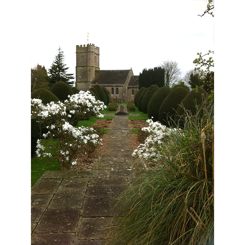
Image copyright © Ky Devas, 2015
No known copyright restriction / Fair Dealing
Results: 3 records
view of church exterior in context - south view
Scene Description: the sundial in the centre of the path is said to include parts of the 15thC font of this church
Copyright Statement: Image copyright © Ky Devas, 2015
Image Source: digital photograph taken 22 April 2015 by Ky Devas in Geocaching [http://www.geocaching.com/seek/log.aspx?LUID=d2ecd558-8095-48bf-9804-0b87f7c389ef&IID=cd8e001f-1443-4645-a06a-9a65cd1825d5] [accessed 7 May 2015]
Copyright Instructions: No known copyright restriction / Fair Dealing
view of church exterior - south portal
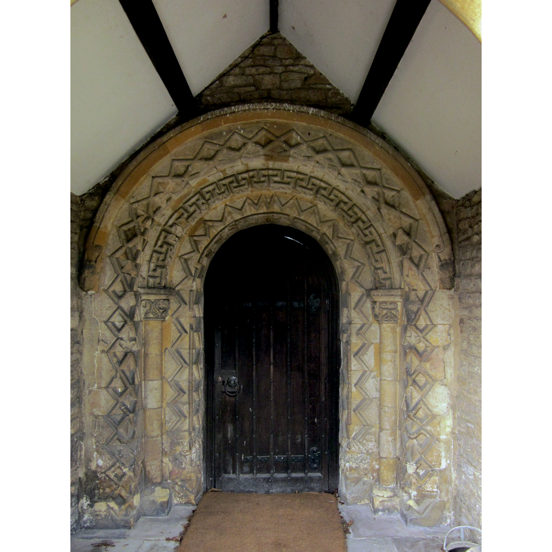
Copyright Statement: Image copyright © Derek Harper, 2014
Image Source: digital photograph taken 22 February 2014 by Derek Harper [www.geograph.org.uk/photo/3872327] [accessed 7 May 2015]
Copyright Instructions: CC-BY-SA-2.0
view of church exterior - south view
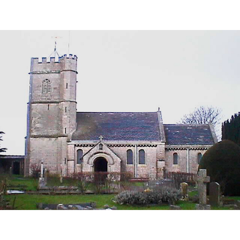
Copyright Statement: Image copyright © John Wilkes, 2008
Image Source: digital photograph taken Februay 2008 by John Wilkes [www.allthecotswolds.com]
Copyright Instructions: Standing permission
INFORMATION
Font ID: 13353COM
Object Type: Baptismal Font1?
Font Date: ca. 1170?
Font Century and Period/Style: 12th century (late?), Late Norman
Church / Chapel Name: Parish Church of All Saints
Church Patron Saint(s): All Saints
Church Address: off Farm Lane, Compton Greenfield, South Gloucestershire, BS35 5RZ
Site Location: Gloucestershire, South West, England, United Kingdom
Directions to Site: Located off (SW) the B4055, just NE of East Compton, NW of the Bristol Golf Course, 10 km NW of Bristol
Ecclesiastic Region: Diocese of Bristol
Historical Region: Hundred of Bentry [in Domesday]
Additional Comments: disappeared font? (the one from the ca.1170 church here) -- re-cycled font? [were its fragments of the Perpendicular font used in the making of the sundial?]
Font Notes:
Click to view
There is an entry for Compton [Greenfield] [variant spelling] in the Domesday survey [http://opendomesday.org/place/ST5782/compton-greenfield/] [accessed 7 May 2015], but it mentions neither cleric nor church in it. Verey & Brooks (1999-2002) note that during the extensive and expensive restoration of 1924 "all internal walls were scraped […] the octagonal Perp[endicular] font was probably also renewed". [NB: the present Church of All Saints had been re-built in the 1850s but dated originally to ca. 1170, according to the English Heritage entry [Listing NGR: ST5708682226] (1960); it reports an octagonal Perpendicular font with wooden cover in it [cf. supra]; we have no information on the original font of this church -- the church itself underwent a major renovation in the 1850s and restored again in the 1920s]. Janet Hiscocks, in the B&AFHS [Bristol & Avon Damily History Society] Journal, 135 ( March 2009) notes: "In 1892 when the ancient west door was reopened, the remains of an old font were discovered. Parts of this original font were used for the upped portion of the sundial pedestal in “first” Churchyard extension."
COORDINATES
UTM: 30U 526261 5709618
Latitude & Longitude (Decimal): 51.537054, -2.621364
Latitude & Longitude (DMS): 51° 32′ 13.39″ N, 2° 37′ 16.91″ W
REFERENCES
- Verey, David, Gloucestershire, London: Penguin Books, 1999-2002, vol. 2: 323