Daylesford / Daeglesford / Daeilesford / Dailsford / Dallifford / Dallisford / Dalysford / Dayleford / Deiglesford / Deilesford / Edesford / Eilesford
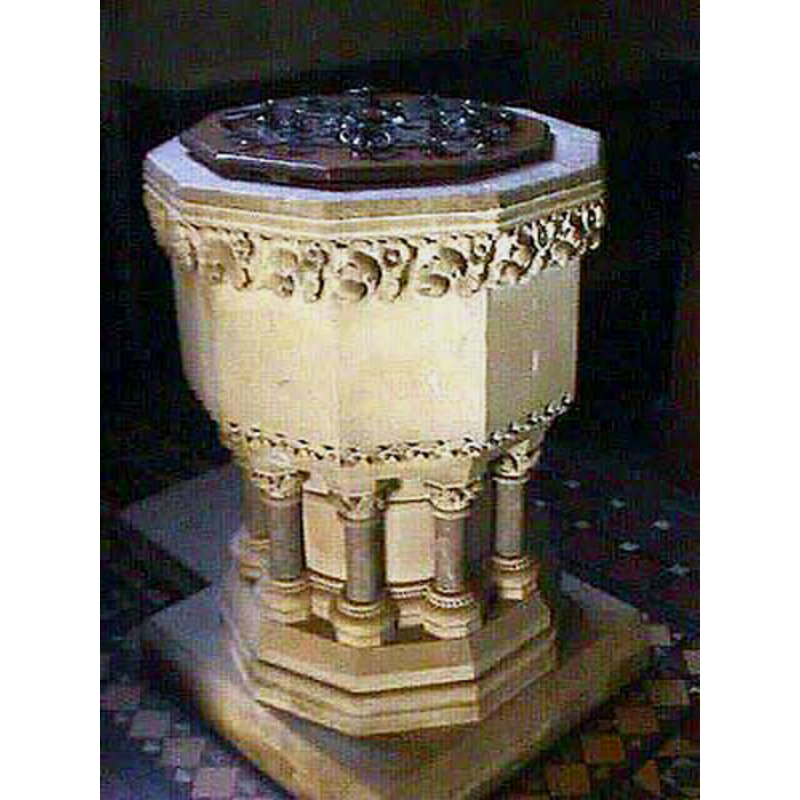
Image copyright © John Wilkes, 2008
Standing permission
Results: 3 records
view of font and cover
Scene Description: the Victorian font [cf. Font notes]
Copyright Statement: Image copyright © John Wilkes, 2008
Image Source: digital photograph by John Wilkes, in The Gloucestershire Photo Library [http://www.allthecotswolds.com/] [accessed 24 January 2008]
Copyright Instructions: Standing permission
view of church exterior - tower
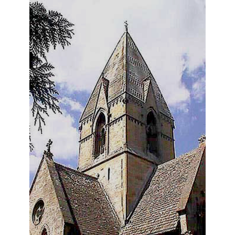
Copyright Statement: Image copyright © John Wilkes, 2008
Image Source: digital photograph by John Wilkes, in The Gloucestershire Photo Library [http://www.allthecotswolds.com/] [accessed 24 January 2008]
Copyright Instructions: Standing permission
view of church interior - nave - looking east
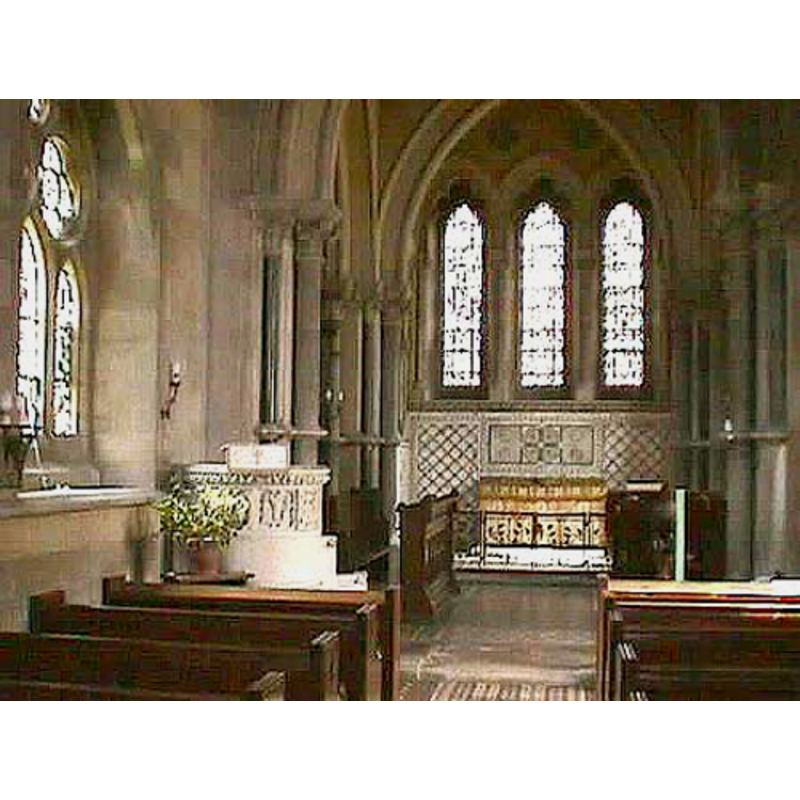
Copyright Statement: Image copyright © John Wilkes, 2008
Image Source: digital photograph by John Wilkes, in The Gloucestershire Photo Library [http://www.allthecotswolds.com/] [accessed 24 January 2008]
Copyright Instructions: Standing permission
INFORMATION
Font ID: 13323DAY
Object Type: Baptismal Font1?
Font Century and Period/Style: 11th century, Pre-Conquest? / Norman
Church / Chapel Name: Parish Church of St. Peter
Church Patron Saint(s): St. Peter
Church Notes: original church demolished ca. 1816
Church Address: Daylesford, Gloucestershire, GL56 0YG
Site Location: Gloucestershire, South West, England, United Kingdom
Directions to Site: Located off (E) the A436, between Stow-on-the-Wold to theSW and Salford to the NE [NB: occasionally listed as being in Oxon., but it is in Gloucs.]
Ecclesiastic Region: Diocese of Oxford
Historical Region: Hundred of Oswaldslow -- formerly a detached part of Worcestershire
Additional Comments: disappeared font? (the one from the Domesday-time church here)
Font Notes:
Click to view
There are two entries for Daylesford [variant spelling] in the Domesday survey [http://domesdaymap.co.uk/place/SP2425/daylesford/] [accessed 24 September 2014], one of which reports a priest but makes no mention of a church in it, though there probably was one there. Miller (1890) writes: "The church was founded by Ethelweld King of Mercia between 716 and 757 [...] rebuilt 1816 [...] again rebuilt 1860", and mentions no font in it. The Victoria County History (Worcester, vol. 3, 1913) notes: "At the time of the Domesday Survey there was a church in Daylesford [...] The present building, designed by J. L. Pearson in 13th-century style, was built in 1860 by Harman Grisewood to replace another erected in 1816 on the site of a very much older church. [...] Some remains of 12th-century work exist in the north wall of the chancel, consisting of two capitals and one bay of a Norman arcade of two square orders." A modern font here is noted in Verey & Brooks (1999-2002): "Decagonal stone font with foliage bands on short marble pillars". This font is Victorian, like the rest of the new church, but this same source reports that the "original Norman or Saxon church was taken down in 1816" [NB: we have no information on the font of the Domesday-time church here]
Credit and Acknowledgements: We are grateful to John Wilkes, of The Gloucestershire Photo Library [www.allthecotswolds.com], for his photographs of church and modern font
COORDINATES
UTM: 30U 592946 5754277
Latitude & Longitude (Decimal): 51.931447, -1.648136
Latitude & Longitude (DMS): 51° 55′ 53.21″ N, 1° 38′ 53.29″ W
REFERENCES
- Victoria County History [online], University of London, 1993-. URL: https://www.british-history.ac.uk.
- Miller, George [Revd.], The Parishes of the Diocese of Worcester, Birmingham: Hall & English, 1890, vol. 2: 245
- Verey, David, Gloucestershire, London: Penguin Books, 1999-2002, vol. 1: 311