Chavenage
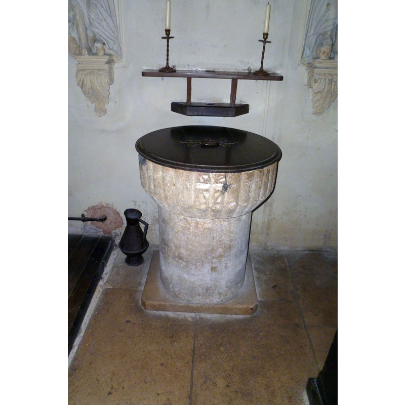
Image copyright © John Wilkes, 2017
Standing permission
Results: 6 records
view of font and cover
Copyright Statement: Image copyright © John Wilkes, 2017
Image Source: digital photograph taken 5 August 2017 by John Wilkes
Copyright Instructions: Standing permission
design element - patterns - piping or ribbed
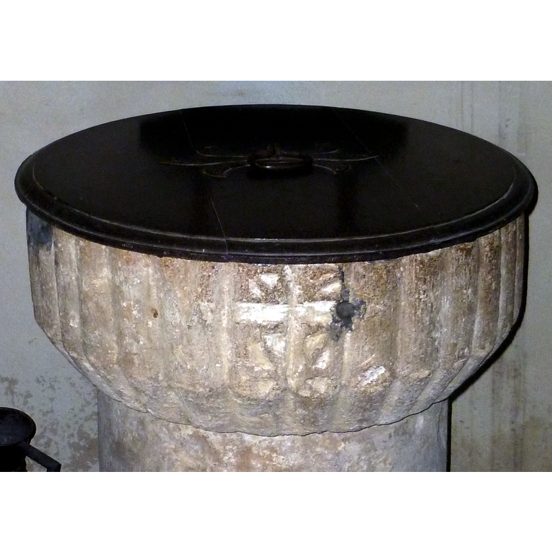
Scene Description: all around the basin sides
Copyright Statement: Image copyright © John Wilkes, 2017
Image Source: edited detail of a digital photograph taken 5 August 2017 by John Wilkes
Copyright Instructions: Standing permission
symbol - cross - Latin
Copyright Statement: Image copyright © John Wilkes, 2017
Image Source: edited detail of a digital photograph taken 5 August 2017 by John Wilkes
Copyright Instructions: Standing permission
view of church exterior - northwest view
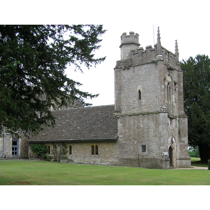
Scene Description: Source caption: "Chavenage Church attached to the Manor"
Copyright Statement: Image copyright © Rick Crowley, 2010
Image Source: digital photograph taken 18 June 2006 by Rick Crowley [www.geograph.org.uk/photo/1756337] [accessed 6 August 2017]
Copyright Instructions: CC-BY-SA-2.0
view of church exterior - south view
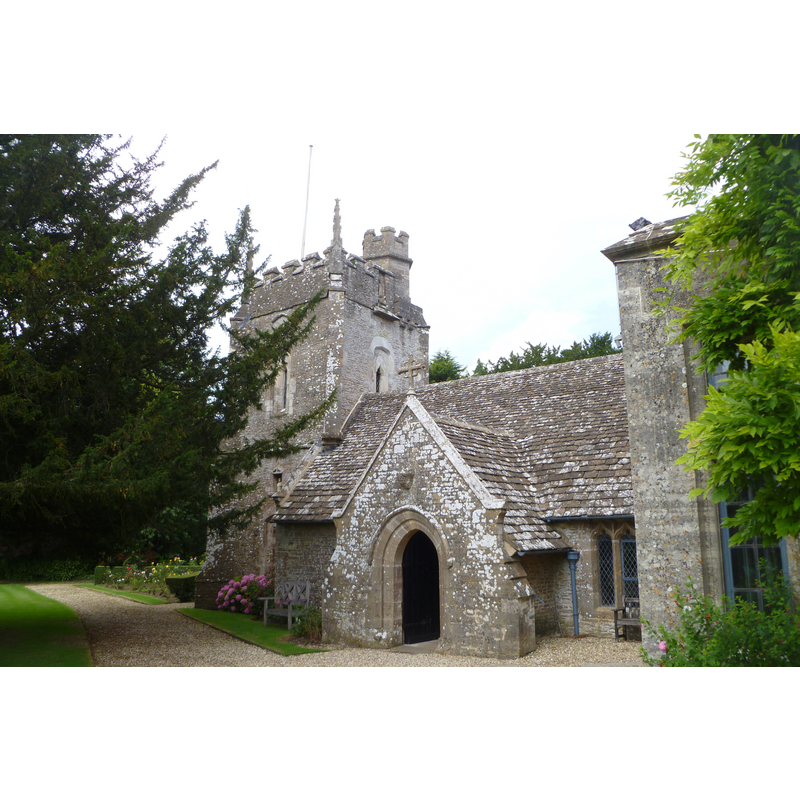
Copyright Statement: Image copyright © John Wilkes, 2017
Image Source: digital photograph taken 5 August 2017 by John Wilkes
Copyright Instructions: Standing permission
view of church interior - nave - looking east
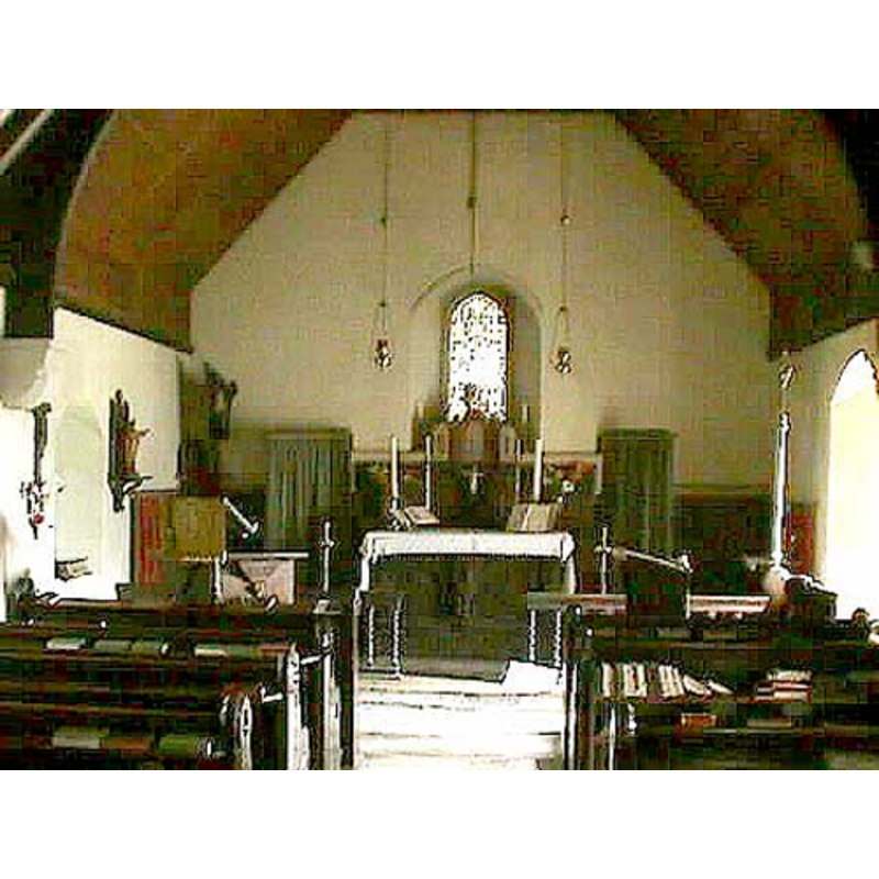
Copyright Statement: Image copyright © John Wilkes, 2008
Image Source: digital photograph by John Wilkes, in The Gloucestershire Photo Library [http://www.allthecotswolds.com/] [accessed 17 January 2008]]
Copyright Instructions: Standing permission
INFORMATION
Font ID: 13313CHA
Object Type: Baptismal Font1
Font Century and Period/Style: 12th century [basin only], Medieval [composite]
Church / Chapel Name: Chavenage House chapel [original church unknown, perhaps Ledgemore Chapel?]
Font Location in Church: [cf. FontNotes]
Church Notes: the Chavenage chapel is chiefly 17th-18thC;
Church Address: Chavenage House, Tetbury GL8 8XP, UK -- Tel.: +44 1666 502329
Site Location: Gloucestershire, South West, England, United Kingdom
Directions to Site: Chavenage House is located off (W) the B4014, 3 km NNW of Tetbury
Historical Region: The Cotswolds
Additional Comments: re-cycled font? / dis-used font [cf. FontNotes]
Font Notes:
Click to view
No entries for either Chavenage or Ledgemore found in the Domesday survey. Verey & Brooks (1999-2002) write: "Font. A fluted Early Norman bowl, found on the estate, and perhaps from a possible medieval chapel at Ledgemore, nearby." [NB: the 'estate' referred to above is Chavenage House, the manor house]
Credit and Acknowledgements: We are grateful to John Wilkes, of The Gloucestershire Photo Library, for his photographs of church and font.
COORDINATES
UTM: 30U 556267 5723125
Latitude & Longitude (Decimal): 51.6563, -2.1866
Latitude & Longitude (DMS): 51° 39′ 22.68″ N, 2° 11′ 11.76″ W
MEDIUM AND MEASUREMENTS
Material: stone
Font Shape: cylindrical, mounted
Basin Interior Shape: round
Basin Exterior Shape: round
LID INFORMATION
Material: wood
Apparatus: no
Notes: flat and round; modern?
REFERENCES
- Verey, David, Gloucestershire, London: Penguin Books, 1999-2002, vol. 1: 220