Stroud
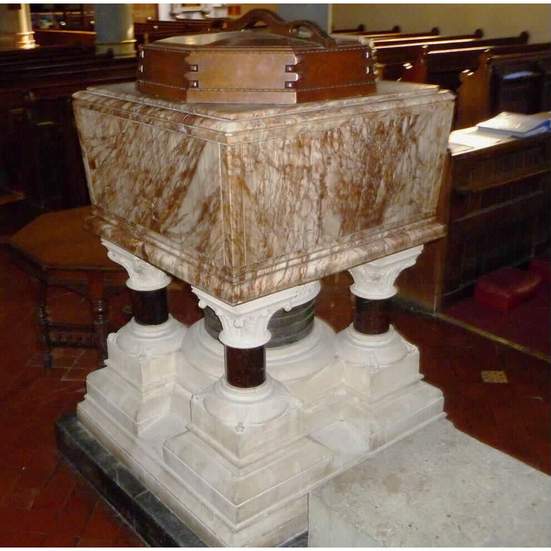
Image copyright © John Wilkes, 2008
Standing permission
Results: 3 records
view of font and cover
Scene Description: the modern font
Copyright Statement: Image copyright © John Wilkes, 2008
Image Source: digital photograph taken by John Wilkes in October 2010 [re-shot] [www.allthecotswolds.com/]
Copyright Instructions: Standing permission
view of church exterior - southeast view
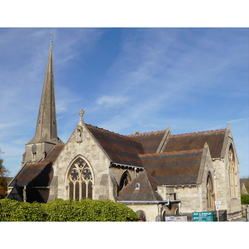
Copyright Statement: Image copyright © John Wilkes, 2010
Image Source: digital photograph taken by John Wilkes in October 2010 [www.allthecotswolds.com/]
Copyright Instructions: Standing permission
view of church exterior - west tower
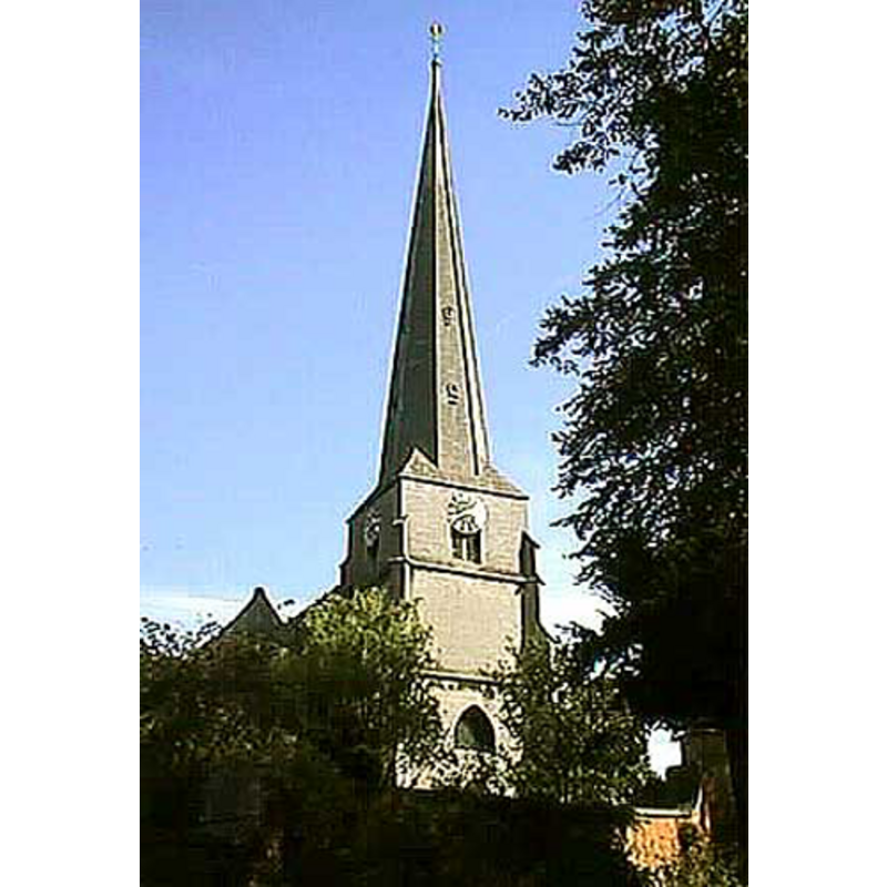
Copyright Statement: Image copyright © John Wilkes, 2008
Image Source: digital photograph by John Wilkes, in The Gloucestershire Photo Library [http://www.allthecotswolds.com/] [accessed 5 January 2008]
Copyright Instructions: Standing permission
INFORMATION
Font ID: 13301STR
Object Type: Baptismal Font1?
Font Date: ca. 1279?
Font Century and Period/Style: 13th century, Medieval
Church / Chapel Name: Parish Church of St. Laurence [aka St. Lawrence's]
Church Patron Saint(s): St. Lawrence [aka Laurence]
Church Address: The Shambles, Stroud, Gloucestershire, GL5 1AP
Site Location: Gloucestershire, South West, England, United Kingdom
Directions to Site: Located 17 km S of Gloucester
Ecclesiastic Region: Diocese of Gloucester
Historical Region: Hundred of Bisley
Additional Comments: disappeared font? [cf. FontNotes]
Font Notes:
Click to view
No idividual entry found for Stroud in the Domesday survey. The entry for this parish in the Victoria County History (Gloucester, vol. 11, 1976) notes: "A church had been built at Stroud by 1279 [...] a chapel of ease to Bisley [...] remained a chapel to Bisley [...] until the 1720s [...] The rebuilding of the body of the church was begun in 1866 and completed in 1868. [...] The carving and ornamentation was carried out by Joshua Wall of Stroud who also made the pulpit, replacing a hexagonal oak pulpit of 1759, and the font, [...] replacing one made c. 1834". Font noted and illustrated in The Gloucestershire Photo Library [www.allthecotswolds.com/] [accessed 5 January 2008]. The present font consists of a square basin raised on a central shaft and four outer colonnettes, all terribly Victorian and compiting in ugliness with the font at Sudeley, of about the same period. Thick octagonal wooden cover. [NB: we have no information of the font of the 13th-century church here].
Credit and Acknowledgements: We are grateful to John Wilkes, of www.allthecotswolds.com, for his photographs of church and font.
COORDINATES
UTM: 30U 554321 5733104
Latitude & Longitude (Decimal): 51.746205, -2.213162
Latitude & Longitude (DMS): 51° 44′ 46.34″ N, 2° 12′ 47.38″ W
LID INFORMATION
Date: 19th-century?
Material: wood
Apparatus: no
Notes: [cf. FontNotes]
REFERENCES
- Victoria County History [online], University of London, 1993-. URL: https://www.british-history.ac.uk.