Tarlton / Torentune [Domesday] / Tornentone
![Main image for Tarlton / Torentune [Domesday] / Tornentone](/static-50478a99ec6f36a15d6234548c59f63da52304e5/compressed/1080103019_compressed.png)
Image copyright © John Wilkes, 2014
Standing permission
Results: 7 records
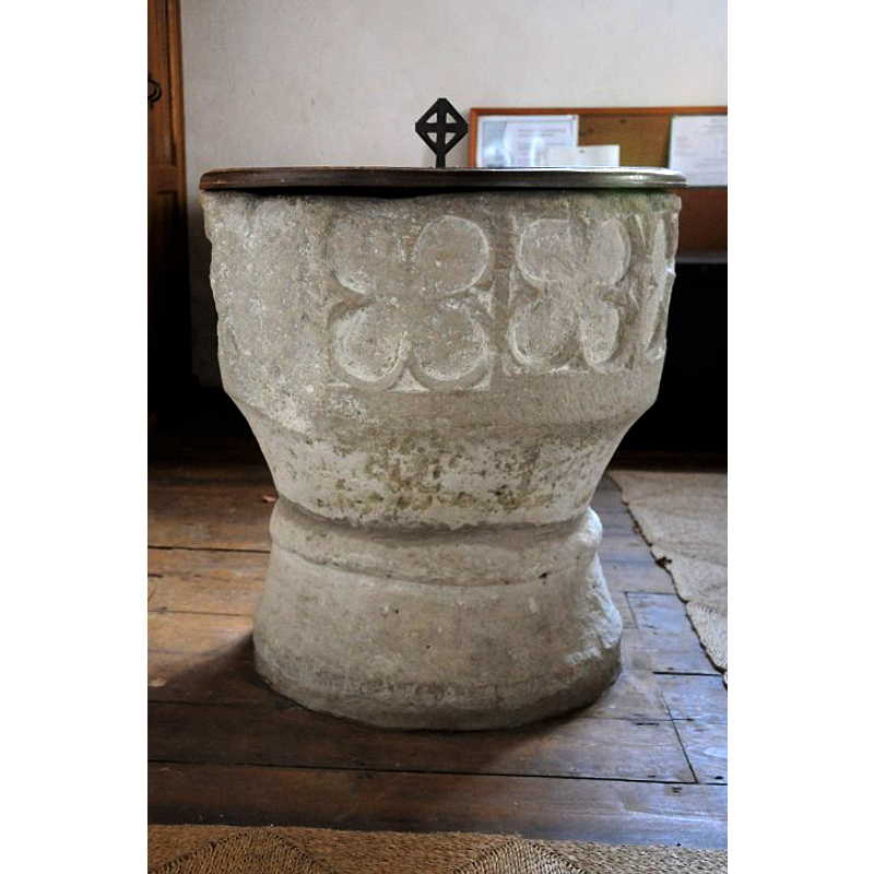
view of font and cover
Scene Description: [cf. Font notes]
Copyright Statement: Image copyright © John Wilkes, 2014
Image Source: digital photograph taken 8 October 2014 by John Wilkes [replaces earlier version by JW
Copyright Instructions: Standing permission
design element - motifs - quatrefoil
Copyright Statement: Image copyright © Philip Halling, 2014
Image Source: digital photograph taken 1 March 2014 by Philip Halling [www.geograph.org.uk/photo/3885045] [accessed 20 February 2019]
Copyright Instructions: CC-BY-SA-2.0
view of church exterior - south view
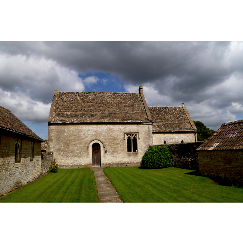
Copyright Statement: Image copyright © John Wilkes, 2017
Image Source: digital photograph taken 10 August 2017 by John Wilkes
Copyright Instructions: Standing permission
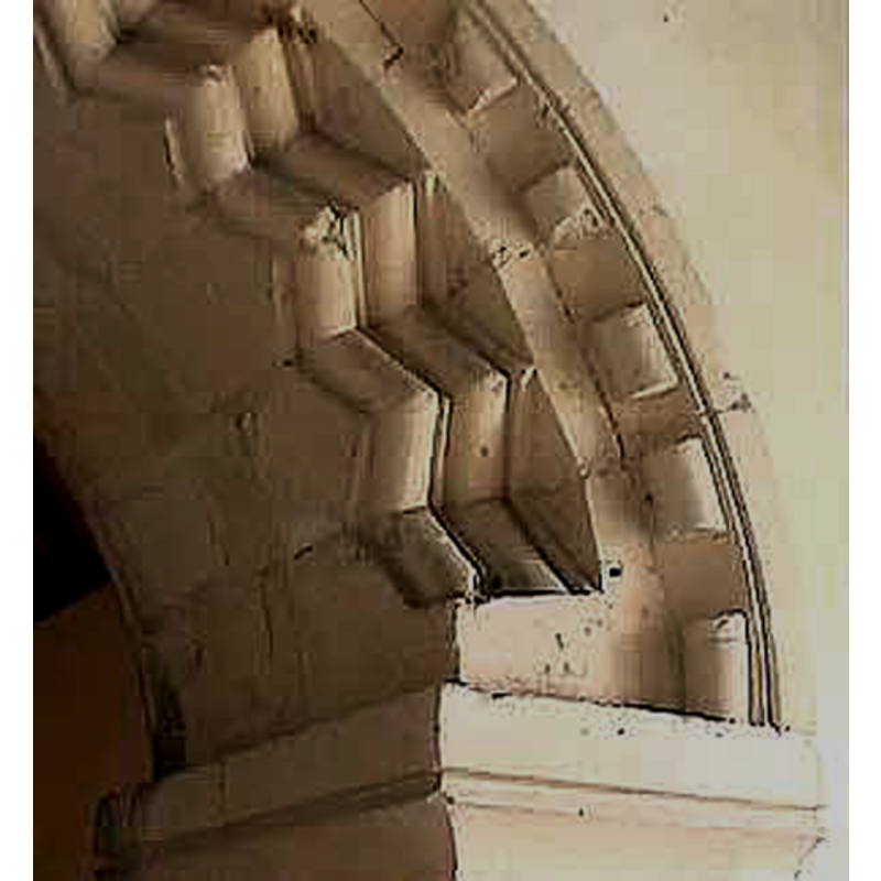
view of church interior - chancel arch
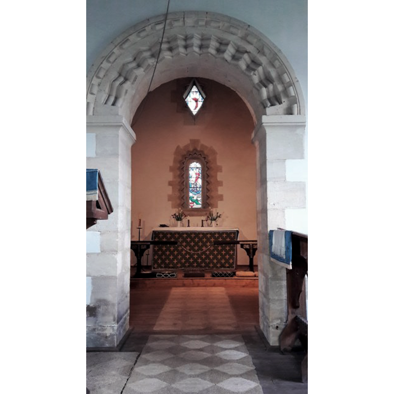
Scene Description: Source caption: "Into the chancel, St Osmund, Tarlton. A genuine Norman Romanesque chancel arch frames a neo-Norman east window and lozenge window above it in the east wall."
Copyright Statement: Image copyright © Chris Brown, 2017
Image Source: digital photograph taken 6 March 2017 by Chris Brown [www.geograph.org.uk/photo/5458339] [accessed 20 February 2019]
Copyright Instructions: CC-BY-SA-2.0
view of church interior - nave - looking east
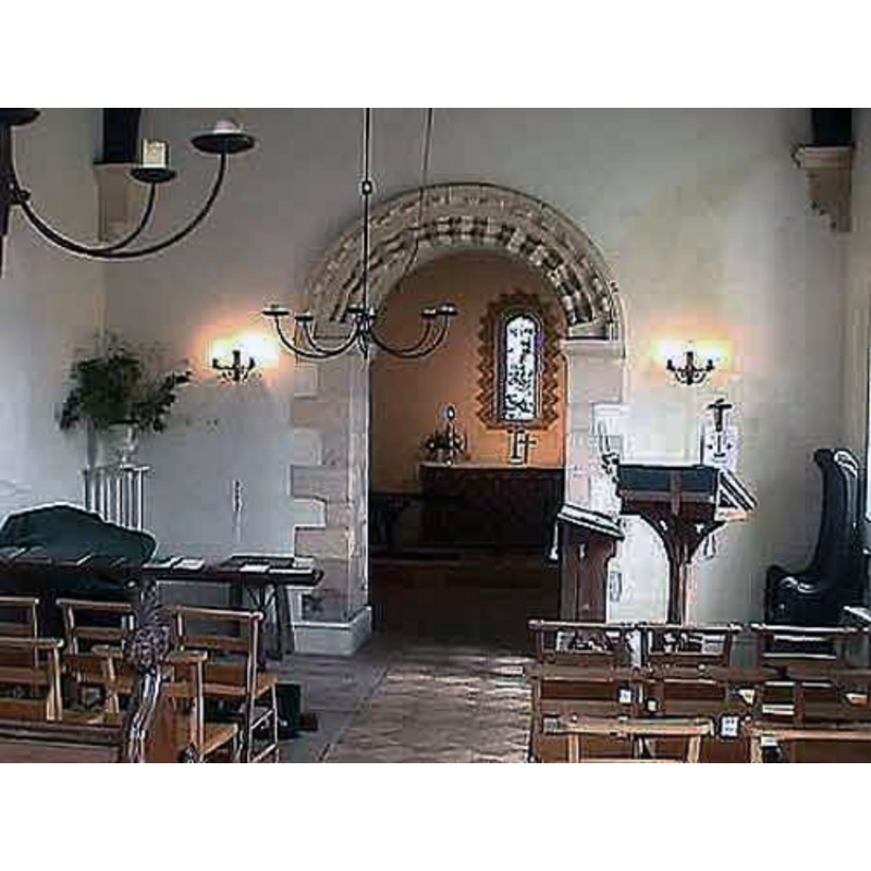
Copyright Statement: Image copyright © John Wilkes, 2008
Image Source: digital photograph by John Wilkes, in The Gloucestershire Photo Library [http://www.allthecotswolds.com/] [accessed 3 January 2008]
Copyright Instructions: Standing permission
design element - motifs - roll moulding
Copyright Statement: Image copyright © Philip Halling, 2014
Image Source: digital photograph taken 1 March 2014 by Philip Halling [www.geograph.org.uk/photo/3885045] [accessed 20 February 2019]
Copyright Instructions: CC-BY-SA-2.0
view of church interior - chancel arch - detail
Copyright Statement: Image copyright © John Wilkes, 2008
Image Source: digital photograph by John Wilkes, in The Gloucestershire Photo Library [http://www.allthecotswolds.com/] [accessed 3 January 2008]
Copyright Instructions: Standing permission
INFORMATION
Font ID: 13298TAR
Object Type: Baptismal Font1
Font Century and Period/Style: 12th century [re-carved], Norman [altered]
Church / Chapel Name: St. Edmund Chapel of Ease [originally from Rodmarton St. Peter's]
Font Location in Church: Inside the church
Church Patron Saint(s): St. Edmund the Martyr [aka Edmund of East Anglia]
Church Address: Tarlton, Gloucestershire, GL7 6PA
Site Location: Gloucestershire, South West, England, United Kingdom
Directions to Site: Located off (W) the A433, 7 km WSW of Cirencester [NB: Rodmarton is 2-3 km SW of Tarlton]
Ecclesiastic Region: Diocese of Gloucester
Historical Region: Hundred of Cirencester [in Domesday] -- Hundred of Longtree
Additional Comments: altered font / re-cycled font (the font originally from Rodmarton) -- disappeared font? (the one from the 12thC church/chapel-of-ease here)
Font Notes:
Click to view
There are two entries for Tarlton [variant spelling] in the Domesday survey [http://domesdaymap.co.uk/place/ST9599/tarlton/] [accessed 9 October 2014], neither of which mentions cleric or church in it. The entry for the parish of Rodmarton in the Victoria County History (Gloucester, vol. 11, 1976) notes: "Although architectural evidence of a church in Rodmarton before the Conquest [...] is not accepted, a priest was recorded in 1086. [...] By the end of the 13th century the church comprised at least a nave, a north aisle of one bay, and a narrow chancel. In the earlier 14th century the chapels, tower, broach spire, and porch were added to complete the plan as it survives today. The completion was probably marked by the dedication of the high altar in 1340. [...] The font was replaced in 1859 when it was considered old and unsightly." The VCH entry (ibid.) notes the nearby chapel at Tarlton, which, "seems, on architectural evidence, to have existed by the late 12th century. [...] The Norman font, which has a tub-shaped bowl recut in the early 14th century, is said to have stood in the parish church until 1859." [the VCH entry footnotes this reference: "Trans. B.G.A.S. 1. 319; card in chapel."]. The Gloucestershire County Council site [www.gloucestershire.gov.uk/index.cfm?articleid=1778] [accessed 3 January 2008] states: "the Norman font was brought from Rodmarton." The Historic Church Trails in Gloucestershire site [www.gloschurchtourism.com/pages2/thamesheadchurches.htm] [accessed 3 January 2008] expands: "the Norman font was brought from Rodmarton church, whose chapel-of-ease St. Osmund's is, to replace 'the old unsightly one'''. The baptismal font now at Tarlton St. Edmund's is roughly chalice-shaped, and consists of a bucket-shaped basin raised on a cylindrical stem and a truncated-cone lower base; the font appears to have been originally undecorated, but part of the surface of the basin has been re-carved (?) and now shows several (three?) large quatrefoils. The wooden font cover is round and flat, with metal decoration and finial/handle; it appears modern.
Credit and Acknowledgements: We are grateful to John Wilkes, of The Gloucestershire Photo Library, for his photographs of church and font.
COORDINATES
UTM: 30U 564816 5727747
Latitude & Longitude (Decimal): 51.696931, -2.062167
Latitude & Longitude (DMS): 51° 41′ 48.95″ N, 2° 3′ 43.8″ W
MEDIUM AND MEASUREMENTS
Material: stone
Font Shape: chalice-shaped, bucket-shaped, mounted
Basin Interior Shape: round
Basin Exterior Shape: round
LID INFORMATION
Date: modern
Material: wood, oak?
Apparatus: no
Notes: [cf. FontNotes]
REFERENCES
- Victoria County History [online], University of London, 1993-. URL: https://www.british-history.ac.uk.