Turkdean / Turcandene / Turchedene / Turghedene
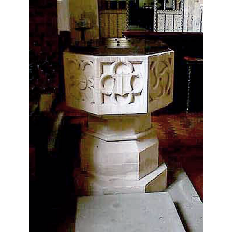
Image copyright © John Wilkes, 2008
Standing permission
Results: 6 records
view of font and cover
Scene Description: the 19th-century font
Copyright Statement: Image copyright © John Wilkes, 2008
Image Source: digital photograph by John Wilkes, in The Gloucestershire Photo Library [http://www.allthecotswolds.com/] [accessed 2 January 2008]
Copyright Instructions: Standing permission
view of church exterior - portal - detail
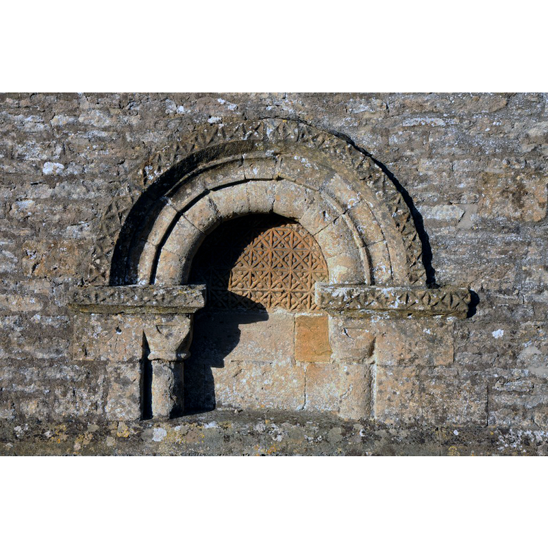
Scene Description: the old Norman portal
Copyright Statement: Image copyright © Philip Halling, 2013
Image Source: digital photograph taken 29 December 2013 by Philip Halling [www.geograph.org.uk/photo/3818672] [accessed 7 February 2019]
Copyright Instructions: CC-BY-SA-2.0
view of church exterior - north view
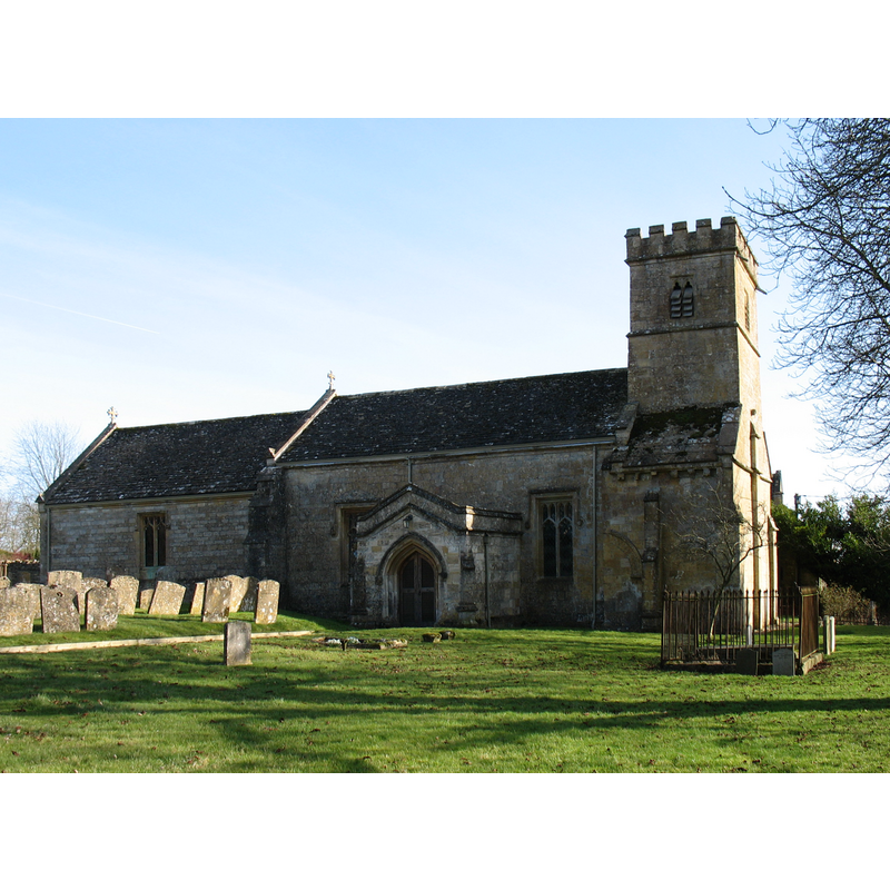
Copyright Statement: Image copyright © David Purchase, 2012
Image Source: digital photograph taken 26 February 2012 by David Purchase [www.geograph.org.uk/photo/2821694] [accessed 7 February 2019]
Copyright Instructions: CC-BY-SA-2.0
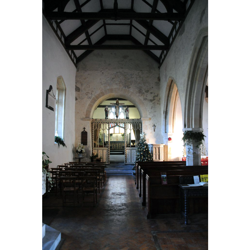
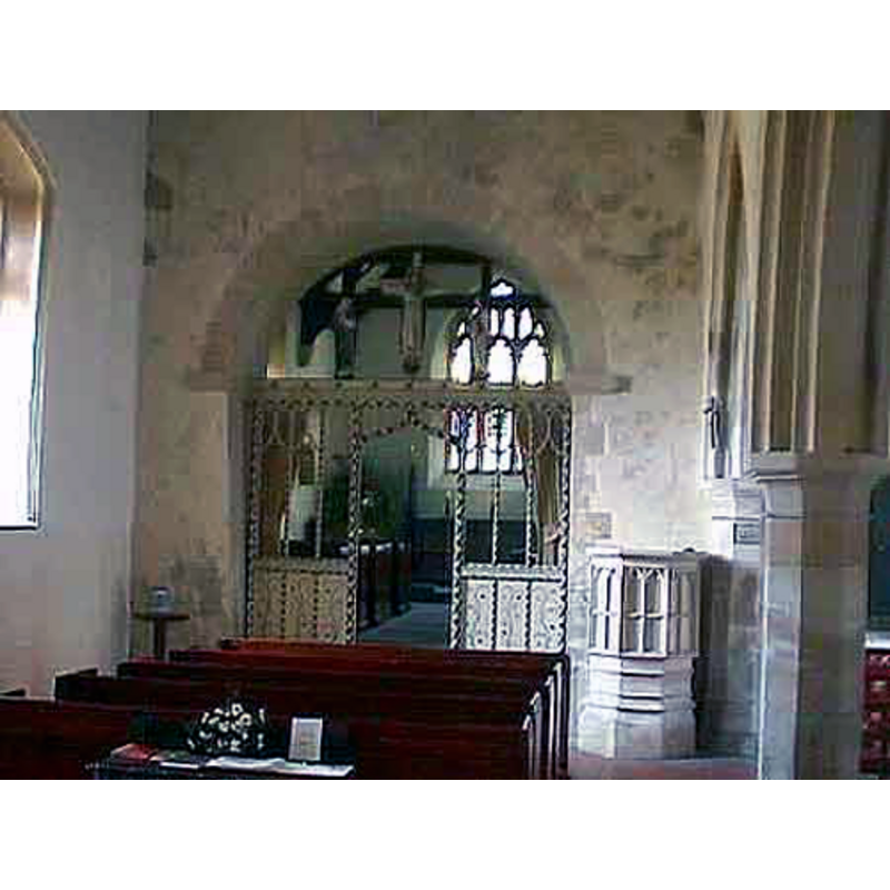
view of church interior - looking west
![with the modern font visible at the far [west] end, right [north] side](/static-50478a99ec6f36a15d6234548c59f63da52304e5/compressed/1190207009_compressed.png)
Scene Description: with the modern font visible at the far [west] end, right [north] side
Copyright Statement: Image copyright © Philip Halling, 2013
Image Source: digital photograph taken 29 December 2013 by Philip Halling [www.geograph.org.uk/photo/3818709] [accessed 7 February 2019]
Copyright Instructions: CC-BY-SA-2.0
view of church interior - looking east
Scene Description: the modern font is partly visible in the foreground, to the left of the camera
Copyright Statement: Image copyright © Philip Halling, 2013
Image Source: digital photograph taken 29 December 2013 by Philip Halling [www.geograph.org.uk/photo/3818704] [accessed 7 February 2019]
Copyright Instructions: CC-BY-SA-2.0
view of church interior - chancel
Copyright Statement: Image copyright © John Wilkes, 2008
Image Source: digital photograph by John Wilkes, in The Gloucestershire Photo Library [http://www.allthecotswolds.com/] [accessed 2 January 2008]
Copyright Instructions: Standing permission
INFORMATION
Font ID: 13289TUR
Object Type: Baptismal Font1?
Font Century and Period/Style: 14th century, Medieval
Church / Chapel Name: Parish Church of All Saints [cf. FontNotes]
Church Patron Saint(s): All Saints [cf. Font Notes]
Church Notes: "Turkdean church was dedicated to ALL SAINTS probably by the later 18th century; (fn. 458) it bore a dedication to St. Mary in 1558 (fn. 459) and allegedly to St. Michael in 1735." [cf. VCH entry in FontNotes]
Church Address: Turkdean, Cheltenham GL54 3NT, UK
Site Location: Gloucestershire, South West, England, United Kingdom
Directions to Site: Located off (N) the A40, 3 km N of Northleach, 17 km E of Cheltenham, 18 km NNE of Cirencester
Ecclesiastic Region: Diocese of Gloucester
Historical Region: Hundred of Bradley
Additional Comments: disappeared font? / damaged font? / replica font / two fonts: the original one form the Norman church, plus the 14th-15th-century one, later damaged [cf. FontNotes]
Font Notes:
Click to view
No individual entry found for Turkdean in the Domesday survey, but the National Archives gives Folio 168v of the Great Domesday Book [http://discovery.nationalarchives.gov.uk/details/r/D7305890] [accessed 7 February 2019] as giving two alternate spellings for Turkdean in it: "Turchedene/Turghedene". The entry for this parish in the Victoria County History (Gloucester, vol. 9, 2001) reports: "Fragments of decorated stone of the mid 11th century incorporated in the west wall may indicate the presence of an 11th-century church on the site, but the oldest standing fabric, notably the west end of the nave, dates from the early 12th century [...] During the restoration [ca. 1859] the church's 14thcentury font was damaged and a copy of it made". Noted in Verey & Brooks (1999-2002): "Font. Octagonal, reputedly a C19 replica of the Perp[endicular] one, which was damaged." The present baptismal font [cf. supra] consists of an octagonal basin the sides of which are decorated with octafoils inscribed with a variety of motifs, as well as with other Gothic motifs; raised on a moulded octagonal pedestal base. Flat wooden cover, octagonal, with metal decorations; Victorian too. [NB: we have no information on the original font of the Norman building]
Credit and Acknowledgements: We are grateful to John Wilkes, of The Gloucestershire Photo Library, for the photographs of this church and modern font.
COORDINATES
UTM: 30U 579574 5745552
Latitude & Longitude (Decimal): 51.855088, -1.844597
Latitude & Longitude (DMS): 51° 51′ 18.32″ N, 1° 50′ 40.55″ W
REFERENCES
- Victoria County History [online], University of London, 1993-. URL: https://www.british-history.ac.uk.
- Verey, David, Gloucestershire, London: Penguin Books, 1999-2002, vol. 1: 701