Yanworth / Teneurde
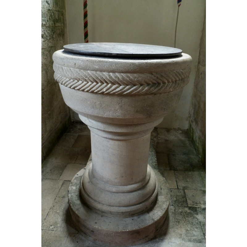
Image copyright © John Wilkes, 2017
Standing permission
Results: 4 records
view of font and cover
Scene Description: showing a different font cover in August 2017
Copyright Statement: Image copyright © John Wilkes, 2017
Image Source: digital photograph taken 6 August 2017 by John Wilkes
Copyright Instructions: Standing permission
view of font and cover
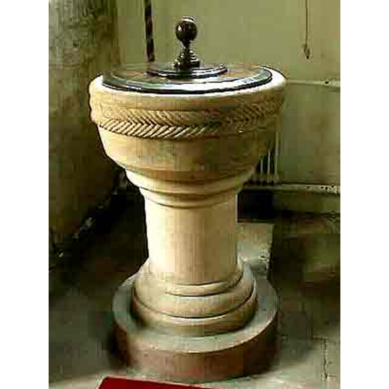
Scene Description: showing a cover with a finial or handle in December 2007
Copyright Statement: Image copyright © John Wilkes, 2007
Image Source: digital photograph by John Wilkes, in The Gloucestershire Photo Library [http://www.allthecotswolds.com/] [accessed 25 December 2007]
Copyright Instructions: Standing permission
view of church exterior - south view
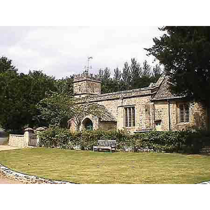
Copyright Statement: Image copyright © John Wilkes, 2007
Image Source: digital photograph by John Wilkes, in The Gloucestershire Photo Library [http://www.allthecotswolds.com/] [accessed 25 December 2007]
Copyright Instructions: Standing permission
view of church interior - looking east
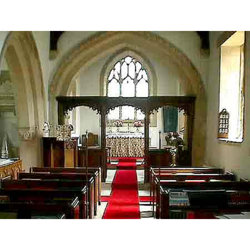
Copyright Statement: Image copyright © John Wilkes, 2007
Image Source: digital photograph by John Wilkes, in The Gloucestershire Photo Library [http://www.allthecotswolds.com/] [accessed 25 December 2007]
Copyright Instructions: Standing permission
INFORMATION
Font ID: 13266YAN
Object Type: Baptismal Font1
Font Date: ca. 1200?
Font Century and Period/Style: 12th - 13th century [re-cut], Transitional [altered]
Church / Chapel Name: Parish Church of St. Michael [formerly St. Mary's?]
Font Location in Church: Inside the church
Church Patron Saint(s): St. Michael [formerly dedicated to St. Mary?]
Church Notes: "Yanworth church bore a dedication to ST. MICHAEL in 1743; (fn. 457) it, or a chantry in it, may have been dedicated to St. Mary in 1355." [cf. VCH entry in FontNotes]
Church Address: Yanworth, Gloucestershire, GL54 3LG
Site Location: Gloucestershire, South West, England, United Kingdom
Directions to Site: Located off (W) the A4729, 15 km NNE of Gloucester
Ecclesiastic Region: Diocese of Gloucester
Historical Region: Hundred of Bradley
Additional Comments: altered font: re-cut and mounted in the 19th century?
Font Notes:
Click to view
There is an entry for Yanworth [variant spelling] in the Domesday survey [http://opendomesday.org/place/SP0713/yanworth/] [accessed 6 August 2017], but it mentions neither priest nor church in it. Verey & Brooks (1999-2002) write: "Font. A Norman tub raised on a C19th pedestal." The Victoria County History (Gloucester, vol. 9, 2001) notes: "The church retains its 12th-century font, which has cable moulding around the rim and stands on a 19th-century base." The basin, which has a double rope moulding in the form of a braid appears to have been re-cut from its original shape, and then mounted on a modern pedestal base. The round flat cover is modern as well [NB: two different covers are shown on the font, one in 2007, another in 2017].
Credit and Acknowledgements: We are grateful to John Wilkes, of www.allthecotswolds.com, for the photographs of this church and font.
COORDINATES
UTM: 30U 576748 5741996
Latitude & Longitude (Decimal): 51.823521, -1.886406
Latitude & Longitude (DMS): 51° 49′ 24.68″ N, 1° 53′ 11.06″ W
MEDIUM AND MEASUREMENTS
Material: stone
Font Shape: round, mounted
Basin Interior Shape: round
Basin Exterior Shape: round
LID INFORMATION
Date: 19th century?
Material: wood
Apparatus: no
Notes: [cf. FontNotes]
REFERENCES
- Victoria County History [online], University of London, 1993-. URL: https://www.british-history.ac.uk.
- Verey, David, Gloucestershire, London: Penguin Books, 1999-2002, vol. 1: 767