West Wratting / Waratinge
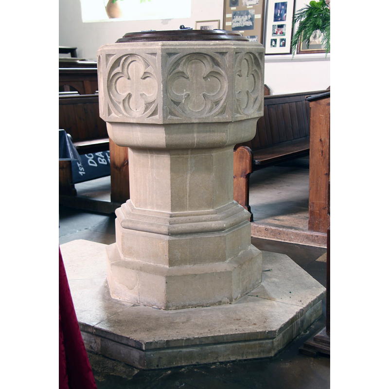
Image copyright © John Salmon, 2015
CC-BY-SA-2.0
Results: 4 records
view of font and cover
Scene Description: the modern font
Copyright Statement: Image copyright © John Salmon, 2015
Image Source: digital photograph taken 10 August 2015 by John Salmon [www.geograph.org.uk/photo/4663244] [accessed 19 May 2016]
Copyright Instructions: CC-BY-SA-2.0
view of church exterior - west end
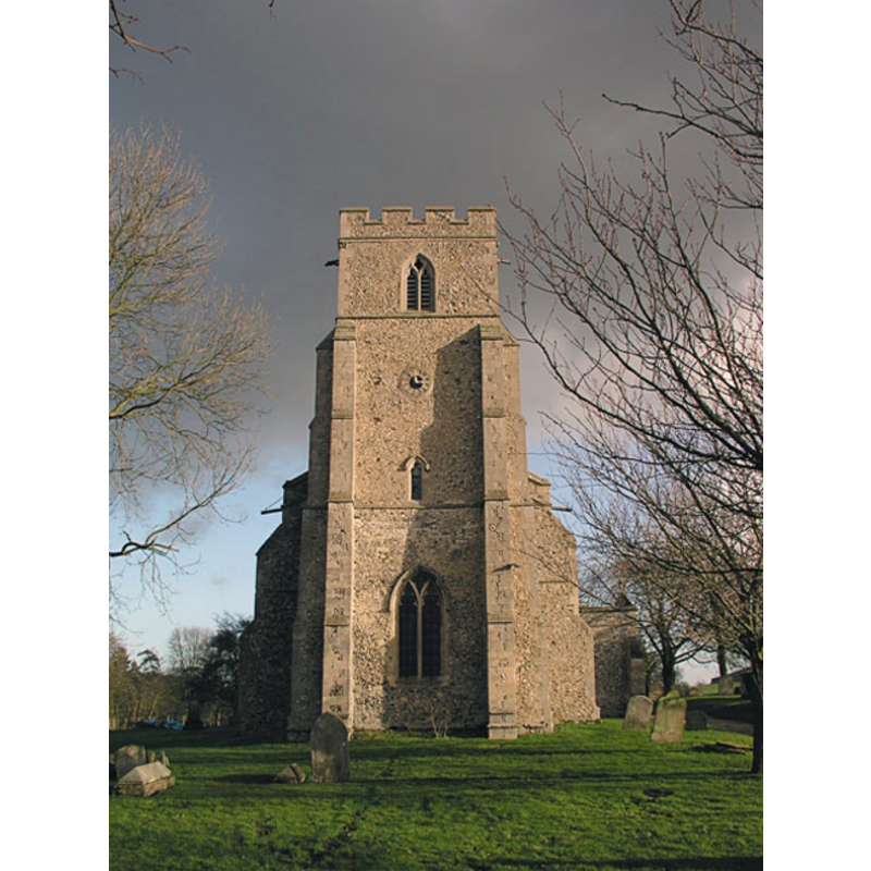
Copyright Statement: Image copyright © Mark Ynys-Mon, 2004
Image Source: digital photograph by Mark Ynys-Mon, 2004, in Cambridgeshire Churches [http://www.druidic.org/camchurch/churches/westwratting.htm] [accessed 15 December 2007]
Copyright Instructions: Standing permission
view of church interior - nave - looking west
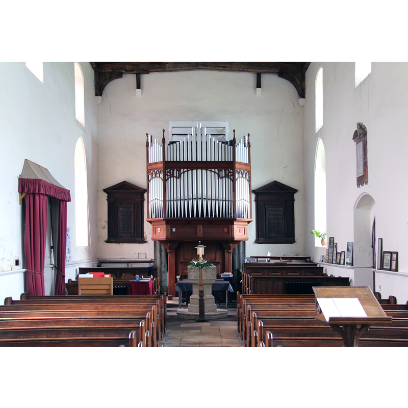
Scene Description: the modern font at the end of the centre aisle
Copyright Statement: Image copyright © John Salmon, 2015
Image Source: digital photograph taken 10 August 2015 by John Salmon [www.geograph.org.uk/photo/4663242] [accessed 19 May 2016]
Copyright Instructions: CC-BY-SA-2.0
view of church interior - nave - looking east
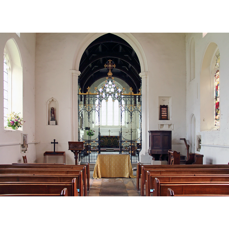
Copyright Statement: Image copyright © John Salmon, 2015
Image Source: digital photograph taken 10 August 2015 by John Salmon [www.geograph.org.uk/photo/4663220] [accessed 19 May 2016]
Copyright Instructions: CC-BY-SA-2.0
INFORMATION
Font ID: 13258WRA
Object Type: Baptismal Font1?
Font Century and Period/Style: 12th century (early?), Norman
Church / Chapel Name: Parish Church of St. Andrew
Church Patron Saint(s): St. Andrew
Church Address: West Wratting, Cambridgeshire CB21 5NA
Site Location: Cambridgeshire, East, England, United Kingdom
Directions to Site: Located 12 km SW of Newmarket, 16 km S of Cambridge
Ecclesiastic Region: Diocese of Ely
Historical Region: Hundred of Radfield
Additional Comments: disappeared font? (the font of the early-12thC church here)
Font Notes:
Click to view
There are six entries for [West] Wratting [variant spelling] in the Domesday survey [http://opendomesday.org/place/TL6052/west-wratting/] [accessed 19 May 2016], none of which mentions cleric or church in it. The Victoria County History (Cambridge..., vol. 6, 1978) notes: "There was a church at West Wratting in the earlier 12th century when Bishop Niel granted it to the infirmary of Ely. [...] Foundations said to have been discovered below the east end of the nave in the late 19th century [...] have been interpreted as the footings of a central tower; if there was such a tower it pre-dated the 13th-century chancel arch and east wall of the nave which are the oldest parts of the building"; no font mentioned in the VCH entry. Noted in Cambridgeshire Churches as a Victorian font [NB: we have no information on the font of the early-12th century church here].
Credit and Acknowledgements: We are grateful to Mark Ynys-Mon, of Cambridgeshire Churches, for the photograph of this church.
COORDINATES
UTM: 31U 318288 5780566
Latitude & Longitude (Decimal): 52.14567, 0.34422
Latitude & Longitude (DMS): 52° 8′ 44.41″ N, 0° 20′ 39.19″ E
REFERENCES
- Victoria County History [online], University of London, 1993-. URL: https://www.british-history.ac.uk.