West Wickham / Wicheham
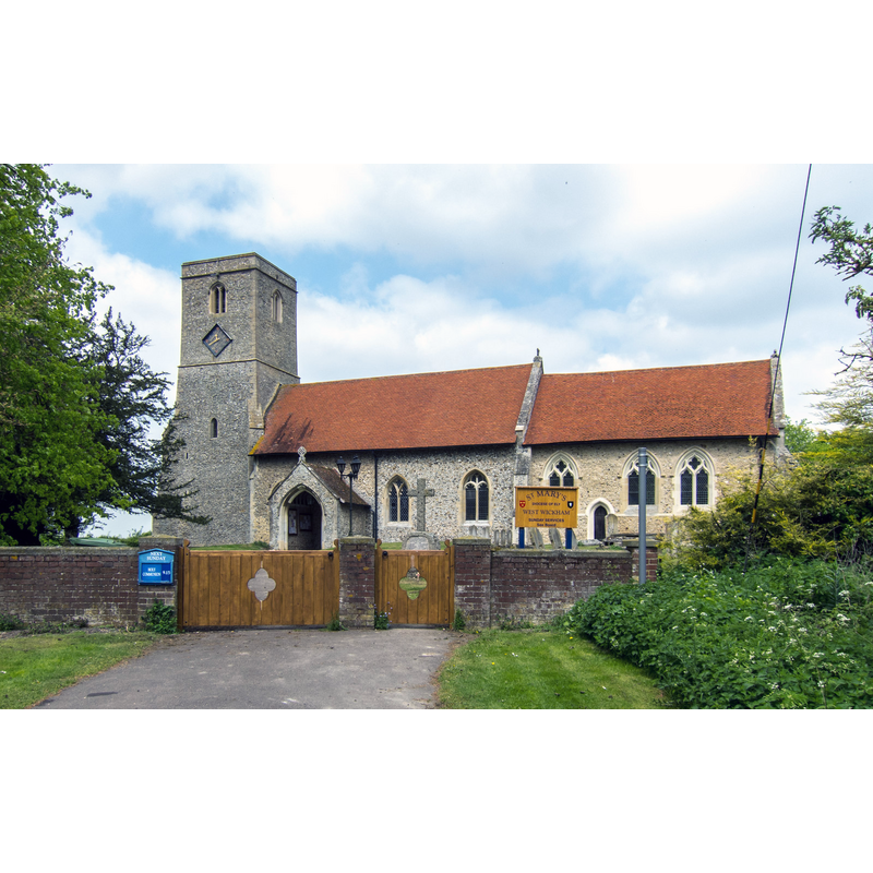
Image copyright © Kim Fyson, 2016
CC-BY-SA-2.0
Results: 2 records
view of church exterior - south view
Copyright Statement: Image copyright © Kim Fyson, 2016
Image Source: digital photograph taken 19 May 2013 by Kim Fyson [www.geograph.org.uk/photo/3466486] [accessed 18 May 2016]
Copyright Instructions: CC-BY-SA-2.0
view of church exterior - west end
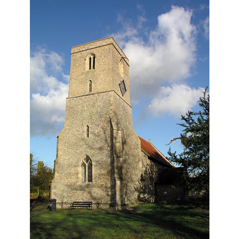
Copyright Statement: Image copyright © Mark Ynys-Mon, 2004
Image Source: digital photograph by Mark Ynys-Mon, 2004, in Cambridgeshire Churches [http://www.druidic.org/camchurch/churches/westwickham.htm] [accessed 15 December 2007]
Copyright Instructions: Standing permission
INFORMATION
Font ID: 13257WIC
Object Type: Baptismal Font1?
Font Century and Period/Style: 15th century, Perpendicular
Church / Chapel Name: Parish Church of St. Mary
Church Patron Saint(s): St. Mary the Virgin
Church Address: 66 High Street, West Wickham, Cambridgeshire CB21 4RY
Site Location: Cambridgeshire, East, England, United Kingdom
Directions to Site: Located off the A1307, NW of Haverhill
Ecclesiastic Region: Diocese of Ely
Historical Region: Hundred of Chilford
Additional Comments: disappeared font? (the one from the ca. 1200 church here)
Font Notes:
Click to view
There are five entries for this [West] Wickam [variant spelling] in the Domesday survey [http://opendomesday.org/place/TL6149/west-wickham/] [accessed 18 May 2016], none of which mentions cleric or church in it. The Victoria County History (Cambridge..., vol. 6, 1978) notes: "By c. 1200 West Wickham had a church [...] The tower may be 13th-century, but its west window has Decorated tracery. The chancel is 14th-century"; no font mentioned in the VCH entry. [NB: we have no information on this font at present; the church itself dates back to the Perpendicular period]
Credit and Acknowledgements: We are grateful to Mark Ynys-Mon, of Cambridgeshire Churches, for the photograph of this church.
COORDINATES
UTM: 31U 318773 5777426
Latitude & Longitude (Decimal): 52.11762, 0.352977
Latitude & Longitude (DMS): 52° 7′ 3.43″ N, 0° 21′ 10.72″ E