Thorney nr. Peterborough
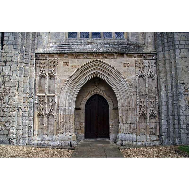
Image copyright © Richard Croft, 2009
CC-BY-SA-2.0
Results: 4 records
view of church exterior - west portal
Scene Description: Source caption: "Fourteenth century west doorway to the Abbey Church, restored 1638"
Copyright Statement: Image copyright © Richard Croft, 2009
Image Source: digital photograph taken 26 May 2009 by Richard Croft [www.geograph.org.uk/photo/1322455] [accessed 27 April 2016]
Copyright Instructions: CC-BY-SA-2.0
view of church exterior
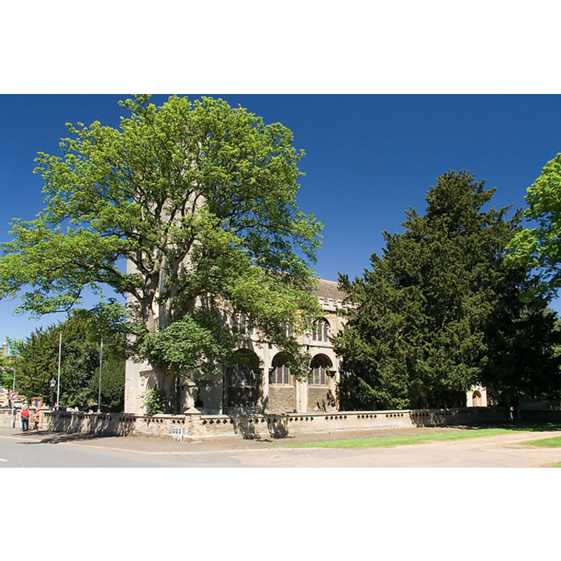
Copyright Statement: Image copyright © Mark Ynys-Mon, 2004
Image Source: digital photograph by Mark Ynys-Mon, 2004, in Cambridgeshire Churches [http://www.druidic.org/camchurch/churches/thorney.htm] [accessed 15 December 2007]
Copyright Instructions: Standing permission
view of church interior - nave - looking east
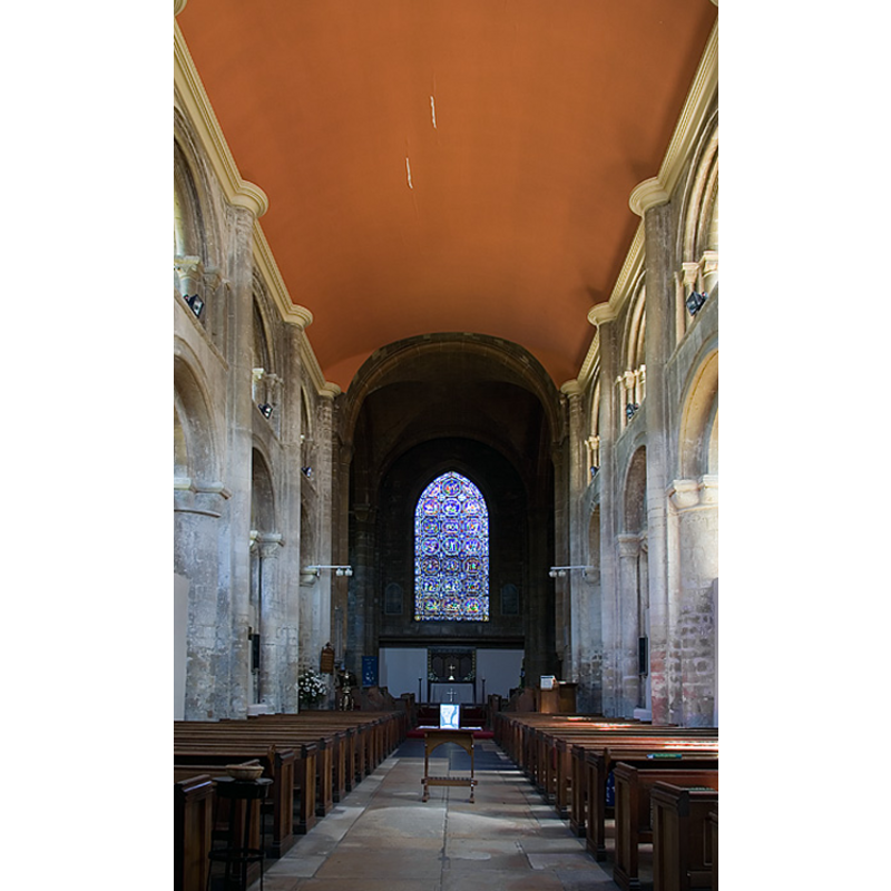
Copyright Statement: Image copyright © Mark Ynys-Mon, 2004
Image Source: digital photograph by Mark Ynys-Mon, 2004, in Cambridgeshire Churches [http://www.druidic.org/camchurch/churches/thorney.htm] [accessed 15 December 2007]
Copyright Instructions: Standing permission
view of object in context
![[cf. Font notes]](/static-50478a99ec6f36a15d6234548c59f63da52304e5/compressed/1071215020_compressed.png)
Scene Description: [cf. Font notes]
Copyright Statement: Image copyright © ULAS, 2001
Image Source: digital photograph in ULAS [www.le.ac.uk/ulas/images/thorneyfont.jpg] accessed 15 December 2007]
Copyright Instructions: No known copyright restriction / Fair Dealing
INFORMATION
Font ID: 13255THO
Object Type: Baptismal Font1?
Font Century and Period/Style: 12th century, Norman
Church / Chapel Name: Abbey Church of St. Mary and St. Botolph [cf. FontNotes]
Font Location in Church: [cf. FontNotes]
Church Patron Saint(s): St. Mary the Virgin & St. Botulf [aka Botolph]
Church Notes: abbey founded 7thC; destroyed in 870 raid by Danes; re-founded 10thC; re-buit 1085-1108; renovated mid-19thC
Church Address: B1040, Thorney, Peterborough PE6 0QA
Site Location: Cambridgeshire, East, England, United Kingdom
Directions to Site: Located at the A47-B1040 crossroads, ENE of Peterborough
Ecclesiastic Region: Diocese of Ely
Historical Region: Hundred of Ely 1 [in Domesday] -- Hundred of Wisbech
Additional Comments: abandoned font? Disused font? [contacted ULAS available e-mail] -- disappeared or destroyed font? (the one from the earliest abbey church here)
Font Notes:
Click to view
No idividual entry for this Thorney found in the Domesday survey. The University of Leicester Archaeological Services [www.le.ac.uk/ulas/projects/thorney.html] [accessed 15 December 2007] reported after the Summer 2001 project at Thorney Abbey, Cambridgeshire: "Roughly central to the building the remains of a stone-faced, brick fireplace were revealed. A small depression cut into some of the bricks was found to contain a lump of lead, further emphasising the lead recycling activities. Another intriguing feature was revealed to the east of the fireplace where a large architectural fragment had been re-used for lead working. The feature was made of a large octagonal limestone block with a c.20cm deep carved bowl in the top. Burning in the bowl and on the upper levels of the block, as well as large amounts of lead waste in the immediate vicinity, provided evidence for its re-use and complements the surrounding evidence for lead working. The earlier use of the stone however remains a mystery. Two possibilities are that it could either be a buried font or a laver (hand basin) both of which seem highly probable given the context of the site." The image in the report shows a quadrangular object, consistent in general shape and size with several of the font designs of the 12th century, one of the periods of activity of Thorney Abbey. Abbeys and monasteries often had parochial functions at the time, especially in the administration of baptism. [NB: thus far we have not been able to ascertain that the object was a baptismal font]. The entry for this church in the Victoria County History (Cambridge..., vol. 4, 2002) reports nave arcades of 12th-century daye here, but a modern font.
COORDINATES
UTM: 30U 696077 5834281
Latitude & Longitude (Decimal): 52.623064, -0.103134
Latitude & Longitude (DMS): 52° 37′ 23.03″ N, 0° 6′ 11.28″ W
MEDIUM AND MEASUREMENTS
Material: stone
Font Shape: square (unmounted)
Basin Interior Shape: round
Basin Exterior Shape: square
REFERENCES
- Victoria County History [online], University of London, 1993-. URL: https://www.british-history.ac.uk.