Watton-at-Stone / Watone / Wattun / Wodtone / Wodtune
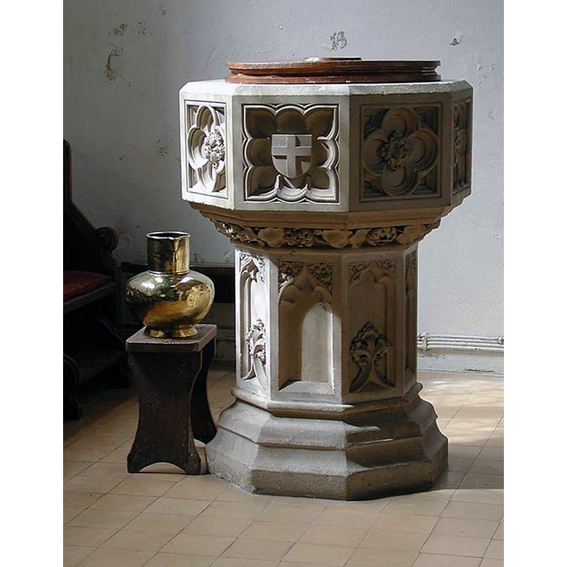
Image copyright © John Salmon, 2007
CC-BY-SA-2.0
Results: 3 records
view of font and cover
Scene Description: the modern font
Copyright Statement: Image copyright © John Salmon, 2007
Image Source: digital photograph taken 25 August 2003 by John Salmon [www.geograph.org.uk/photo/356520] [accessed 18 October 2016]
Copyright Instructions: CC-BY-SA-2.0
view of church exterior - southeast view
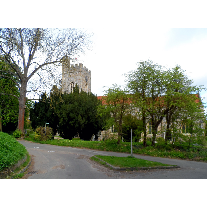
Copyright Statement: Image copyright © Bikeboy, 2013
Image Source: digital photograph taken 4 May 2013 by Bikeboy [www.geograph.org.uk/photo/3445133] [accessed 18 October 2016]
Copyright Instructions: CC-BY-SA-2.0
view of church interior - nave - looking east
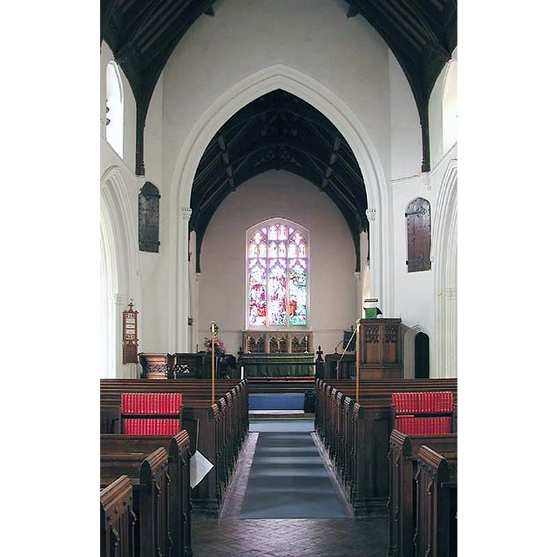
Copyright Statement: Image copyright © John Salmon, 2007
Image Source: digital photograph taken 25 August 2003 by John Salmon [www.geograph.org.uk/photo/356517] [accessed 18 October 2016]
Copyright Instructions: CC-BY-SA-2.0
INFORMATION
Font ID: 13252WAT
Object Type: Baptismal Font1?
Font Century and Period/Style: 13th century, Early English
Church / Chapel Name: Parish Church of St. Mary and St. Andrew
Church Patron Saint(s): St. Mary the Virgin & St. Andrew
Church Address: Perrywood Lane, Watton at Stone, Hertfordshire SG14 3SZ
Site Location: Hertfordshire, East, England, United Kingdom
Directions to Site: Located at the A602-A119 cross-roads, 10 km SE of Stevenage
Ecclesiastic Region: Diocesis of St. Albans
Historical Region: Hundred of Broadwater
Additional Comments: disappeared font? (the one from the 13thC (?) church here)
Font Notes:
Click to view
There are four entries for this Watton [variant spelling] in the Domesday survey [http://opendomesday.org/place/TL3018/watton/] [accessed 18 October 2016], one of which, in the lordship of Anketil of Rots, mentions a priest but not a church in it, though there probably was one there. The Gentleman's Magazine (issue for SeptemberJuly 1842, p. 298) lists in its 'Literary and Scientific Intelligence' section," 'A Companion to the Baptismal Font', by the Rev. E. Bickersteth, Rector of Watton, Herts. 18mo. 2s". The Victoria County History (Hertford, vol. 3, 1912) notes: "The advowson is first mentioned in 1304, when it was in the hands of Mabel de Tuwe […] The original church was entirely obliterated by the 15th-century rebuilding […] The nave arcades are of the 13th century"; no font mentioned in the VCH entry. The present font is Victorian, octagonal all over, of a Perpendicular-style design. [NB: the fabric of the church goes back to the 13th century, but we have no information on its earlier font].
COORDINATES
UTM: 30U 699039 5748733
Latitude & Longitude (Decimal): 51.853854, -0.109806
Latitude & Longitude (DMS): 51° 51′ 13.87″ N, 0° 6′ 35.3″ W
REFERENCES
- Victoria County History [online], University of London, 1993-. URL: https://www.british-history.ac.uk.