Snailwell / Snellewelle
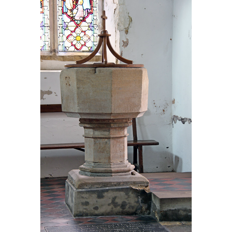
Image copyright © John Salmon, 2015
CC-BY-SA-2.0
Results: 5 records
view of font and cover
Scene Description: notice the damage at the upper rim of the basin, where the anchoring for an earlier cover would have been attached
Copyright Statement: Image copyright © John Salmon, 2015
Image Source: digital photograph taken 16 February 2015 by John Salmon [www.geograph.org.uk/photo/4374047] [accessed 20 July 2016]
Copyright Instructions: CC-BY-SA-2.0
view of church exterior - south view
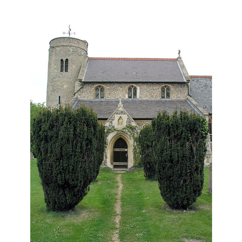
Copyright Statement: Image copyright © Mark Ynys-Mon, 2004
Image Source: digital photograph by Mark Ynys-Mon, 2004, in Cambridgeshire Churches [http://www.druidic.org/camchurch/churches/snailwell.htm] [accessed 28 November 2007]
Copyright Instructions: Standing permission
view of church exterior - southeast view
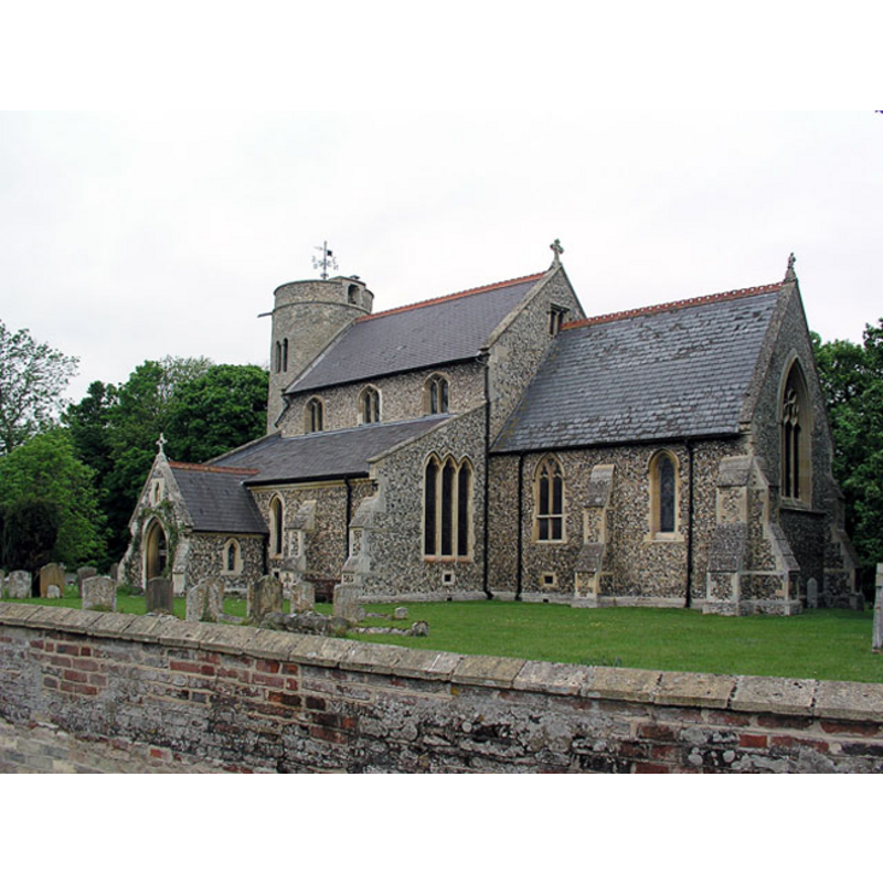
Copyright Statement: Image copyright © Mark Ynys-Mon, 2004
Image Source: digital photograph by Mark Ynys-Mon, 2004, in Cambridgeshire Churches [http://www.druidic.org/camchurch/churches/snailwell.htm] [accessed 28 November 2007]
Copyright Instructions: Standing permission
view of church interior - nave - looking east
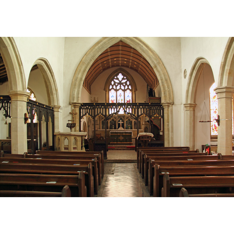
Copyright Statement: Image copyright © John Salmon, 2015
Image Source: digital photograph taken 16 February 2015 by John Salmon [www.geograph.org.uk/photo/4374047] [accessed 20 July 2016]
Copyright Instructions: CC-BY-SA-2.0
design element - motifs - moulding
Scene Description: several on the octagonal pedestal base
Copyright Statement: Image copyright © John Salmon, 2015
Image Source: digital photograph taken 16 February 2015 by John Salmon [www.geograph.org.uk/photo/4374047] [accessed 20 July 2016]
Copyright Instructions: CC-BY-SA-2.0
INFORMATION
Font ID: 13240SNA
Object Type: Baptismal Font1
Font Date: ca. 1320?
Font Century and Period/Style: 14th century (early?), Decorated
Church / Chapel Name: Parish Church of St. Peter [originally (?) St. Andrew's]
Font Location in Church: Iniside the church
Church Patron Saint(s): St. Peter [originally (?) dedicated to St. Andrew]
Church Notes: round-tower church
Church Address: Church Lane, Snailwell, Cambridgeshire CB8 7LZ
Site Location: Cambridgeshire, East, England, United Kingdom
Directions to Site: Located off (E) the E142, 5 km NE of Newmarket
Ecclesiastic Region: Diocese of Ely
Historical Region: Hundred of Staploe
Additional Comments: disappeared font? (the one from the 11thC church here)
Font Notes:
Click to view
There is an entry for Snailwell [variant spelling] in the Domesday survey [http://opendomesday.org/place/TL6467/snailwell/] [accessed 20 July 2016], but it mentions neither cleric nor church in it. The Victoria County History (Cambridge…, vol. 10, 2002) notes: "There was a church at Snailwell by the 11th century. […] Snailwell church, always remaining a rectory, belonged from the 12th century to the bishops of Ely. […] The parish church of ST. PETER, so called in 1791 […] and perhaps from c. 1400, […] but dedicated to St. Andrew in the late 13th century, […] consists of a clerestoried nave with north and south aisles, chancel and west tower. […] Its 11thcentury round tower dressed in Barnack limestone, of three stages with a plain parapet, had until c. 1850 a lead spire, which probably collapsed before 1877"; no font mentioned in the VCH entry. The St. Margaret's Church, Chippenham, web site [http://ely.anglican.org/parishes/chippenham/index.htm] [accessed 28 November 2007] notes: "St Peter's Church in the parish of Snailwell is also ancient. The present church dates from 1070 A.D. and the rare flint constructed round tower survives from this period [...] In addition to the round tower of St Peter's, there are traces of the Norman nave and roof still clearly visible at the west end of the church [...] The nave was enlarged in 1320 when the north aisle and the original vestry were built. A door leading into the north aisle can still be seen outside the church. The present stone font and canopied tomb by the high altar date from this period." The present wooden cover is modern but there is evidence on the sides of the upper rim of the basin of anchoring spots for an earlier cover. [NB: there probably was an earlier font, dating from the original early-Norman church, but we have no information on that font].
Credit and Acknowledgements: We are grateful to Mark Ynys-Mon, of Cambridgeshire Churches, for his photographs of this church.
COORDINATES
UTM: 31U 323036 5795465
Latitude & Longitude (Decimal): 52.281025, 0.405756
Latitude & Longitude (DMS): 52° 16′ 51.69″ N, 0° 24′ 20.72″ E
MEDIUM AND MEASUREMENTS
Material: stone
Font Shape: octagonal, mounted
Basin Interior Shape: round
Basin Exterior Shape: octagonal
LID INFORMATION
Date: modern
Material: wood
Apparatus: no
Notes: [cf. FontNotes]
REFERENCES
- Victoria County History [online], University of London, 1993-. URL: https://www.british-history.ac.uk.