Tooting Graveney / Lower Tooting / Lytle Totynge / Toting Gravenee / Totinge / Totinges / Totynge Grauenel
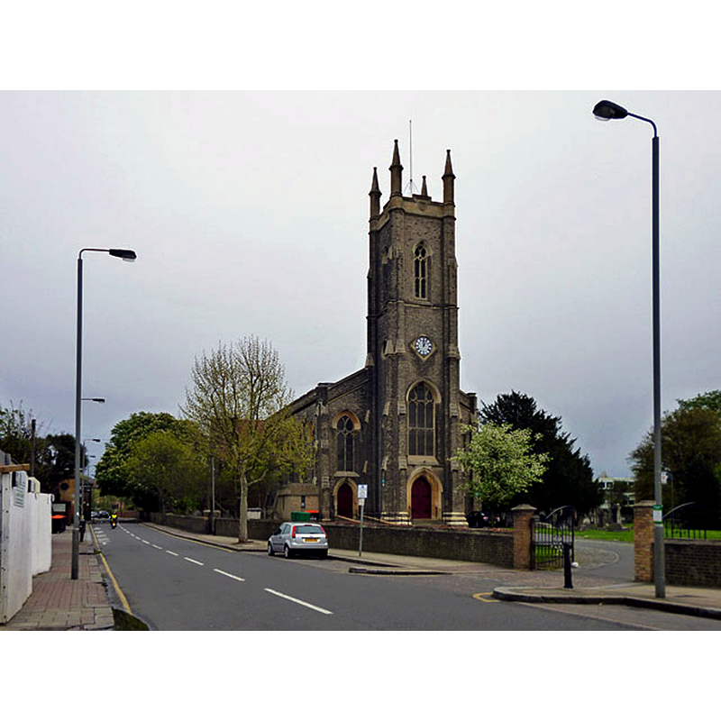
Image copyright © Robin Webster, 2012
CC-BY-SA-2.0
Results: 1 records
view of church exterior - northwest view
Copyright Statement: Image copyright © Robin Webster, 2012
Image Source: digital photograph taken 6 May 2012 by Robin Webster [www.geograph.org.uk/photo/2931593] [accessed 14 March 2016]
Copyright Instructions: CC-BY-SA-2.0
INFORMATION
Font ID: 13236TOO
Object Type: Baptismal Font1?
Font Century and Period/Style: 11th century, Pre-Conquest? / Norman
Church / Chapel Name: Parish Church of St. Nicholas
Church Patron Saint(s): St. Nicholas of Myra
Church Address: Church Lane, Tooting Graveney, London, SW17 9PP -- Tel.: +44 20 8672 7691
Site Location: Greater London, South East, England, United Kingdom
Directions to Site: Locating on Franciscan Rd., nr. Tooting Bec, in SW Gt. London, N of Sutton, Botough of Wandsworth
Ecclesiastic Region: Diocese of Southwark
Historical Region: Hundred of Brixton -- formerly in Surrey
Additional Comments: disappeared font?
Font Notes:
Click to view
There are four entries for Tooting [Graveney] and [Upper] Tooting [variant spelling] in the Domesday survey [http://opendomesday.org/place/XX0000/tooting-graveney-and-upper-tooting/] [accessed 14 March 2016], one of which reports a church in it. The Victoria County History (Surrey, vol. 4, 1912) notes: "The first mention of the church of St. Nicholas seems to be that of 1086 [...] In the vestry [of the present church] is an old print of the church which preceded this one on the same site [...] the font of grey Purbeck marble with a tall green and gold wood cover."
COORDINATES
Latitude & Longitude (DMS): 51° 25' 29" N, 0° 9' 43" E
LID INFORMATION
Material: wood
Notes: [cf. FontNotes]
REFERENCES
- Victoria County History [online], University of London, 1993-. URL: https://www.british-history.ac.uk.