Reach
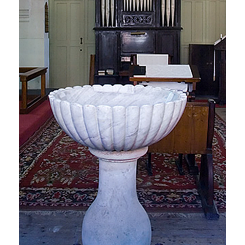
Image copyright © Mark Ynys-Mon, 2005
Standing permission
Results: 5 records
view of font in context
Scene Description: new font in new church
Copyright Statement: Image copyright © Mark Ynys-Mon, 2005
Image Source: detail of a digital photograph by Mark Ynys-Mon, 2005, in Cambridgeshire Churches [http://www.druidic.org/camchurch/churches/reach.htm] [accessed 23 November 2007]
Copyright Instructions: Standing permission
view of church exterior
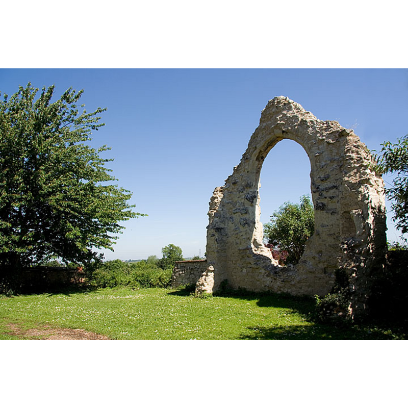
Scene Description: remains of the medieval church
Copyright Statement: Image copyright © Mark Ynys-Mon, 2005
Image Source: digital photograph by Mark Ynys-Mon, 2005, in Cambridgeshire Churches [http://www.druidic.org/camchurch/churches/reach.htm] [accessed 23 November 2007]
Copyright Instructions: Standing permission
view of church interior - apse
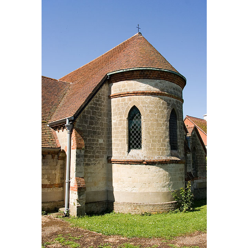
Scene Description: new church
Copyright Statement: Image copyright © Mark Ynys-Mon, 2005
Image Source: digital photograph by Mark Ynys-Mon, 2005, in Cambridgeshire Churches [http://www.druidic.org/camchurch/churches/reach.htm] [accessed 23 November 2007]
Copyright Instructions: Standing permission
view of church exterior - northwest view
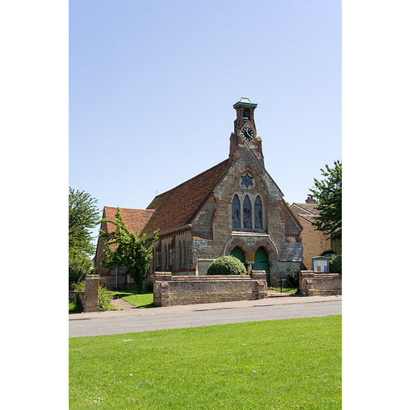
Scene Description: new church
Copyright Statement: Image copyright © Mark Ynys-Mon, 2005
Image Source: digital photograph by Mark Ynys-Mon, 2005, in Cambridgeshire Churches [http://www.druidic.org/camchurch/churches/reach.htm] [accessed 23 November 2007]
Copyright Instructions: Standing permission
view of church interior
Scene Description: new church
Copyright Statement: Image copyright © Mark Ynys-Mon, 2005
Image Source: digital photograph by Mark Ynys-Mon, 2005, in Cambridgeshire Churches [http://www.druidic.org/camchurch/churches/reach.htm] [accessed 23 November 2007]
Copyright Instructions: Standing permission
INFORMATION
Font ID: 13232REA
Object Type: Baptismal Font1?
Font Century and Period/Style: Medieval
Church / Chapel Name: Parish Church of St. Etheldreda and the Holy Trinity [replaced St John's in 1860]
Church Patron Saint(s): St. Etheldreda [aka Audrey, Æðelþryð, Æþelðryþe, Æthelthryth, Ediltrudis] & the Holy Trinity
Church Address: Chapel Lane, Reach, Cambridgeshire CB25 0JQ
Site Location: Cambridgeshire, East, England, United Kingdom
Directions to Site: Located 4 km WSW of Burwell, 20 km ENE of Cambridge
Ecclesiastic Region: Diocese of Ely
Historical Region: Hundred of Staine
Additional Comments: disappeared font (the one from the original medieval church/chapel)
Font Notes:
Click to view
No entry found for Reach in the Domesday survey. The Victoria County History (Cambridge and the Isle of Ely, vol. 10, 2002) notes: "Probably in the 1220s the rector of St. Mary's, Burwell, with the consent of his patron, the abbot of Ramsey, agreed that his parishioners at the 'vill' of Reach might have a chapel, in which a chaplain supplied by the rector would serve weekly. […] That was presumably the origin of the chapel of St. John, standing north-east of Reach green, on the Burwell side." The VCH (ibid.) shows masses were regularly said at the chapel in all periods, but it is not clear what other sacraments were performed there. The original font, together with most of the medieval church, has disappeared. The curent font is probably contemporary with the new High Victorian church. It consists of a ribbed hemispherical basin raised on a baluster pedestal base.
Credit and Acknowledgements: We are grateful to Mark Ynys-Mon, of Cambridgeshire Churches, for his photographs of church and font.
COORDINATES
UTM: 31U 315495 5794704
Latitude & Longitude (Decimal): 52.271705, 0.295756
Latitude & Longitude (DMS): 52° 16′ 18.14″ N, 0° 17′ 44.72″ E
REFERENCES
- Victoria County History [online], University of London, 1993-. URL: https://www.british-history.ac.uk.