Kirtling / Chertelinge
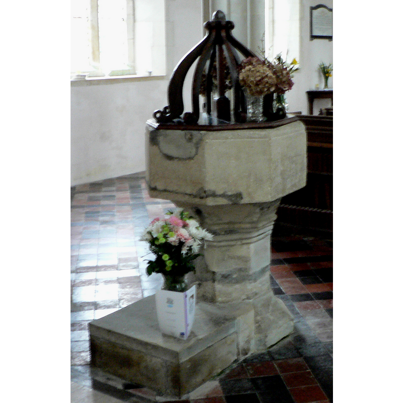
Image copyright © Rob Allard, 2007
Permission received (email of 29 Oct 2007)
Results: 8 records
view of font and cover
Copyright Statement: Image copyright © Rob Allard, 2007
Image Source: detail of a digital photograph by Rob Allard [http://allard.actewagl.net.au]
Copyright Instructions: Permission received (email of 29 Oct 2007)
view of font and cover in context
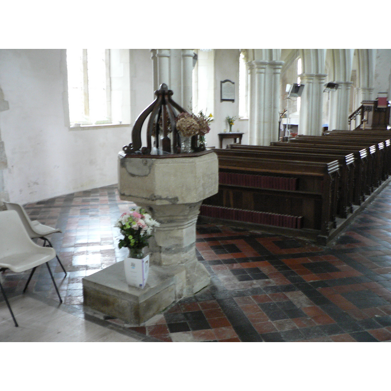
Copyright Statement: Image copyright © Rob Allard, 2007
Image Source: digital photograph by Rob Allard [http://allard.actewagl.net.au]
Copyright Instructions: Permission received (email of 29 Oct 2007)
design element - motifs - moulding
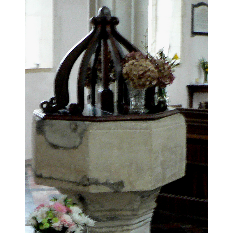
Scene Description: notice the damage and repairs on the basin side
Copyright Statement: Image copyright © Rob Allard, 2007
Image Source: detail of a digital photograph by Rob Allard [http://allard.actewagl.net.au]
Copyright Instructions: Permission received (email of 29 Oct 2007)
view of church exterior - south portal
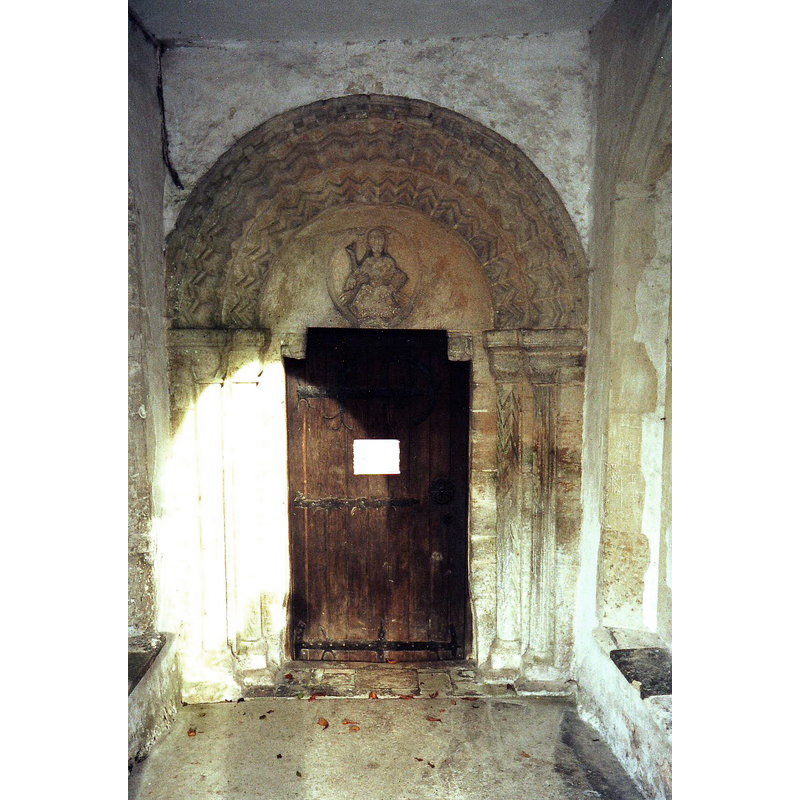
Scene Description: the 12thC portal
Copyright Statement: Image copyright © Nick Macneill, 2010
Image Source: digital image of a photograph taken 17 November 2001 by nick macneill [www.geograph.org.uk/photo/1670369] [accessed 12 July 2016]
Copyright Instructions: CC-BY-SA-2.0
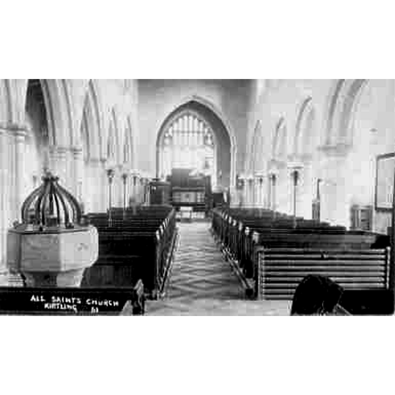
view of church exterior - south view
![Source caption: "All Saints Church, Kirtling. The village of Kirtling was situated around the church until the time of the Black Death. It is thought that the village was then moved to its present site about a mile south of the church. The victims of the Black Death are buried in a part of the church yard which will never be allowed to be reopened for burials.
1910 FONT CNTXT POSTCARD digital image of a 1910 postcard in Ancestry.com [www.rootsweb.ancestry.com/~engcam/images/KirtlingChurchFont1910.jpg] [accessed 12 July 2016] COPYRIGHT Cambridgeshire EnglandGenWeb, 2014 NO KNOWN…](/static-50478a99ec6f36a15d6234548c59f63da52304e5/compressed/1160712003_compressed.png)
Scene Description: Source caption: "All Saints Church, Kirtling. The village of Kirtling was situated around the church until the time of the Black Death. It is thought that the village was then moved to its present site about a mile south of the church. The victims of the Black Death are buried in a part of the church yard which will never be allowed to be reopened for burials.
1910 FONT CNTXT POSTCARD digital image of a 1910 postcard in Ancestry.com [www.rootsweb.ancestry.com/~engcam/images/KirtlingChurchFont1910.jpg] [accessed 12 July 2016] COPYRIGHT Cambridgeshire EnglandGenWeb, 2014 NO KNOWN…
Copyright Statement: Image copyright © Bob Jones, 2008
Image Source: digital photograph taken 24 November 2008 by Bob Jones [www.geograph.org.uk/photo/1058734] [accessed 12 July 2016]
Copyright Instructions: CC-BY-SA-2.0
view of church interior
Copyright Statement: Image copyright © Cambridgeshire EnglandGenWeb, 2014
Image Source: digital image of a 1910 postcard in Ancestry.com [www.rootsweb.ancestry.com/~engcam/images/KirtlingChurchFont1910.jpg] [accessed 12 July 2016]
Copyright Instructions: No known copyright restriction / Fair Dealing
view of church interior - nave - looking east
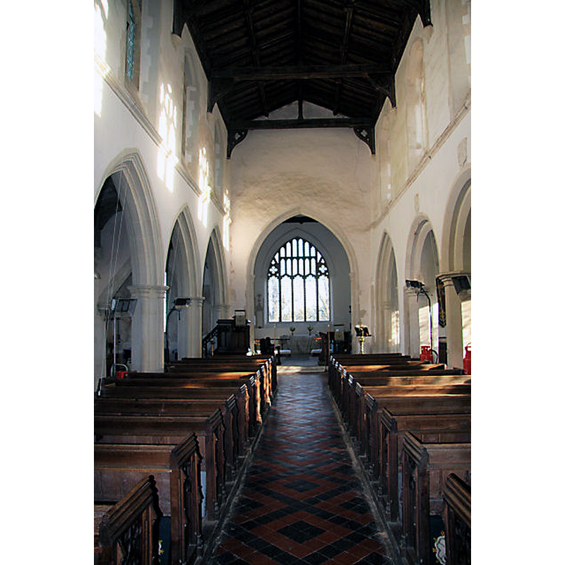
Scene Description: Source caption: "Interior of All Saints Church, Kirtling. The clerestory above the nave was added in the 15th century. The rest of the church dates back to Anglo-Saxon times."
Copyright Statement: Image copyright © Bob Jones, 2008
Image Source: digital photograph taken 24 November 2008 by Bob Jones [www.geograph.org.uk/photo/1058738] [accessed 12 July 2016]
Copyright Instructions: CC-BY-SA-2.0
design element - motifs - moulding
Copyright Statement: Image copyright © Rob Allard, 2007
Image Source: detail of a digital photograph by Rob Allard [http://allard.actewagl.net.au]
Copyright Instructions: Permission received (email of 29 Oct 2007)
INFORMATION
Font ID: 13216KIR
Object Type: Baptismal Font1
Font Century and Period/Style: 15th century, Perpendicular
Church / Chapel Name: Parish Church of All Saints
Font Location in Church: Inside the church, in the W end, opposite the doorway
Church Patron Saint(s): All Saints
Church Address: Kirtling, Cambridgeshire CB8 9PA
Site Location: Cambridgeshire, East, England, United Kingdom
Directions to Site: Located 9 km SE of Newmarket
Ecclesiastic Region: Diocese of Ely
Historical Region: Hundred of Cheveley
Additional Comments: damaged font (the present font has been repaired) -- disappeared font? (the one from the earlier church here: pre-Conquest? / 13thC?)
Font Notes:
Click to view
There is an entry for this Kirtling [variant spelling] in the Domesday survey [http://opendomesday.org/place/TL6857/kirtling/] [accessed 12 July 2016], but it mentions neither cleric nor church in it. The Victoria County History (Cambridge…, vol. 10, 2002) notes: "The church was once cruciform, with a low central tower over the crossing and a long aisleless nave. The foundations of the crossing survive below ground level. (fn. 55) The proportions of the building have been thought characteristic of an Anglo-Saxon church of high status, perhaps a minster, […] but churches were still being built in that form after 1066, and no features remain which are unambiguously pre-Conquest. Apart from what can be deduced of the original plan, the oldest surviving feature above ground is a small round-headed window at the west end of the south nave wall, the only part of the nave walls not altered in later centuries. The window head is carved from a single large block of stone, scooped out underneath to form an arch, and very simply decorated on the external face with concentric round arches. It dates from the later 11th century and may be pre-Conquest, but the window opening is straight, not splayed as many late Anglo-Saxon windows were"; no font mentioned in the VCH entry. A font here is noted in the Kirtling & Upend site [www.kirtlingandupend.org.uk/html/history_of_kirtling_-_6.html] [accessed 28 October 2007]: "Opposite to the door there is an octagonal plain stone font of unknown date". The basin is octagonal with a moulding at the upper rim, otherwise plain, with vertical sides; the underbowl chamfer is slightly concave and plain; there is a set of thin mouldings at the joining point of basin and base; the lower base splays and there is a chunky kneeling stone attached to the west side of the lower base. There is repaired damage on the basin and on the stem. The cover consists of a flat octagonal platform with the usual arrangement of eight (?) ribs around a central pivot.
Credit and Acknowledgements: We are grateful to Rob Allard, of http://allard.actewagl.net.au, for the photograph of this font.
COORDINATES
UTM: 31U 326812 5785271
Latitude & Longitude (Decimal): 52.190661, 0.466277
Latitude & Longitude (DMS): 52° 11′ 26.38″ N, 0° 27′ 58.6″ E
MEDIUM AND MEASUREMENTS
Material: stone
Font Shape: octagonal, mounted
Basin Interior Shape: round
Basin Exterior Shape: octagonal
LID INFORMATION
Material: wood
Notes: appears to be of the Jacobean type