Graveley nr. Stevenage / Grauelai
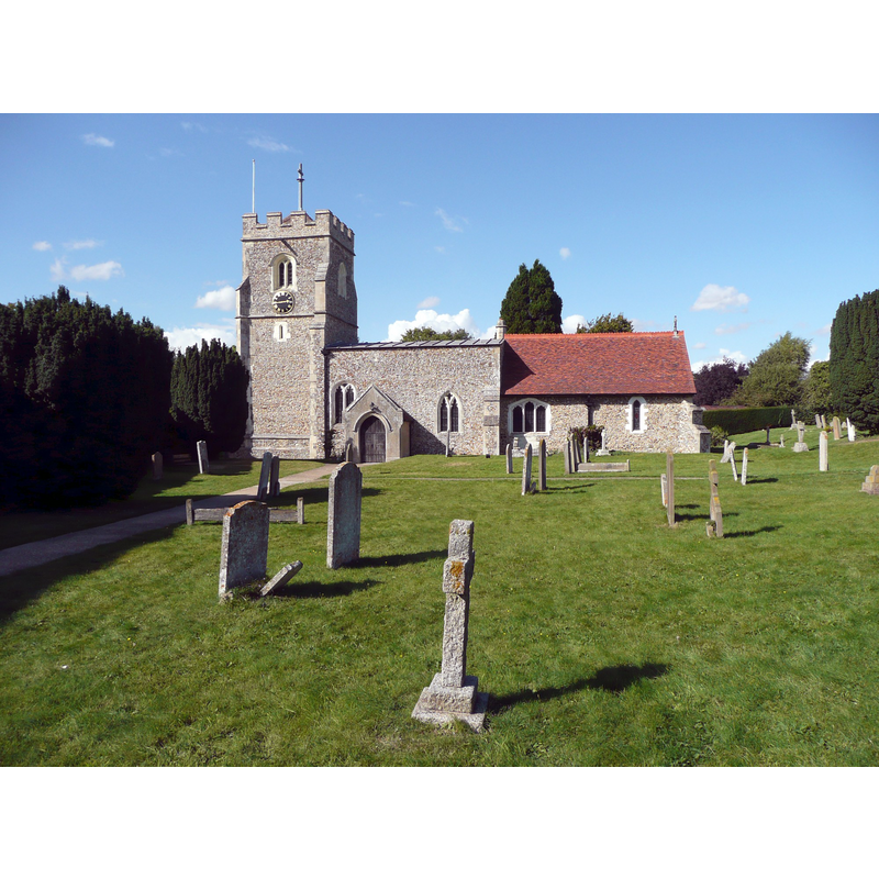
Image copyright © Humphrey Bolton, 2012
CC-BY-SA-2.0
Results: 1 records
view of church exterior - south view
Scene Description: Source caption: "St Mary’s Church, Graveley. This church is Grade I listed. The nave is 12C (heightened in the 15C), the chancel 13C and the tower built c.1485."
Copyright Statement: Image copyright © Humphrey Bolton, 2012
Image Source: digital photograph taken 18 September 2012 by Humphrey Bolton [www.geograph.org.uk/photo/3142348] [accessed 4 July 2016]
Copyright Instructions: CC-BY-SA-2.0
INFORMATION
Font ID: 13214GRA
Object Type: Baptismal Font1
Font Century and Period/Style: 15th century, Perpendicular
Church / Chapel Name: Parish Church of St. Mary
Font Location in Church: Inside the church
Church Patron Saint(s): St. Mary the Virgin
Church Address: Church Lane, Graveley, Hertfordshire SG4 7LR
Site Location: Hertfordshire, East, England, United Kingdom
Directions to Site: Located on the B197, 2-3 km N of Stevenage, 6 km E of Hitchin
Ecclesiastic Region: Diocese of St. Albans
Historical Region: Hundred of Broadwater [in Domesday]
Additional Comments: disappeared font? (the one from the 12thC church here)
Font Notes:
Click to view
There are five entries for this Graveley [variant spelling] in the Domesday survey [http://opendomesday.org/place/TL2327/graveley/] [accessed 4 July 2016], none of which mentions cleric or church in it. The Victoria County History (Hertford, vol. 3, 1912) notes: "The nave is the oldest part of the present structure and probably dates from the 12th century. In the 13th century the chancel was either enlarged or wholly rebuilt. The west tower was added about 1480, and the south porch probably in the 18th century. The north aisle and north vestry date from 1887, when the church was restored throughout. […] The font, of limestone, is octagonal, of the 15th century." [NB: the VCH (ibid.) mentions the ruined church of Chesfield St. Etheldreda's nearby, but we have no information on any font from that church]
COORDINATES
UTM: 30U 692126 5758201
Latitude & Longitude (Decimal): 51.941304, -0.204774
Latitude & Longitude (DMS): 51° 56′ 28.69″ N, 0° 12′ 17.18″ W
MEDIUM AND MEASUREMENTS
Material: stone, limestone
Font Shape: octagonal, mounted
Basin Interior Shape: round
Basin Exterior Shape: octagonal
LID INFORMATION
Date: 19th century?
Material: wood, oak?
Notes: wooden cover with floral decoration; modern
REFERENCES
- Victoria County History [online], University of London, 1993-. URL: https://www.british-history.ac.uk.