East Hatley / Castell Hatley / Hatelai
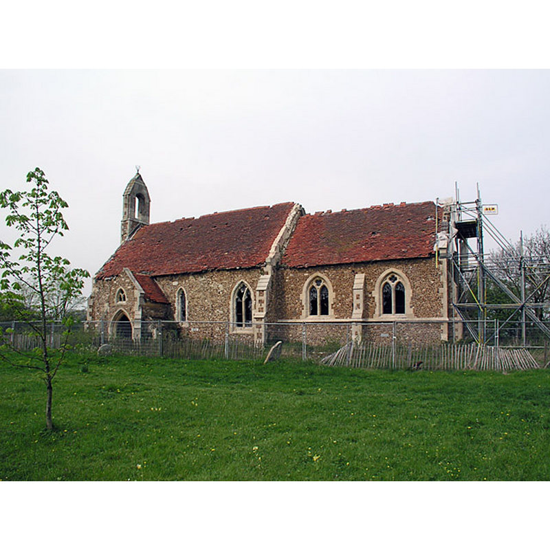
Image copyright © mym, 2009
CC-BY-SA-2.0
Results: 1 records
view of church exterior - southeast end
Scene Description: redundant since 1959
Copyright Statement: Image copyright © mym, 2009
Image Source: digital photograph taken 3 May 2004 by mym [www.geograph.org.uk/photo/3288] [accessed 6 June 2016]
Copyright Instructions: CC-BY-SA-2.0
INFORMATION
Font ID: 13207HAT
Object Type: Baptismal Font1?
Font Century and Period/Style: 13th century (early?), Early English
Church / Chapel Name: former Parish Church of St. Denys [aka St. Denis] [redundant since 1959]
Font Location in Church: [cf. FontNotes]
Church Patron Saint(s): St. Denys [aka Denis, Dennis, Dionis, Dyonisius]
Church Address: East Hatley, Hatley, Cambridgeshire SG19 3JA, UK
Site Location: Cambridgeshire, East, England, United Kingdom
Directions to Site: Located W the A1198 and N of the B1042, 7 km ENE of Potton, 20 km SW of Cambridge
Ecclesiastic Region: Diocese of Ely
Historical Region: Hundred of Arringford
Additional Comments: disappeared font? (the one from the original early-13thC church here)
Font Notes:
Click to view
There are three entries for [East] Hatley [variant spelling] in the Domesday survey [http://opendomesday.org/place/TL2850/east-hatley/] [accessed 6 June 2016], none of which mentions cleric or church in it. [NB: the Royal Commission on Historical Monuments (West Cambs., 1968) reports no font in this church, probably an indication that it had already disappeared by the time of the RCHM inventory taking in this county]. The Victoria County Histor (Cambridge..., vol. 8, 1982) notes: "church, recorded by 1217 [...] The [present] church was probably built mainly late in the 13th century, although reconsecrated in 1352. [...] By 1685 the north door was blocked, and the nave choked with large pews. The font, then consigned to a stable, (fn. 190) had been replaced by 1748. [...] The church was restored in 1873–4 to designs by William Butterfield. The chancel was lengthened and largely rebuilt, the arch being widened. The bellcot and south porch were reconstructed, and a new pulpit, font, and stone reredos installed." The Cambridgeshire Churches site [http://www.druidic.org/camchurch/churches/easthatley.htm] [accessed 24 October 2007] informs that "but the medieval church had become ruinous by the 19th century - the tower had fallen, the bell had cracked and the whole thing was unsafe", and that it was later "rebuilt by Butterfield [...] in 1874 to serve its resurgent community". This site further informs that "the church was finally declared redundant in 1980 (the last service had been in 1959) the building was simply abandoned, and is now [i.e., 2004] slowly crumbling into the soil".
COORDINATES
UTM: 30U 696824 5780303
Latitude & Longitude (Decimal): 52.138131, -0.123805
Latitude & Longitude (DMS): 52° 8′ 17.27″ N, 0° 7′ 25.7″ W
REFERENCES
- Victoria County History [online], University of London, 1993-. URL: https://www.british-history.ac.uk.