Duxford No. 2 / Dochesuuorde / Dodesuuorde / Duxworth
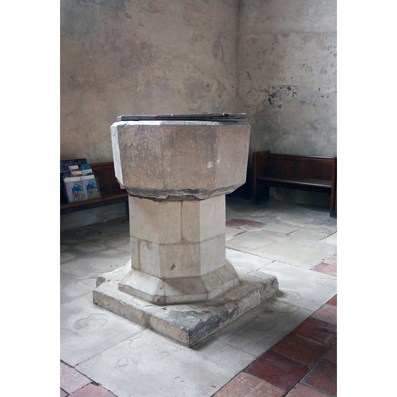
Image copyright © John Salmon, 2011
CC-BY-SA-2.0
Results: 6 records
view of font and cover
Scene Description: the font looks composite, or much re-tooled
Copyright Statement: Image copyright © John Salmon, 2011
Image Source: digital photograph taken 29 July 2011 by John Salmon [www.geograph.org.uk/photo/2528596] [accessed 19 May 2016]
Copyright Instructions: CC-BY-SA-2.0
view of church exterior - southeast view
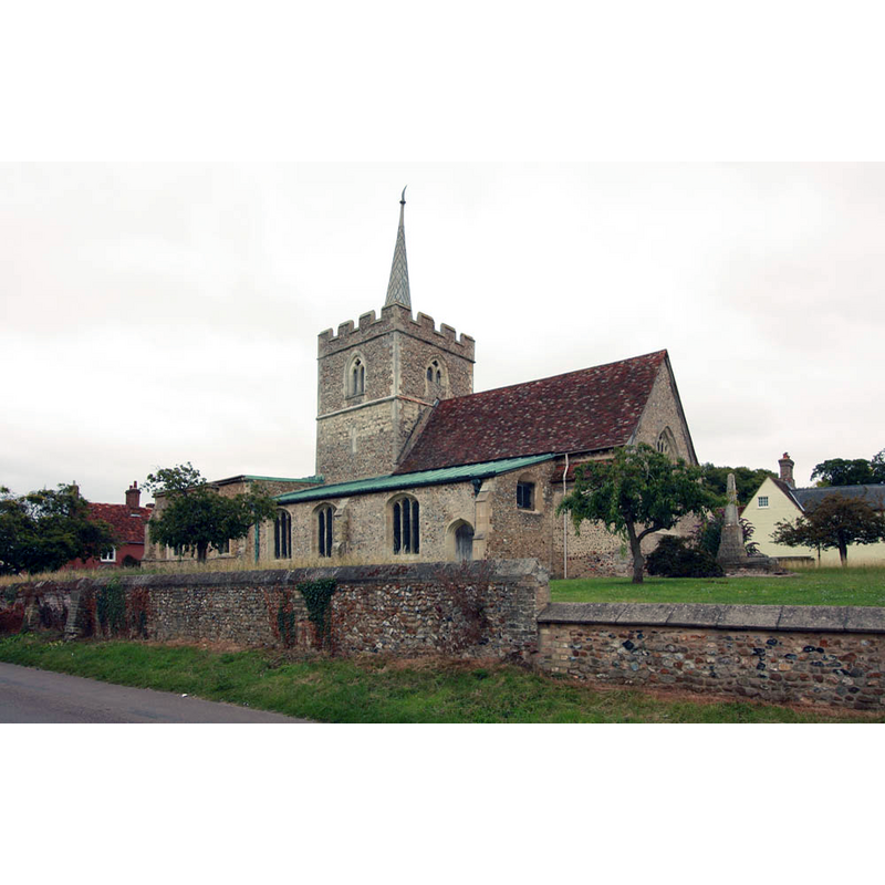
Copyright Statement: Image copyright © John Salmon, 2011
Image Source: digital photograph taken 29 July 2011 by John Salmon [www.geograph.org.uk/photo/2528571] [accessed 19 May 2016]
Copyright Instructions: CC-BY-SA-2.0
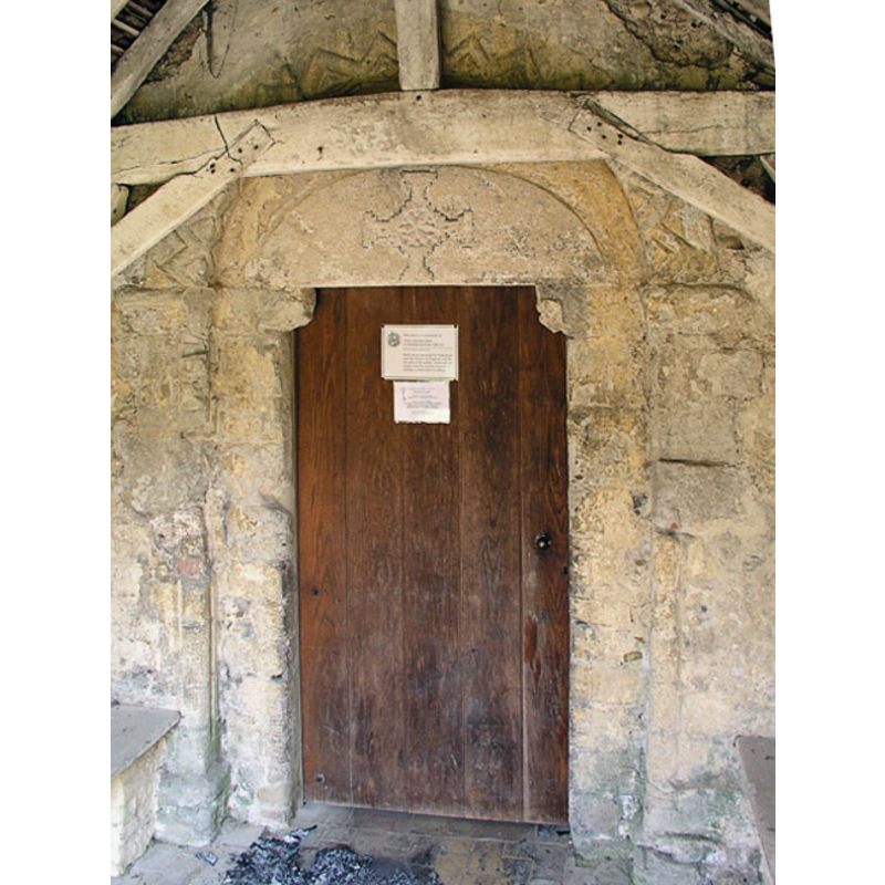
view of church exterior - south portal
![[cf. Font notes]](/static-50478a99ec6f36a15d6234548c59f63da52304e5/compressed/1071021030_compressed.png)
Scene Description: [cf. Font notes]
Copyright Statement: Image copyright © Mark Ynys-Mon, 2005
Image Source: digital photograph by Mark Ynys-Mon, 2004, in Cambrdgeshire Churches [http://www.druidic.org/camchurch/churches/duxfordjohn.htm] [accessed 21 October 2007]
Copyright Instructions: Standing permission
view of church exterior - north view
Copyright Statement: Image copyright © Mark Ynys-Mon, 2005
Image Source: digital photograph by Mark Ynys-Mon, 2004, in Cambrdgeshire Churches [http://www.druidic.org/camchurch/churches/duxfordjohn.htm] [accessed 21 October 2007]
Copyright Instructions: Standing permission
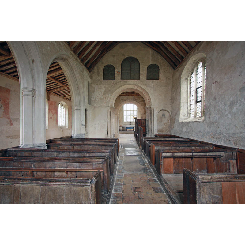
view of church interior - nave - looking west
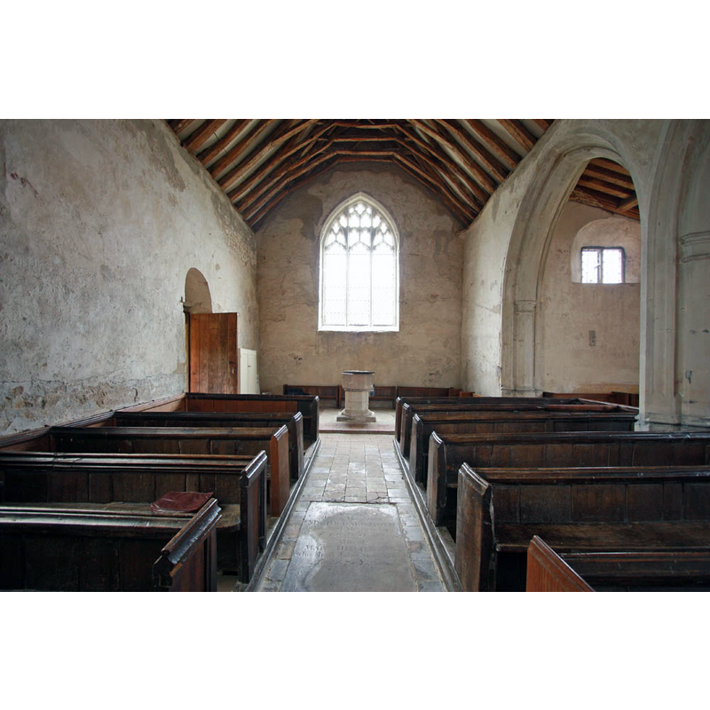
Copyright Statement: Image copyright © John Salmon, 2011
Image Source: digital photograph taken 29 July 2011 by John Salmon [www.geograph.org.uk/photo/2528583] [accessed 19 May 2016]
Copyright Instructions: CC-BY-SA-2.0
view of church interior - nave - looking east
Copyright Statement: Image copyright © John Salmon, 2011
Image Source: digital photograph taken 29 July 2011 by John Salmon [www.geograph.org.uk/photo/2528581] [accessed 19 May 2016]
Copyright Instructions: CC-BY-SA-2.0
INFORMATION
Font ID: 13206DUX
Object Type: Baptismal Font1
Font Century and Period/Style: 13th century, Early English
Church / Chapel Name: Parish Church of St. John [redundant]
Font Location in Church: Inside the church, in the W end of the nave
Church Patron Saint(s): St. John
Church Address: St John's Street, Duxford, Cambridgeshire CB2 4RH
Site Location: Cambridgeshire, East, England, United Kingdom
Directions to Site: Located just SE of the M11-A505 junction, 17 km S of Cambridge
Ecclesiastic Region: Diocese of Ely
Historical Region: Hundred of Whittlesford
Additional Comments: disappeared font? (the one from the 12thC church here)
Font Notes:
Click to view
There are five entries for this Duxford [variant spelling] in the Domesday survey [http://opendomesday.org/place/TL4746/duxford/] [accessed 19 May 2016], none of which mention cleric or church in it. The entry for this church in English Heritage [Listing NGR: TL4781346197] (1967) notes: "Font C13 octagonal bowl on clunch pedestal." The Victoria County History (Cambridge..., vol. 6, 1978) notes: "Duxford is an instance [...] of a single township anomalously containing two parish churches, each with its own incumbent. The duplication probably arose from the separate foundation before c. 1200 [...] of churches at the northern and southern ends of the village by the lords of the two manors to which the two advowsons were at first annexed, that of St. John's belonging to Lacy's manor, that of St. Peter's to Bustelers. [...] The original fabric of the chancel, nave, and lower part of the tower is 12th-century. The tower is divided from the chancel and nave by Norman arches, of which that to the nave has to the west triple shafts and a billet moulding. The original walls retain internally traces of early medieval painted decoration. The south doorway has also a round arch, but the tympanum under it contains a cross with stepped arms recalling early AngloSaxon design"; there is no font mentioned for Duxford St John's in the VCH entry. Described in The Churches Conservation Trust [www.visitchurches.org.uk/uploads/publications/33.pdf] [accessed 21 October 2007: "Font, at the west end (back) of the nave. It is a plain octagonal shape, about 14th century, with a later wooden cover." This same source shows the church interior plan with the location of the font as indicated. [NB: we have no information of the font of the original 12th-century church here].
Credit and Acknowledgements: We are grateful to Mark Ynys-Mon, of Cambrdgeshire Churches [www.druidic.org/camchurch/], for the photographs of this church.
COORDINATES
UTM: 31U 305090 5775262
Latitude & Longitude (Decimal): 52.093537, 0.154619
Latitude & Longitude (DMS): 52° 5′ 36.73″ N, 0° 9′ 16.63″ E
MEDIUM AND MEASUREMENTS
Material: stone
Font Shape: octagonal, mounted
Basin Interior Shape: round
Basin Exterior Shape: octagonal
LID INFORMATION
Date: modern
Material: wood
Apparatus: no
Notes: [cf. FontNotes]
REFERENCES
- Victoria County History [online], University of London, 1993-. URL: https://www.british-history.ac.uk.