Burwell nr. Cambridge / Burewelle / Buruuella / Buruuelle / Burwella / Burwelle

Image copyright © Janice Tostevin, 2009
Standing permission
Results: 6 records
view of font and cover
Copyright Statement: Image copyright © Janice Tostevin, 2009
Image Source: digital photograph taken 6 June 2009 by Janice Tostevin
Copyright Instructions: Standing permission
design element - motifs - quatrefoil - in a circle - 8
Copyright Statement: Image copyright © Janice Tostevin, 2009
Image Source: digital photograph taken 6 June 2009 by Janice Tostevin
Copyright Instructions: Standing permission
view of church exterior - northwest view
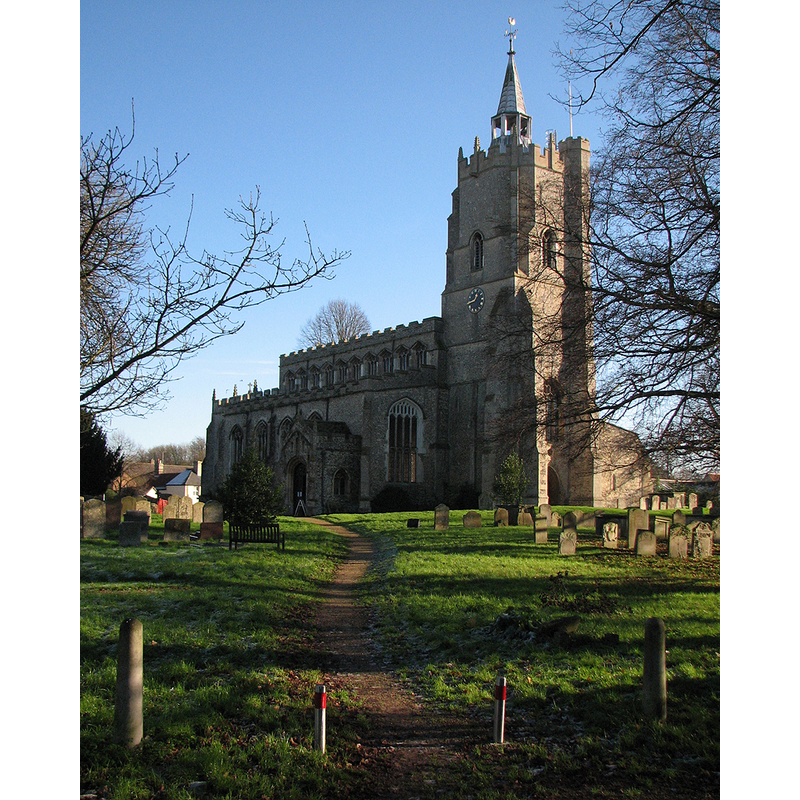
Scene Description: Source caption: "Burwell: St Mary's Church from the north-west. "One of the best examples of English Perp, the box-shaped temple of glass ... look first from NW corner of churchyard. From here you see (lower half of tower's N face) outlines of blocked tall round-headed lights and narrow ashlar buttresses, hints of former grand Romanesque building" (Norman Scarfe, Shell Guide)"
Copyright Statement: Image copyright © John Sutton, 2014
Image Source: digital photograph taken 6 December 2014 by John Sutton [www.geograph.org.uk/photo/4270249] [accessed 20 July 2016]
Copyright Instructions: CC-BY-SA-2.0
view of church exterior - southwest view
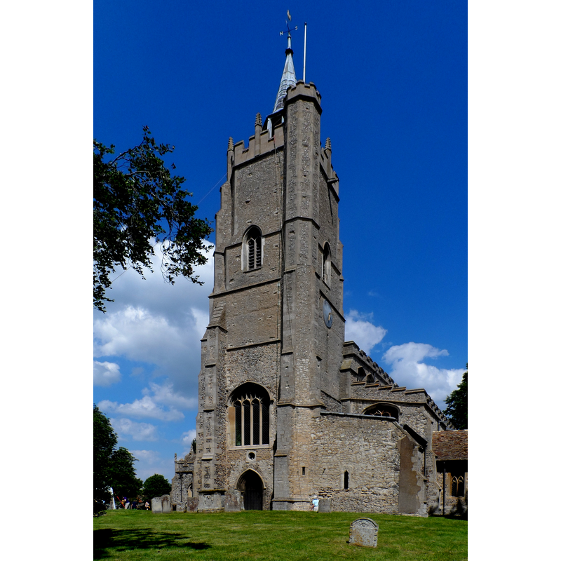
Scene Description: Source caption: "St Mary's church, Burwell. An earlier church was largely rebuilt in C15. The work is believed to be that of Reginald Ely, master mason of King's College Chapel, Cambridge. The spirlet on the tower has the date 1799. There were two C19 restorations of the church."
Copyright Statement: Image copyright © Bikeboy, 2014
Image Source: digital photograph taken 21 June 2014 by Bikeboy [www.geograph.org.uk/photo/4044781] [accessed 20 July 2016]
Copyright Instructions: CC-BY-SA-2.0
view of church interior - nave - looking east
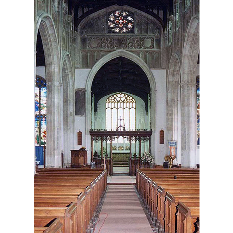
Copyright Statement: Image copyright © John Salmon, 2009
Image Source: digital image of a photograph taken 28 August 1993 by John Salmon [www.geograph.org.uk/photo/1151096] [accessed 20 July 2016]
Copyright Instructions: CC-BY-SA-2.0
design element - architectural - arch or window - trefoiled - 8
Copyright Statement: Image copyright © Janice Tostevin, 2009
Image Source: digital photograph taken 6 June 2009 by Janice Tostevin
Copyright Instructions: Standing permission
INFORMATION
Font ID: 13195BUR
Object Type: Baptismal Font1
Font Century and Period/Style: 15th century, Perpendicular
Church / Chapel Name: Parish Church of St. Mary
Font Location in Church: Inside the church
Church Patron Saint(s): St. Mary the Virgin
Church Address: 2 Church Ln, Burwell, Cambridgeshire CB5 0HB, UK
Site Location: Cambridgeshire, East, England, United Kingdom
Directions to Site: Located off the B1102, 6 km WNW of Newmarket, 16 km ENE of Cambridge
Ecclesiastic Region: Diocese of Ely
Historical Region: Hundred of Staploe
Additional Comments: disappeared font? (the one from the 10thC church here)
Font Notes:
Click to view
There are five entries for this Burwell [variant spelling] in the Domesday survey [http://opendomesday.org/place/TL5866/burwell/] [accessed 20 July 2016], none of which mentions cleric or church in it. The RCHM (1972) notes: "Font: octagonal lead-lined stone bowl with quatrefoil panels, stem with trefoil-headed panels in each face, and moulded base; 15th-century. The Victoria County History (Cambridge and the Isle of Ely, vol. 10, 2002) notes: "From the 12th century until after 1550 Burwell had two churches in use, standing close together near the south end of the village street. St. Andrew's on the east was appropriated by 1280. St. Mary's to the south-west remained a rectory until its appropriation, possibly the last in the country, in 1544, and was thereafter a vicarage. […] St. Mary's was presumably the church whose advowson Aelfgar had given by the 990s with his Burwell estate to Ramsey abbey […] About 1115 Everard, priest of Burwell, gave to the abbey his church and its lands with eight titheable fields assigned to him, apparently from the abbot's demesne (aula) […] The earliest surviving parts are the 12th-century lower stages, almost 40 ft. high, of the west tower, slightly elongated east-west. In the upper part of that portion's thick walls are narrow roundheaded windows in deep splays, almost all blocked; they include single-light ones, two on the north side, below the 12th-century string course, and larger, mostly paired, windows with shafted jambs above it. The north face has, besides massive corner buttresses, a gabled central pilaster and on the north-west another 12thcentury angle buttress, rising to carved capitals. […] The remainder of the church was rebuilt c. 1450-70 […] The octagonal 15th-century font was covered in 1743 by an ornate wooden spire, probably removed c. 1822". The present wooden cover is a plain and flat octagonal one, modern.
Credit and Acknowledgements: We are grateful to Janice Tostevin for her photograph of this font
COORDINATES
UTM: 31U 317699 5794381
Latitude & Longitude (Decimal): 52.269542, 0.328183
Latitude & Longitude (DMS): 52° 16′ 10.35″ N, 0° 19′ 41.46″ E
MEDIUM AND MEASUREMENTS
Material: stone
Font Shape: octagonal, mounted
Basin Interior Shape: round
Basin Exterior Shape: octagonal
Drainage Notes: lead-lined
LID INFORMATION
Date: 18th-century?
Material: wood
Notes: disappeared? [cf. FontNotes for a description of the present cover]
REFERENCES
- Victoria County History [online], University of London, 1993-. URL: https://www.british-history.ac.uk.
- Great Britain. Royal Commission on Historical Monuments (England), An inventory of historical monuments in the County of Cambridge, Woking; London: Printed in England for Her Majesty's Stationary Office by Unwin Brothers Unlimited, 1968, vol. 2: 25