Teversham / Teuersham / Teuresham
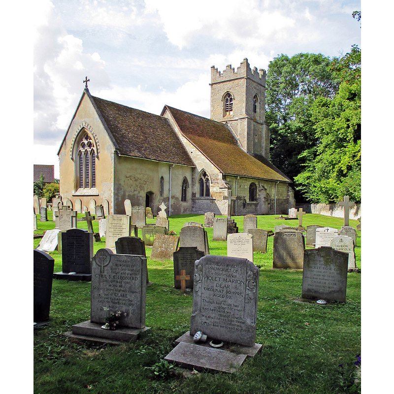
Image copyright © John Sutton, 2014
CC-BY-SA-2.0
Results: 2 records
view of church exterior - northeast view
Copyright Statement: Image copyright © John Sutton, 2014
Image Source: digital photograph taken 4 August 2014 by John Sutton [www.geograph.org.uk/photo/4104287] [accessed 19 July 2016]
Copyright Instructions: CC-BY-SA-2.0
view of church exterior - southeast view
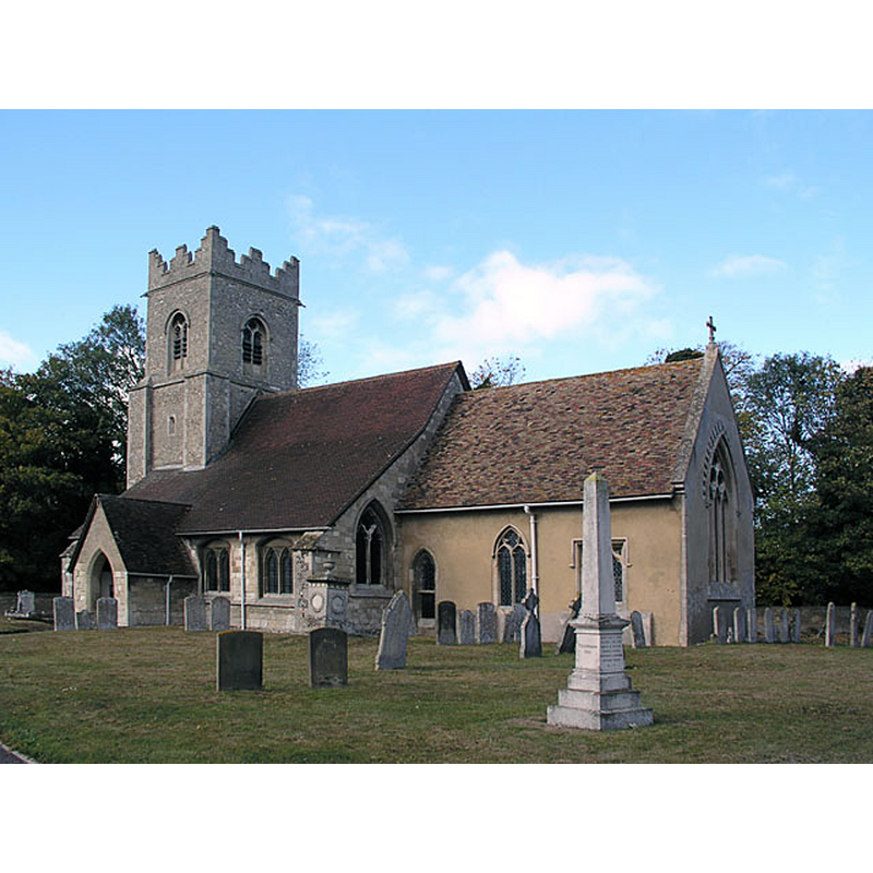
Copyright Statement: Image copyright © mym, 2005
Image Source: digital photograph taken 18 November 2003 by mym [www.geograph.org.uk/photo/2821] [accessed 19 July 2016]
Copyright Instructions: CC-BY-SA-2.0
INFORMATION
Font ID: 13190TEV
Object Type: Baptismal Font1
Font Century and Period/Style: 13th century [basin only] [re-cut] -- 15th century [base only] [composite font], Medieval [composite]
Church / Chapel Name: Parish Church of All Saints
Font Location in Church: Inside the church
Church Patron Saint(s): All Saints
Church Address: 19 Church Road, Teversham, Cambridgeshire CB1 5AW
Site Location: Cambridgeshire, East, England, United Kingdom
Directions to Site: Located 5-6 km ESE of Cambridge, by the airport, now practically a suburb of Cambridge
Ecclesiastic Region: Diocese of Ely
Historical Region: Hundred of Flendish [Fleamdyke in Domesday]
Additional Comments: altered font / composite font / re-cut font (13thC re-cut basin on a 15thC pedestal base)
Font Notes:
Click to view
There are four entries for Teversham [variant spelling] in the Domesday survey [http://opendomesday.org/place/TL4958/teversham/] [accessed 19 July 2016], one of which mentions a church in it. Paley's Guide (1844) reports: "The font is a plain octagonal basin, on a stem." The Cambridgeshire County Council archive catalogue [http://calm.cambridgeshire.gov.uk] [accessed 16 October 2007] [ref. P/153/6/7] has an entry for 9 December 1887 that includes a "Citation for faculty to [...] "clean and restore font". Noted in the RCHM (1972) as a "much-restored and recut bowl" and suggests possibly a 13th-century date, on a 15th-century stem. The Victoria Cconty History (Cambridge and the Isle of Ely, vol. 10, 2002) notes: "The church mentioned at Teversham by 1086, one of the few then recorded in Cambridgeshire, was attached to the hide appropriated from the abbey of Ely by John son of Waleran, […] whose father had already granted tithes from Teversham to St. Stephen's abbey, Caen (dep. Calvados). […] The much-recut, perhaps 13th-century, octagonal font stands on a 15th-century stem."
COORDINATES
UTM: 31U 307930 5787507
Latitude & Longitude (Decimal): 52.204493, 0.189108
Latitude & Longitude (DMS): 52° 12′ 16.18″ N, 0° 11′ 20.79″ E
MEDIUM AND MEASUREMENTS
Material: stone
Font Shape: octagonal, mounted
Basin Interior Shape: round
Basin Exterior Shape: octagonal
REFERENCES
- Victoria County History [online], University of London, 1993-. URL: https://www.british-history.ac.uk.
- Great Britain. Royal Commission on Historical Monuments (England), An inventory of historical monuments in the County of Cambridge, Woking; London: Printed in England for Her Majesty's Stationary Office by Unwin Brothers Unlimited, 1968, vol. 2: 136
- Paley, Frederick Apthorp, The Ecclesiologist's guide to the churches within a circuit of seven miles round Cambridge, with introductory remarks, London; Cambridge: J. van Voorst; Metcalfe and Palmer, 1844, p. 49