Fulbourn No. 2 / Fulbourne / Fuleberne
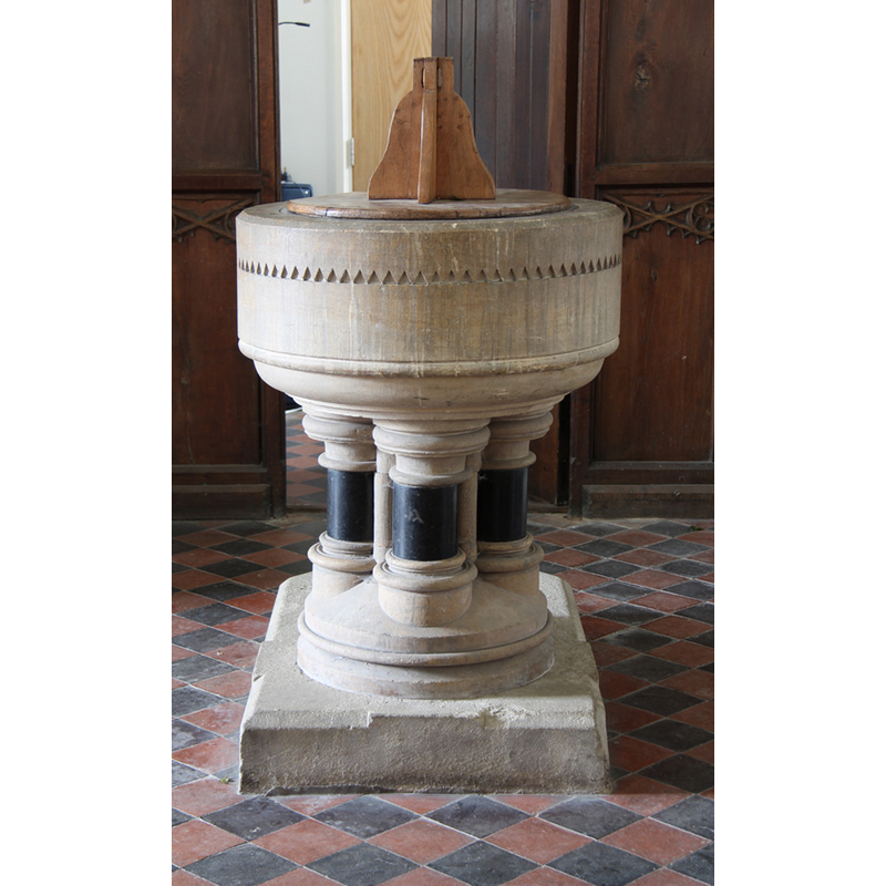
Image copyright © John Salmon, 2016
CC-BY-SA-2.0
Results: 4 records
view of font and cover
Scene Description: the modern font
Copyright Statement: Image copyright © John Salmon, 2016
Image Source: digital photograph taken 31 May 2016 by John Salmon [www.geograph.org.uk/photo/4994320] [accessed 19 July 2016]
Copyright Instructions: CC-BY-SA-2.0
view of church exterior - north view
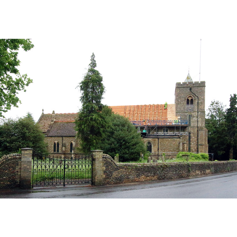
Copyright Statement: Image copyright © John Salmon, 2016
Image Source: digital photograph taken 31 May 2016 by John Salmon [www.geograph.org.uk/photo/4994291] [accessed 19 July 2016]
Copyright Instructions: CC-BY-SA-2.0
view of church exterior - south view
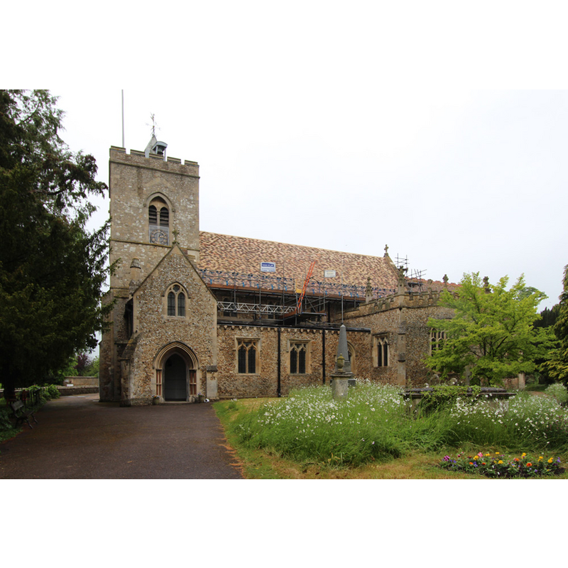
Copyright Statement: Image copyright © John Salmon, 2016
Image Source: digital photograph taken 31 May 2016 by John Salmon [www.geograph.org.uk/photo/4994295] [accessed 19 July 2016]
Copyright Instructions: CC-BY-SA-2.0
view of church interior - nave - looking east
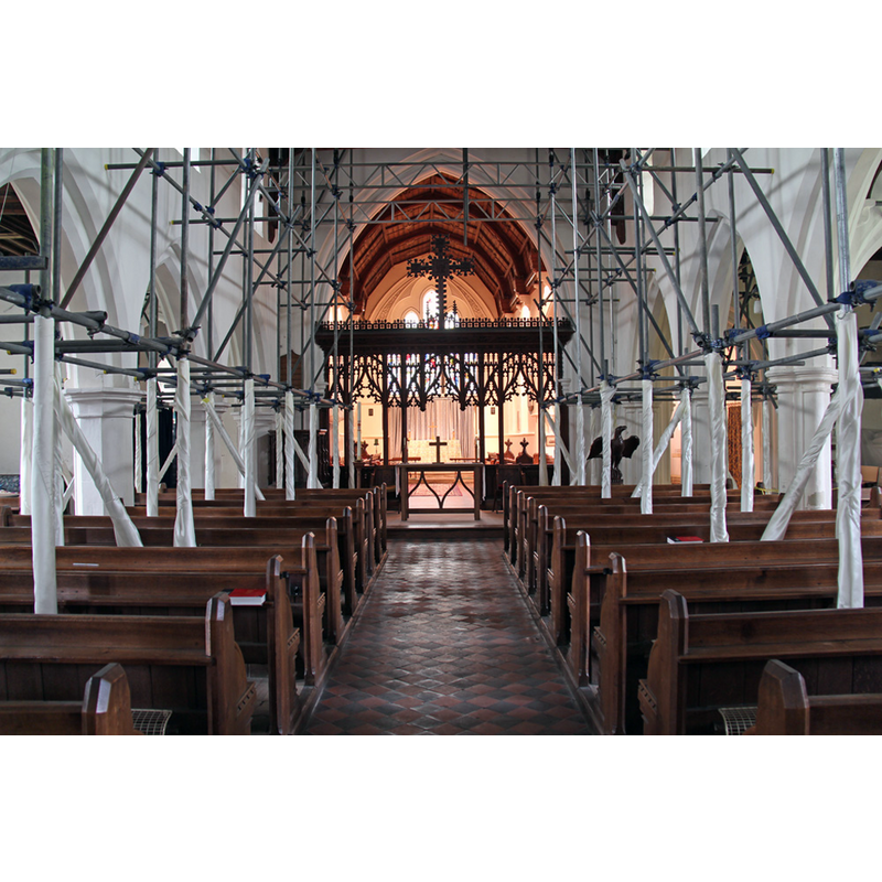
Copyright Statement: Image copyright © John Salmon, 2016
Image Source: digital photograph taken 31 May 2016 by John Salmon [www.geograph.org.uk/photo/4994297] [accessed 19 July 2016]
Copyright Instructions: CC-BY-SA-2.0
INFORMATION
Font ID: 13188FUL
Object Type: Baptismal Font1?
Font Century and Period/Style: 11th - 12th century, Medieval
Church / Chapel Name: Parish Church of St. Vigor with All Saints
Church Patron Saint(s): St. Vigor with All Saints
Church Notes: Two churches existed side by side according to the VCH [cf. FontNotes]: All Saints [so-known by 1185], and St. Vigor [so-known by 1220s]; All Saints decayed and was demolished in 1775, though two sets of churchwardens were kept well into the 19th century
Church Address: 2 Church Lane, Fulbourn CB21 5BN
Site Location: Cambridgeshire, East, England, United Kingdom
Directions to Site: Located 8-9 km E of Cambridge
Ecclesiastic Region: Diocese of Ely
Historical Region: Hundred of Flendish [Fleamdyke in Domesday]
Additional Comments: disappeared fonts? (the one form the original 11th-12thC church here and the 18th-century marble font seen by Paley ca. 1844)
Font Notes:
Click to view
There are five entries for Fulbourne [variant spelling] in the Domesday survey [http://opendomesday.org/place/TL5256/fulbourn/] [accessed 19 July 2016], none of which mentions cleric or church in it. Paley's Guide (1844) reports the font as "modern". The Victoria County History (Cambridge and the Isle of Ely, vol. 10, 2002) notes: "Like several other Cambridgeshire townships, Fulbourn had from the 12th century two churches, which stood together in one churchyard until one fell in 1766. Even thereafter their two parishes remained formally distinct, although the two benefices were united in 1876. […] [St Vigor's], being named after a 6th-century bishop of Bayeux, was probably founded after 1066 by the tenants of the Mandeville fee. […] It has always remained a rectory. […] Rectors were recorded for both churches from the 1190s […] The two churches of ALL SAINTS, so named by 1185, (fn. 149) and ST. VIGOR, so named by the 1220s, (fn. 150) formerly stood barely 7 ft. (2 m.) apart in the south-eastern and north-western parts of the same churchyard near the southeast end of the main street. (fn. 151) Earlier use of that site for religious purposes is suggested by the surviving head of a stone wheel-headed cross carved with interlace, perhaps dating from c. 1000, found under St. Vigor's nave in 1869. […] A major restoration, amounting to virtual rebuilding, was undertaken in 1869-70 […] A new font replaced a marble 18th-century basin". [NB: we have no information on the original font of this church].
COORDINATES
UTM: 31U 310176 5785036
Latitude & Longitude (Decimal): 52.183082, 0.223311
Latitude & Longitude (DMS): 52° 10′ 59.09″ N, 0° 13′ 23.92″ E
REFERENCES
- Victoria County History [online], University of London, 1993-. URL: https://www.british-history.ac.uk.
- Paley, Frederick Apthorp, The Ecclesiologist's guide to the churches within a circuit of seven miles round Cambridge, with introductory remarks, London; Cambridge: J. van Voorst; Metcalfe and Palmer, 1844, p. 43