Harston nr. Cambridge / Helestone
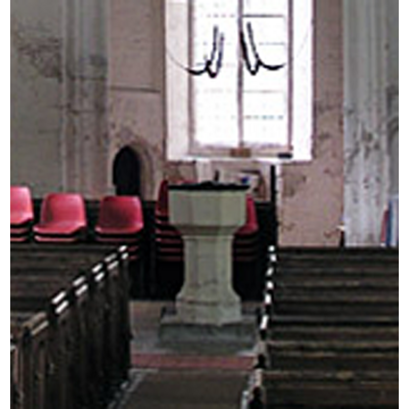
Image copyright © Mark Ynys-Mon, 2004
Standing permission
Results: 5 records
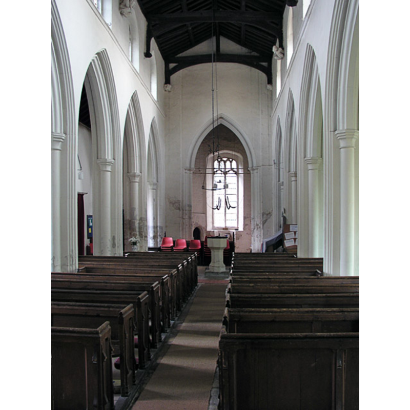
view of font and cover
Copyright Statement: Image copyright © Mark Ynys-Mon, 2004
Image Source: digital photograph by Mark Ynys-Mon, 2004 in Cambridgeshire Churches [http://www.druidic.org/camchurch/churches/grantchester.htm] [accessed 13 October 2007]
Copyright Instructions: Standing permission
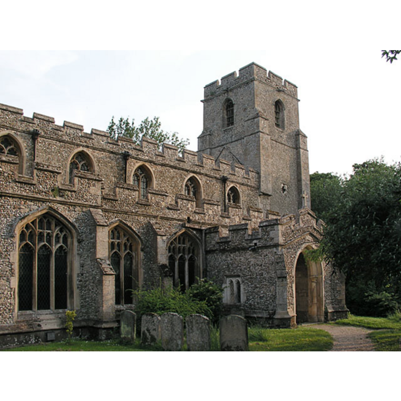
view of church exterior - north view
Copyright Statement: Image copyright © Mark Ynys-Mon, 2004
Image Source: digital photograph by Mark Ynys-Mon, 2004 in Cambridgeshire Churches [http://www.druidic.org/camchurch/churches/grantchester.htm] [accessed 13 October 2007]
Copyright Instructions: Standing permission
view of font and cover in context
Copyright Statement: Image copyright © Mark Ynys-Mon, 2004
Image Source: digital photograph by Mark Ynys-Mon, 2004 in Cambridgeshire Churches [http://www.druidic.org/camchurch/churches/grantchester.htm] [accessed 13 October 2007]
Copyright Instructions: Standing permission
design element - motifs - moulding
Scene Description: [cf. Font notes]
Copyright Statement: Image copyright © Mark Ynys-Mon, 2004
Image Source: digital photograph by Mark Ynys-Mon, 2004 in Cambridgeshire Churches [http://www.druidic.org/camchurch/churches/grantchester.htm] [accessed 13 October 2007]
Copyright Instructions: Standing permission
INFORMATION
Font ID: 13184HAR
Object Type: Baptismal Font1
Font Century and Period/Style: 15th century, Perpendicular
Church / Chapel Name: Parish Church of All Saints
Font Location in Church: Inside the church
Church Patron Saint(s): All Saints
Church Address: 65 Church Street, Harston, Cambridgeshire CB2 5NP
Site Location: Cambridgeshire, East, England, United Kingdom
Directions to Site: Located off (N) the A10, 5 km SSW of Cambridge
Ecclesiastic Region: Diocese of Ely
Historical Region: Hundred of Thriplow
Additional Comments: disappeared font? (the one from the pre-Conquest church here)
Font Notes:
Click to view
There are four entries for this Harston [variant spelling] in the Domesday survey [http://opendomesday.org/place/TL4150/harston/] [accessed 13 June 2016]; none of which mentions a church in it; one of the parts, however, was in 1066 in the lordship of four freemen and a priest, which would likely indicate the presence of a pre-Conquest church here; the lordship of that part was in the hands of Odo in 1086. Paley's Guide (1844) has: "The font is a plain octagonal basin". The Victoria County History (Cambridge..., vol. 8, 1982) notes: "A priest held ½ yardland in 1066. (fn. 448) By 1090 Picot had given the church to the canons of Barnwell priory, to whom Pain Peverel confirmed it c. 1112. [...] [the present church] is mainly 15th-century, although the narrowness of the south aisle suggests a rebuilding then on older foundations. [...] An oak pulpit of c. 1450 on a narrow stair survives, [...] and the octagonal font is also 15th-century." The font consists of an octagonal basin with plain vertical sides, and plain underbowl chamfer; the octagonal pedestal base has a moulding at the top, and the splaying lower base is also moulded; it stands on a narrow quadrangular plinth at the west end of the nave, in the centre aisle. The wooden cover is octagonal and flat.
Credit and Acknowledgements: We are grateful to Ben Colburn and Mark Ynys-Mon, of Cambridgeshire Churches, for the photographs of church and font.
COORDINATES
UTM: 31U 299555 5780486
Latitude & Longitude (Decimal): 52.13847, 0.070859
Latitude & Longitude (DMS): 52° 8′ 18.49″ N, 0° 4′ 15.09″ E
MEDIUM AND MEASUREMENTS
Material: stone
Font Shape: octagonal, mounted
Basin Interior Shape: round
Basin Exterior Shape: octagonal
LID INFORMATION
Material: wood
Apparatus: no
Notes: [cf. FontNotes]
REFERENCES
- Victoria County History [online], University of London, 1993-. URL: https://www.british-history.ac.uk.
- Paley, Frederick Apthorp, The Ecclesiologist's guide to the churches within a circuit of seven miles round Cambridge, with introductory remarks, London; Cambridge: J. van Voorst; Metcalfe and Palmer, 1844, p. 31