Willoughby Waterleys / Wilebi / Wilechebi / Willoughby Waterless
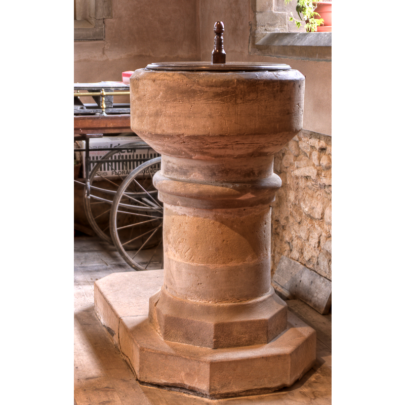
Image copyright © Christopher Jones, 2009
Standing permission
Results: 6 records
view of font and cover
Copyright Statement: Image copyright © Christopher Jones, 2009
Image Source: detail of a digital photograph taken 7 June 2009 by Christopher Jones [www.flickr.com/photos/glugwine/sets/72157618777365856/] [accessed 17 August 2009]
Copyright Instructions: Standing permission
design element - motifs - roll moulding
Scene Description: [cf. Font notes]
Copyright Statement: Image copyright © Christopher Jones, 2009
Image Source: detail of a digital photograph taken 7 June 2009 by Christopher Jones [www.flickr.com/photos/glugwine/sets/72157618777365856/] [accessed 17 August 2009]
Copyright Instructions: Standing permission
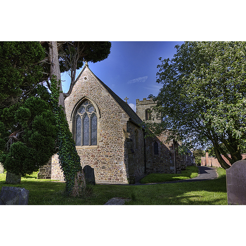
view of church exterior - northeast view
Copyright Statement: Image copyright © Christopher Jones, 2009
Image Source: digital photograph taken 7 June 2009 by Christopher Jones [www.flickr.com/photos/glugwine/sets/72157618777365856/] [accessed 12 February 2015]
Copyright Instructions: Standing permission
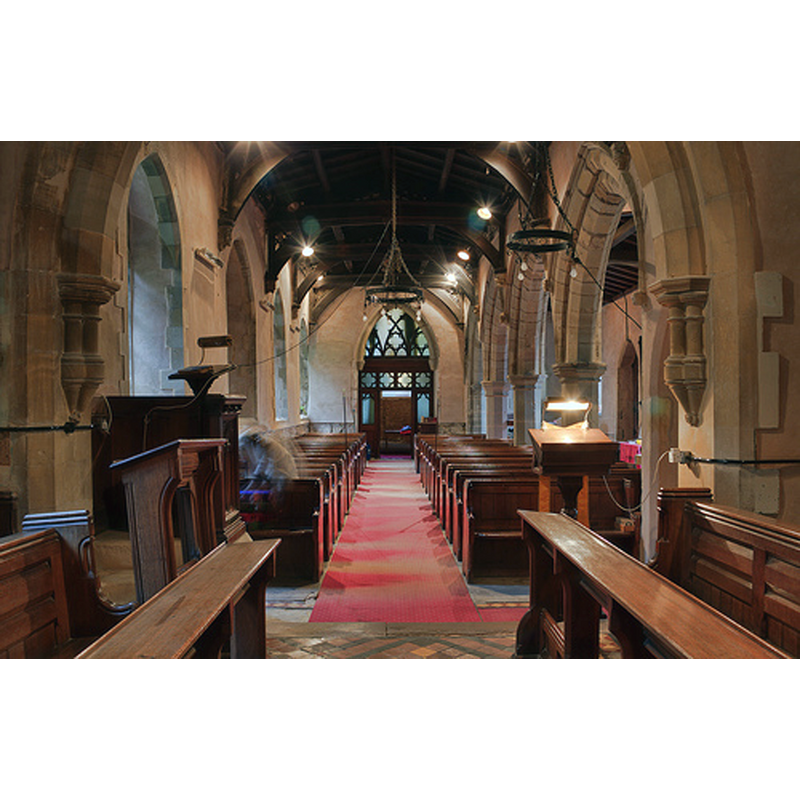
view of church interior - nave - looking west
Copyright Statement: Image copyright © Christopher Jones, 2009
Image Source: digital photograph taken 7 June 2009 by Christopher Jones [www.leicestershirechurches.co.uk/willoughby-waterleys-st-mary/] [accessed 28 August 2015]
Copyright Instructions: Standing permission
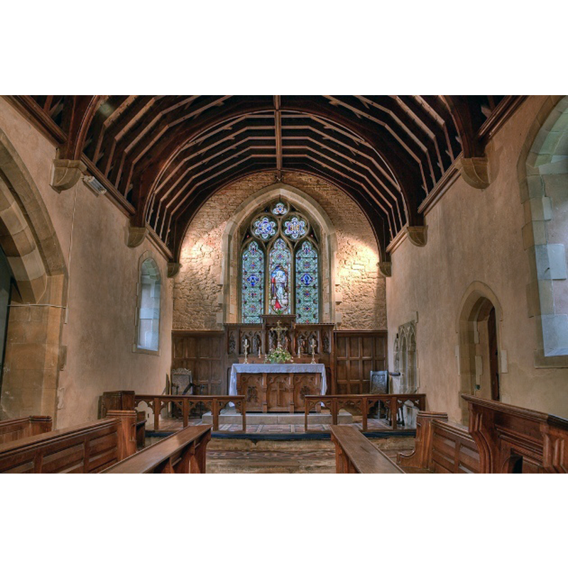
view of church interior - nave - looking east
Copyright Statement: Image copyright © Christopher Jones, 2009
Image Source: digital photograph taken 7 June 2009 by Christopher Jones [www.leicestershirechurches.co.uk/willoughby-waterleys-st-mary/] [accessed 28 August 2015]
Copyright Instructions: Standing permission
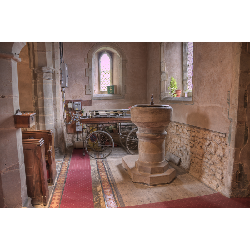
view of font and cover in context
Copyright Statement: Image copyright © Christopher Jones, 2009
Image Source: digital photograph taken 7 June 2009 by Christopher Jones [www.flickr.com/photos/glugwine/sets/72157618777365856/] [accessed 17 August 2009]
Copyright Instructions: Standing permission
INFORMATION
Font ID: 13169WIL
Object Type: Baptismal Font1
Font Century and Period/Style: 13th - 14th century [restored?], Early Decorated [altered?]
Church / Chapel Name: Parish Church of St. Mary
Font Location in Church: Inside the church, at the W end
Church Patron Saint(s): St. Mary the Virgin
Church Address: 9 Church Farm Lane, Willoughby Waterleys, Leicestershire, LE8 6BU
Site Location: Leicestershire, East Midlands, England, United Kingdom
Directions to Site: Located off (E) the A426 and the M1, 10 km NNE of Lutterworth, 13-14 SSW Leicester
Ecclesiastic Region: Diocese of Leicester
Historical Region: Hundred of Guthlaxton [in Domesday]
Additional Comments: altered font? (the present one; restored)
Font Notes:
Click to view
There are three entries for Willoughby [Waterless] [variant spelling] in the Domesday survey [http://domesdaymap.co.uk/place/SP5792/willoughby-waterless/] [accessed 12 February 2015], neither of which mentions cleric or church in it. A font here is noted and illustrated in Upcott (1818). The baptismal font consists of a plain cylindrical basin with a pronounced underbowl chamfer; there is round moulding in the centre ring position, at the upper end of the otherwise plain cylindrical pedestal; the latter appears to be only partly original, the lower part, the lower base and the plinth all modern replacements. The wooden cover is round and flat, plain, with a knob handle/finial; also modern.
Credit and Acknowledgements: We are grateful to Christopher Jones, of www.leicestershirechurches.co.uk, for his photographs of this church and font
COORDINATES
UTM: 30U 625277 5821276
Latitude & Longitude (Decimal): 52.527162, -1.153291
Latitude & Longitude (DMS): 52° 31′ 37.78″ N, 1° 9′ 11.85″ W
MEDIUM AND MEASUREMENTS
Material: stone
Font Shape: cylindrical, mounted
Basin Interior Shape: round
Basin Exterior Shape: round
LID INFORMATION
Date: modern
Material: wood, oak?
Apparatus: no
Notes: [cf. FontNotes]
REFERENCES
- Upcott, William, A bibliographical account of the principal works relating to English topography, London: Printed by Richard and Arthur Taylor, 1818, [vol. IV, part I, p. 528 and pl. lx / [http://books.google.com/books?id=gLwuAAAAMAAJ&pg=PA228&lpg=PA228&dq=upcott+1818&source=web&ots=lJwT-K00zU&sig=oVT6Kc6G03vqjYf4Synuk_Aek9w#PPP15,M1] [accessed 30 September 2007]