Belton / Belton nr. Shepshead
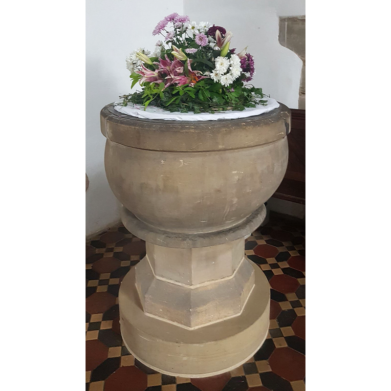
Image copyright © SMacB, 2017
No known copyright restriction / Fair Dealing
Results: 2 records
view of font
Scene Description: the basin may be either modern or totally restored
Copyright Statement: Image copyright © SMacB, 2017
Image Source: digital photograph taken in 2017 (?) by SMacB [www.waymarking.com/waymarks/WMV3PP_Baptism_Font_St_John_the_Baptist_Belton_Leicestershire] [accessed 1 October 2018]
Copyright Instructions: No known copyright restriction / Fair Dealing
view of church exterior - southeast view
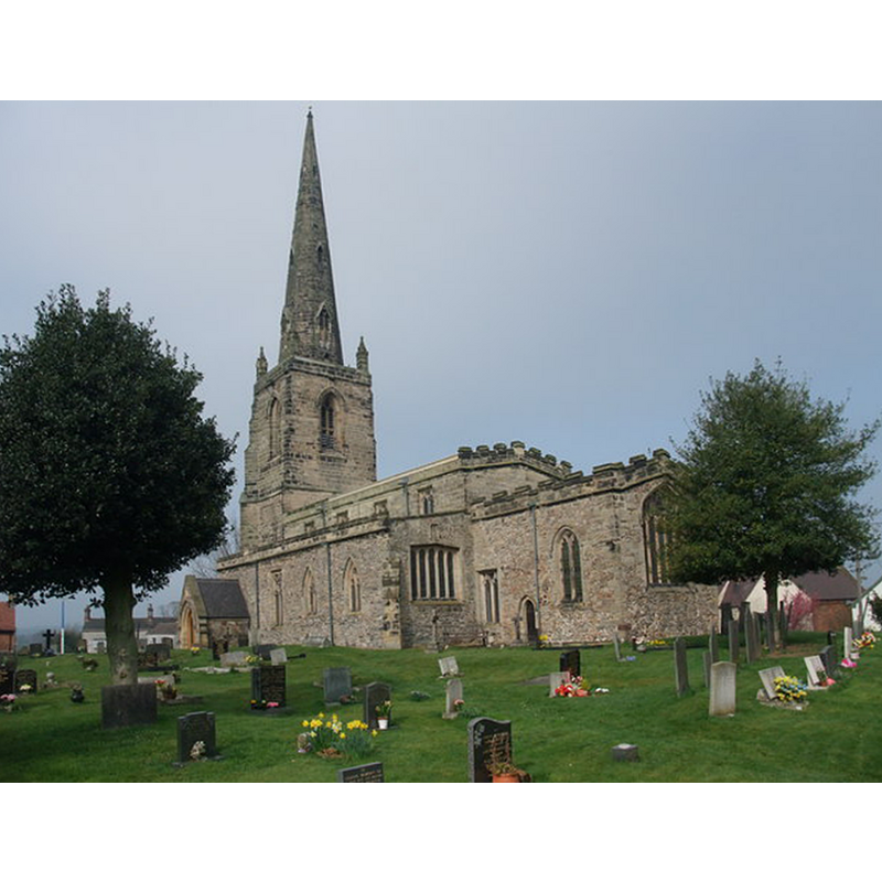
Copyright Statement: Image copyright © Tim Heaton, 2012
Image Source: digital photograph taken 22 March 2012 by Tim Heaton [www.geograph.org.uk/photo/2894263] [accessed 11 June 2014]
Copyright Instructions: CC-BY-SA-2.0
INFORMATION
Font ID: 13151BEL
Object Type: Baptismal Font1
Font Century and Period/Style: Medieval? / Modern?
Church / Chapel Name: Parish Church of St. John the Baptist
Font Location in Church: Inside the church [cf. FontNotes]
Church Patron Saint(s): St. John the Baptist
Church Address: 2 Church Street, Belton, Leicestershire, LE12 9UH, UK -- Tel.: 01509 678966
Site Location: Leicestershire, East Midlands, England, United Kingdom
Directions to Site: Located on the B5324, 4 km WNW of Shepshed, 10 km WNW of Loughborough
Ecclesiastic Region: Diocese of Leicester
Historical Region: Hundred of West Goscote
Font Notes:
Click to view
No entry found for this Belton in the Domesday survey. A baptismal font in this church is noted and illustrated in Upcott (1818). [NB: a plan of this church in 1852-1853 [by Joseph Mitchell?] appears to show the [a?] font in the west end of the centre aisle [source: www.churchplansonline.org/show_full_image.asp?resource_id=04458a.tif] [accessed 29 September 2007]. English Heritage [www.britishlistedbuildings.co.uk/en-358057-church-of-st-john-the-baptist-belton-lei] [accessed 11 June 2014] notes: "bowl-shaped font on octagonal base, either C19-C20 or very heavily restored".
COORDINATES
UTM: 30U 612145 5849320
Latitude & Longitude (Decimal): 52.782029, -1.337239
Latitude & Longitude (DMS): 52° 46′ 55.3″ N, 1° 20′ 14.06″ W
MEDIUM AND MEASUREMENTS
Material: stone
Font Shape: hemispheric, mounted
Basin Interior Shape: round
Basin Exterior Shape: round
REFERENCES
- Upcott, William, A bibliographical account of the principal works relating to English topography, London: Printed by Richard and Arthur Taylor, 1818, [vol. III, part II, p. 516 and pl. lxxxvi / [http://books.google.com/books?id=gLwuAAAAMAAJ&pg=PA228&lpg=PA228&dq=upcott+1818&source=web&ots=lJwT-K00zU&sig=oVT6Kc6G03vqjYf4Synuk_Aek9w#PPP15,M1] [accessed 29 September 2007]