Shangton / Sanctone / Santone [Domesday] / Shankton
![Main image for Shangton / Sanctone / Santone [Domesday] / Shankton](/static-50478a99ec6f36a15d6234548c59f63da52304e5/compressed/1151005033_compressed.png)
Image copyright © Christopher Jones, 2015
Standing permission
Results: 6 records
view of font and cover
Copyright Statement: Image copyright © Christopher Jones, 2015
Image Source: edited detail of a digital photograph taken by Christopher Jones [www.leicestershirechurches.co.uk/shangton-church-st-nicholas/] [accessed 24 August 2015]
Copyright Instructions: Standing permission
design element - motifs - moulding
Copyright Statement: Image copyright © Christopher Jones, 2015
Image Source: edited detail of a digital photograph taken by Christopher Jones [www.leicestershirechurches.co.uk/shangton-church-st-nicholas/] [accessed 24 August 2015]
Copyright Instructions: Standing permission
view of church exterior - south view
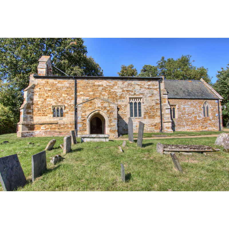
Copyright Statement: Image copyright © Christopher Jones, 2015
Image Source: digital photograph taken by Christopher Jones [www.leicestershirechurches.co.uk/shangton-church-st-nicholas/] [accessed 24 August 2015]
Copyright Instructions: Standing permission
view of church interior - nave - looking west

Scene Description: the font and cover are visible at the far end, centrail aisle
Copyright Statement: Image copyright © Christopher Jones, 2015
Image Source: digital photograph taken by Christopher Jones [www.leicestershirechurches.co.uk/shangton-church-st-nicholas/] [accessed 24 August 2015]
Copyright Instructions: Standing permission
design element - motifs - moulding - graded
Copyright Statement: Image copyright © Christopher Jones, 2015
Image Source: edited detail of a digital photograph taken by Christopher Jones [www.leicestershirechurches.co.uk/shangton-church-st-nicholas/] [accessed 24 August 2015]
Copyright Instructions: Standing permission
design element - motifs - moulding
Copyright Statement: Image copyright © Christopher Jones, 2015
Image Source: edited detail of a digital photograph taken by Christopher Jones [www.leicestershirechurches.co.uk/shangton-church-st-nicholas/] [accessed 24 August 2015]
Copyright Instructions: Standing permission
INFORMATION
Font ID: 13137SHA
Object Type: Baptismal Font1
Font Century and Period/Style: 14th - 15th century, Late Decorated? / Early Perpendicular?
Church / Chapel Name: Parish Church of St. Nicholas
Font Location in Church: Inside the church, at the W end of the nave
Church Patron Saint(s): St. Nicholas of Myra
Church Address: Shangton, Leicestershire LE8 0PP
Site Location: Leicestershire, East Midlands, England, United Kingdom
Directions to Site: Located on the B6047, 10 km N of Market Harborough, 16 km SE of Leicester
Ecclesiastic Region: Diocese of Leicester
Historical Region: Hundred of Gartree
Additional Comments: disappeared font? (the one from the early-12thC church here)
Font Notes:
Click to view
There are three entries for Shangton [variant spelling] in the Domesday survey [http://opendomesday.org/place/SP7196/shangton/] [accessed 24 August 2015], none of which mentions cleric or church in it. A font here is noted and illustrated in Upcott (1818). The Victoria County History (Leicestershire, vol. 5, 1964) notes: "About 1220 the church at Shangton belonged to Lilleshull Priory (Salop.) [...] The rectory was valued at 1 mark in 1217 [...] The north wall of the nave still has a short length of a chamfered string course externally above the north door and is probably part of a 13th-century or earlier church. [...] The font probably dates from the late 14th century; it is octagonal, of grey limestone, and has a low moulded base. The wooden cover is Victorian and incorporates an early roof boss."
COORDINATES
UTM: 30U 639189 5824990
Latitude & Longitude (Decimal): 52.557151, -0.946797
Latitude & Longitude (DMS): 52° 33′ 25.75″ N, 0° 56′ 48.47″ W
MEDIUM AND MEASUREMENTS
Material: stone, limestone (grey)
Font Shape: octagonal, mounted
Basin Interior Shape: round
Basin Exterior Shape: octagonal
LID INFORMATION
Date: 19th-century?
Material: wood, oak?
Notes: [cf. FontNotes]
REFERENCES
- Victoria County History [online], University of London, 1993-. URL: https://www.british-history.ac.uk.
- Upcott, William, A bibliographical account of the principal works relating to English topography, London: Printed by Richard and Arthur Taylor, 1818, [vol. II, part II, p. 506] and pl. cxxviii [on the letter-press] / [http://books.google.com/books?id=gLwuAAAAMAAJ&pg=PA228&lpg=PA228&dq=upcott+1818&source=web&ots=lJwT-K00zU&sig=oVT6Kc6G03vqjYf4Synuk_Aek9w#PPP15,M1] [accessed 23 September 2007]