Laughton nr. Leicester / Lachestone
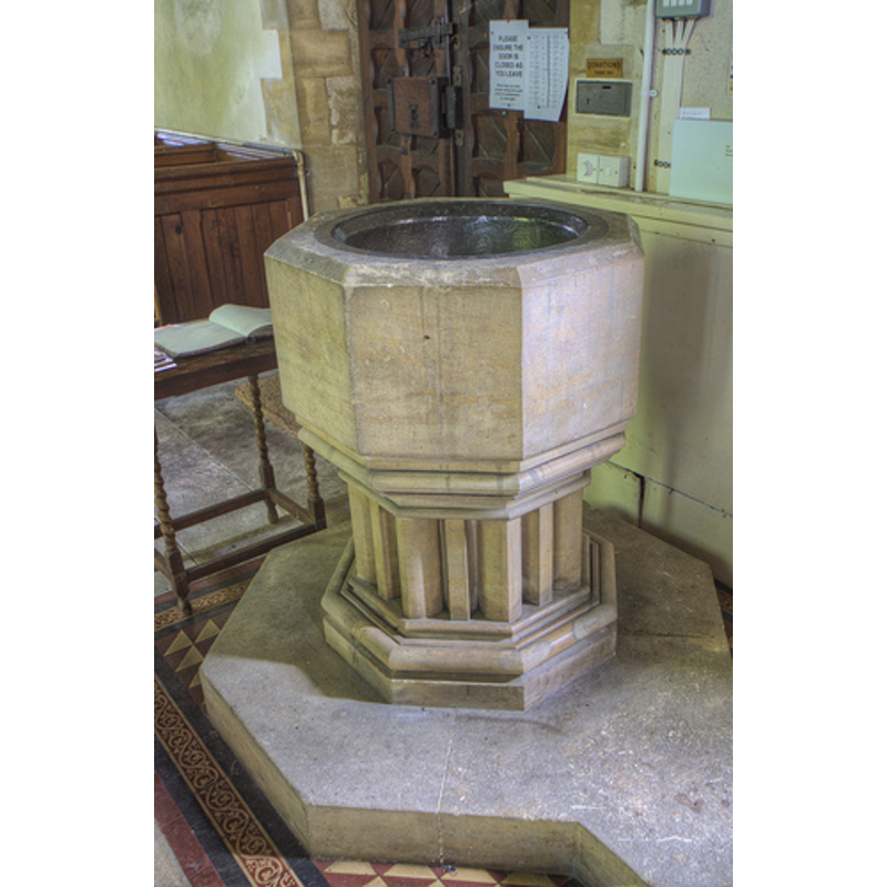
Image copyright © Leicestershire & Rutland Churches, 2013
Standing permission
Results: 4 records
view of font
Scene Description: the modern font [cf. FontNotes] -- [no images available yet of the original font]
Copyright Statement: Image copyright © Leicestershire & Rutland Churches, 2013
Image Source: digital photograph taken by Christopher Jones, in Leicestershire & Rutland Churches [www.leicestershirechurches.co.uk/laughton-church-st-luke/] [accessed 23 January 2013]
Copyright Instructions: Standing permission
view of church exterior - south view
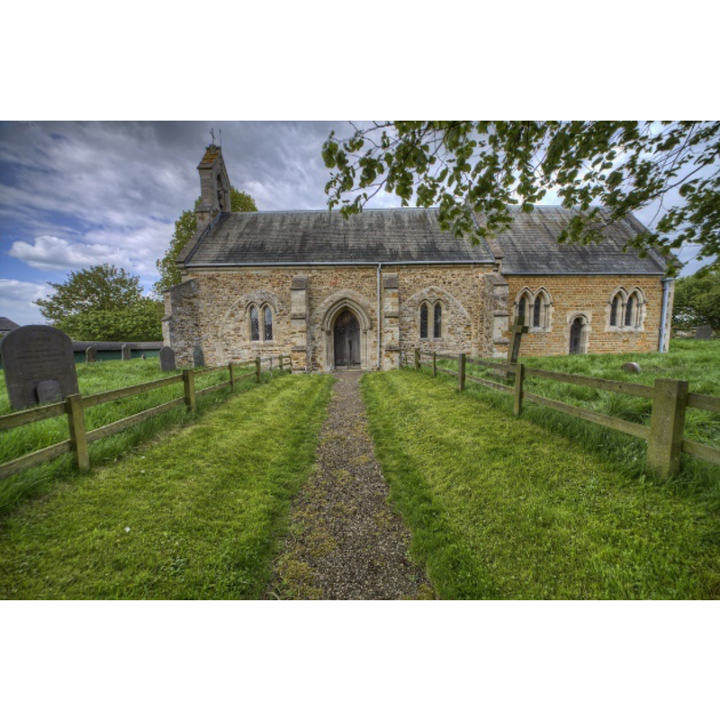
Copyright Statement: Image copyright © Leicestershire & Rutland Churches, 2013
Image Source: digital photograph taken by Christopher Jones, in Leicestershire & Rutland Churches [www.leicestershirechurches.co.uk/laughton-church-st-luke/] [accessed 23 January 2013]
Copyright Instructions: Standing permission
view of church interior - nave - looking west
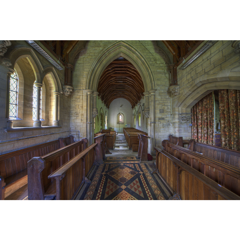
Copyright Statement: Image copyright © Leicestershire & Rutland Churches, 2013
Image Source: digital photograph taken by Christopher Jones, in Leicestershire & Rutland Churches [www.leicestershirechurches.co.uk/laughton-church-st-luke/] [accessed 23 January 2013]
Copyright Instructions: Standing permission
view of church interior - nave - looking east
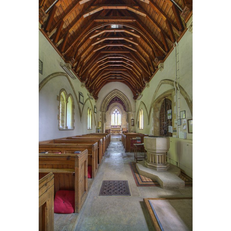
Scene Description: the font in the photograph is the modern one
Copyright Statement: Image copyright © Leicestershire & Rutland Churches, 2013
Image Source: digital photograph taken by Christopher Jones, in Leicestershire & Rutland Churches [www.leicestershirechurches.co.uk/laughton-church-st-luke/] [accessed 23 January 2013]
Copyright Instructions: Standing permission
INFORMATION
Font ID: 13136LAU
Object Type: Baptismal Font1
Object Details: capital
Font Century and Period/Style: Medieval
Church / Chapel Name: Parish Church of St. Luke
Font Location in Church: Inside the church
Church Patron Saint(s): St. Luke
Church Address: Main Street, Laughton, Leicestershire, LE17 6QE
Site Location: Leicestershire, East Midlands, England, United Kingdom
Directions to Site: Located off (N) the A4304, just WSW of Gumley, 8 km W of Market Harborough, 20 km SSE of Leicester
Ecclesiastic Region: Diocese of Leicester
Historical Region: Hundred of Gartree
Additional Comments: composite font? the lower base is an inverted capital -- disappeared font? (the one from the ca.1200 church here)
Font Notes:
Click to view
There is an entry for this Laughton [variant spelling] in the Domesday survey [http://opendomesday.org/place/SP6689/laughton/] [accessed 17 August 2015], but it mentions neither cleric nor church in it. A font here is noted and illustrated in Upcott (1818). The Victoria County History (Leicestershire, vol. 5, 1964) notes: "Shortly before 1220 Saer de Quency, Earl of Winchester (d. 1219), was patron of the church of Laughton. [...] There are some features of the 13th century and later medieval date in spite of the extensive rebuilding which took place in the 18th and 19th centuries [...] In 1880 [...] the gallery was removed and new pewing introduced; the pulpit and font were also removed, and although a new font was installed in the same year the pulpit has never been replaced. Part of the old pewing and the original font could still be seen, at Killock Farm, in 1958, the former in the barn and the latter in the garden. By 1961 the old font was in the church, though not in use; it is octagonal with roll mouldings at each angle and rests on an inverted capital of the late 13th century, serving as a base.
From: 'Laugn." The modern font is also octagonal with a moulded underbowl, raised on cluster columns and a moulded octagonal lower base.
From: 'Laugn." The modern font is also octagonal with a moulded underbowl, raised on cluster columns and a moulded octagonal lower base.
Credit and Acknowledgements: We are grateful to Christopher Jones, of Leicestershire & Rutland Churches [www.leicestershirechurches.co.uk] for his photographs of this church and the modern font
COORDINATES
UTM: 30U 633685 5818012
Latitude & Longitude (Decimal): 52.495836, -1.030751
Latitude & Longitude (DMS): 52° 29′ 45.01″ N, 1° 1′ 50.71″ W
MEDIUM AND MEASUREMENTS
Material: stone
Font Shape: octagonal, mounted
Basin Exterior Shape: octagonal
REFERENCES
- Victoria County History [online], University of London, 1993-. URL: https://www.british-history.ac.uk.
- Upcott, William, A bibliographical account of the principal works relating to English topography, London: Printed by Richard and Arthur Taylor, 1818, [vol. II, part II, p. 505] and pl. cxvii. [on the letter-press] / [http://books.google.com/books?id=gLwuAAAAMAAJ&pg=PA228&lpg=PA228&dq=upcott+1818&source=web&ots=lJwT-K00zU&sig=oVT6Kc6G03vqjYf4Synuk_Aek9w#PPP15,M1] [accessed 23 September 2007]