Kibworth Beauchamp / Chiburde / Lower Kibworth
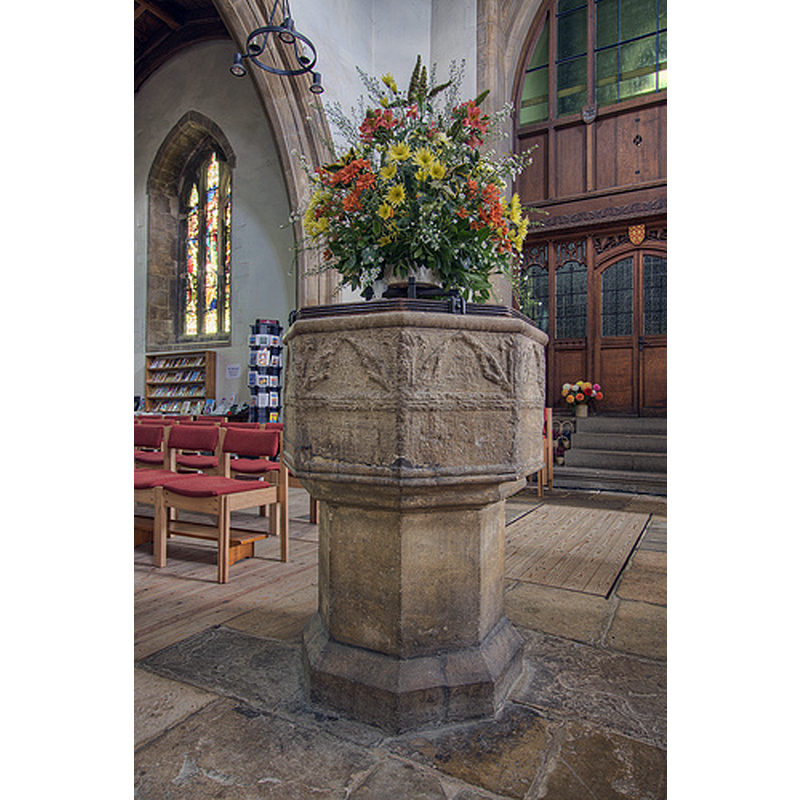
Image copyright © Christopher Jones, 2015
Standing permission
Results: 5 records
view of font and cover in context
Scene Description: at the west end of the nave
Copyright Statement: Image copyright © Christopher Jones, 2015
Image Source: digital photograph taken by Christopher Jones [www.leicestershirechurches.co.uk/kibworth-church-st-wilfrid/] [accessed 13 August 2015]
Copyright Instructions: Standing permission
design element - architectural - arch or window - trefoiled - 8
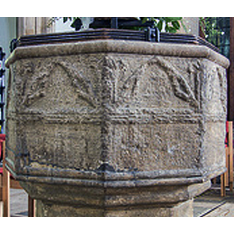
Scene Description: much eroded; notice also the damage and repair on the lower left side
Copyright Statement: Image copyright © Christopher Jones, 2015
Image Source: detail of a digital photograph taken by Christopher Jones [www.leicestershirechurches.co.uk/kibworth-church-st-wilfrid/] [accessed 13 August 2015]
Copyright Instructions: Standing permission
view of church exterior - southwest view
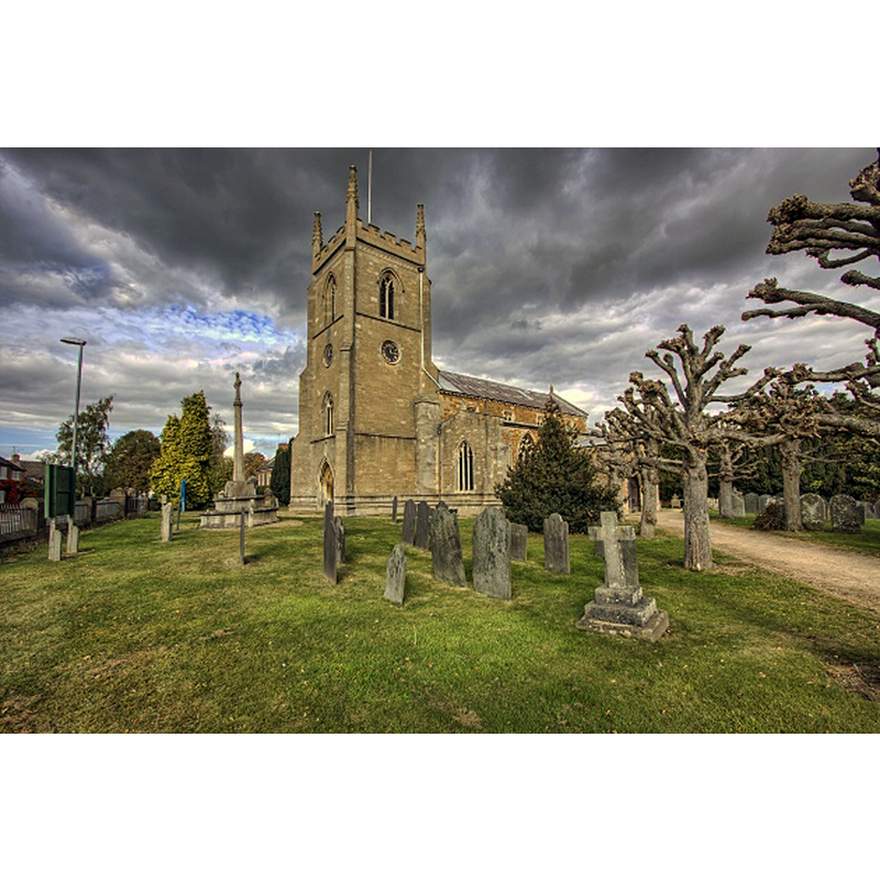
Copyright Statement: Image copyright © Christopher Jones, 2015
Image Source: digital photograph taken by Christopher Jones [www.leicestershirechurches.co.uk/kibworth-church-st-wilfrid/] [accessed 13 August 2015]
Copyright Instructions: Standing permission
view of church exterior - southeast view
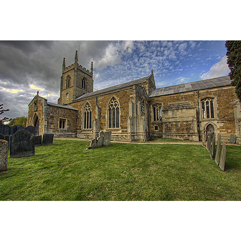
Copyright Statement: Image copyright © Christopher Jones, 2015
Image Source: digital photograph taken by Christopher Jones [www.leicestershirechurches.co.uk/kibworth-church-st-wilfrid/] [accessed 13 August 2015]
Copyright Instructions: Standing permission
view of church interior - nave - looking west
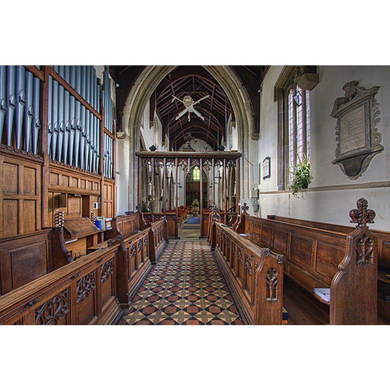
Scene Description: the font is visible at the far end
Copyright Statement: Image copyright © Christopher Jones, 2015
Image Source: digital photograph taken by Christopher Jones [www.leicestershirechurches.co.uk/kibworth-church-st-wilfrid/] [accessed 13 August 2015]
Copyright Instructions: Standing permission
INFORMATION
Font ID: 13135KIB
Object Type: Baptismal Font1
Font Century and Period/Style: 14th century [basin only] [composite font], Medieval [composite]
Church / Chapel Name: Parish Church of St. Wilfred [aka St. Wilfrid's]
Font Location in Church: Inside the church [cf. FontNotes]
Church Patron Saint(s): St. Wilfrid [aka Wilfred, Wilfrith]
Church Address: Church Road, Kibworth Beauchamp, Leicestershire LE8 0NB
Site Location: Leicestershire, East Midlands, England, United Kingdom
Directions to Site: Both Kibworths (Beauchamp and Harcourt) are located at opposite sides of the A6, SE of Leicester
Ecclesiastic Region: Diocese of Leicester
Historical Region: Hundred of Gartree [in Domesday]
Additional Comments: discarded font / abandoned font / damaged font / composite font / re-cycled font (used as horse trough) / restored font [cf. FontNotes]
Font Notes:
Click to view
There is an entry for Kibworth[ Beauchamp] [variant spelling] in the Domesday survey [http://opendomesday.org/place/SP6893/kibworth-beauchamp/] [accessed 13 August 2015], neither of which mentions cleric or church in it. A font in Kibworth is noted and illustrated in Upcott (1818). The Victoria Count History (Leicestershire, vol. 5, 1964) notes: "About 1220 the patron of Kibworth Beauchamp church was Walter de Beauchamp. [...] The advowson remained in the hands of the Beauchamp family until at least 1435 [...] Apart from some 13th-century work in the chancel the church was rebuilt in the second half of the 14th century, the clerestory, chancel windows, and the original tower possibly not being completed until the early 15th century. The present tower replaced one which collapsed in 1825. The lower part of the north and south chancel walls and the small priest's door on the south side date from early in the 13th century. [...] The font, which has traces of trefoiled arcading and may date from the 14th century, was retrieved from a field and replaced in the church during the restoration." [NB: the base of the font appears to be of a later date, probably Victorian]. Noted and illustrated in Leicestershire Churches [www.leicestershirechurches.co.uk/kibworth-church-st-wilfrid/] [accessed 13 August 2015]: "The font is probably 13th century and was removed from the church in the 1650’s by the Puritan Roundhead minister Captain John Yaxley (read more on him in link). It was used as a horse trough for many years until it was reinstated in 1864. The plain 17th century font was given to a church in Zanzibar".
Credit and Acknowledgements: We are grateful to Christopher Jones, of Leicestershire Churches [www.leicestershirechurches.co.uk], for his photographs of this church and font
COORDINATES
UTM: 30U 636155 5823107
Latitude & Longitude (Decimal): 52.541005, -0.992304
Latitude & Longitude (DMS): 52° 32′ 27.62″ N, 0° 59′ 32.29″ W
MEDIUM AND MEASUREMENTS
Material: stone
Font Shape: octagonal, mounted
Basin Interior Shape: round
Basin Exterior Shape: octagonal
LID INFORMATION
Material: wood
Apparatus: no
Notes: octagonal and flat; moulded edges; date unknown
REFERENCES
- Victoria County History [online], University of London, 1993-. URL: https://www.british-history.ac.uk.
- Upcott, William, A bibliographical account of the principal works relating to English topography, London: Printed by Richard and Arthur Taylor, 1818, [vol. II, part II, p. 504] and pl. cviii. [on the letter-press] / [http://books.google.com/books?id=gLwuAAAAMAAJ&pg=PA228&lpg=PA228&dq=upcott+1818&source=web&ots=lJwT-K00zU&sig=oVT6Kc6G03vqjYf4Synuk_Aek9w#PPP15,M1] [accessed 23 September 2007]