Edmondthorpe / Edmerestorp / Edmersthorp / Edmerthorp / Thorp Edmer
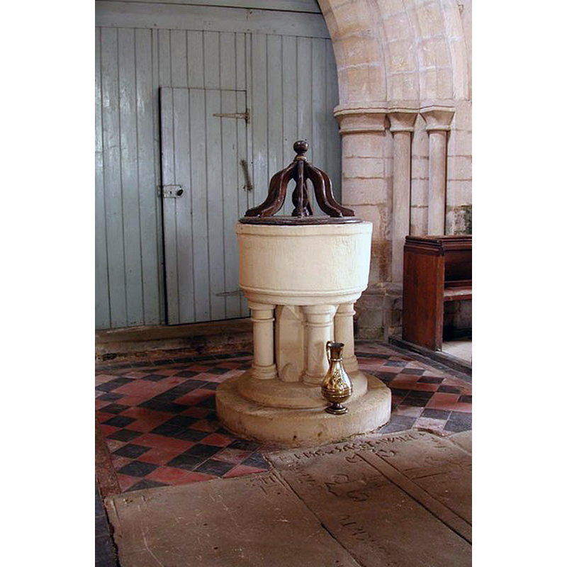
Image copyright © John Salmon, 2002
CC-BY-SA-2.0
Results: 5 records
view of font and cover
Copyright Statement: Image copyright © John Salmon, 2002
Image Source: digital photograph taken 15 June 2002 by John Salmon [www.geograph.org.uk/photo/385078] [accessed 11 August 2015]
Copyright Instructions: CC-BY-SA-2.0
view of church exterior in context - north view
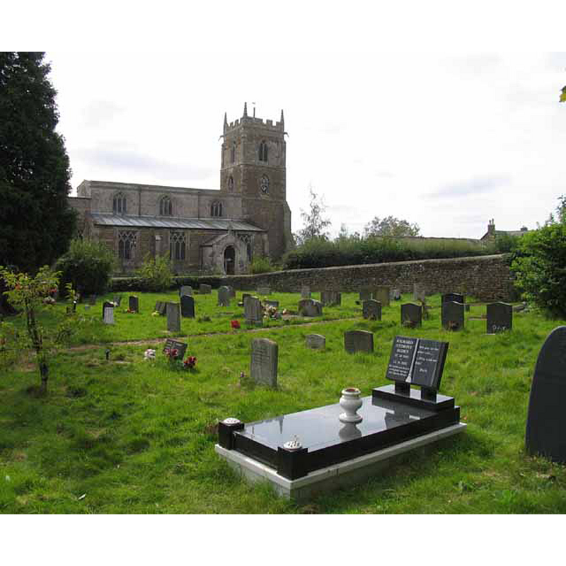
Copyright Statement: Image copyright © Andrew Tatlow, 2012
Image Source: digital photograph taken 16 September 2012 by Andrew Tatlow [www.geograph.org.uk/photo/3350195] [accessed 11 August 2015]
Copyright Instructions: CC-BY-SA-2.0
view of church exterior - south view
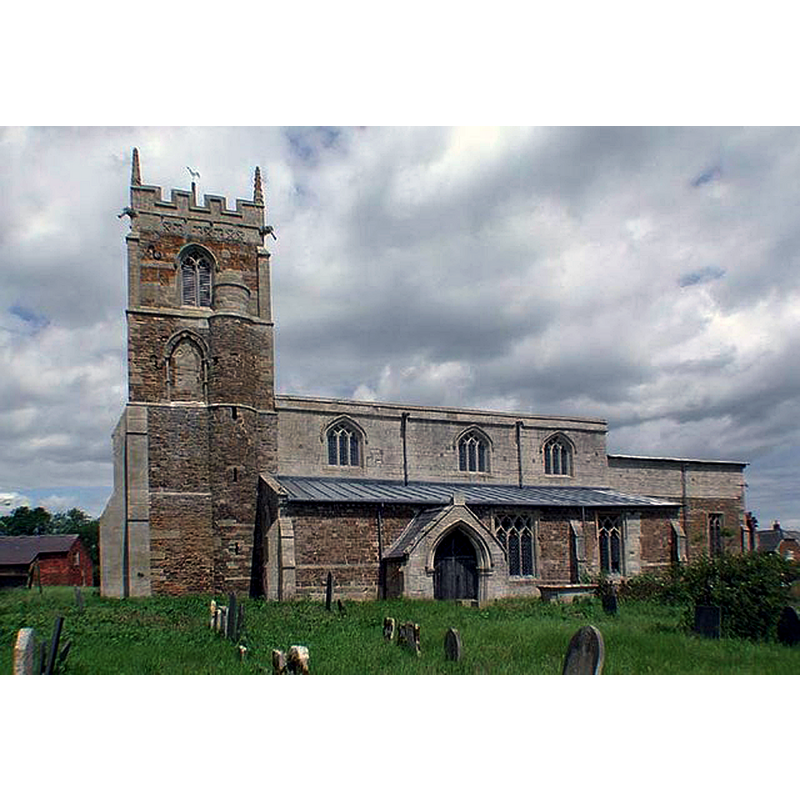
Copyright Statement: Image copyright © John Salmon, 2002
Image Source: digital photograph taken 15 June 2002 by John Salmon [www.geograph.org.uk/photo/385070] [accessed 11 August 2015]
Copyright Instructions: CC-BY-SA-2.0
view of font and cover in context
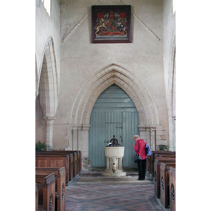
Scene Description: at the west end of the nave, centre aisle
Copyright Statement: Image copyright © John Salmon, 2002
Image Source: digital photograph taken 15 June 2002 by John Salmon [www.geograph.org.uk/photo/385083] [accessed 11 August 2015]
Copyright Instructions: CC-BY-SA-2.0
view of church interior - nave - looking east
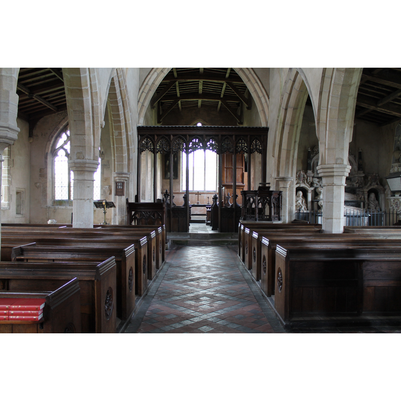
Copyright Statement: Image copyright © J. Hannan-Briggs, 2012
Image Source: digital photograph taken 26 August 2012 by J.Hannan-Briggs [www.geograph.org.uk/photo/3130989] [accessed 11 August 2015]
Copyright Instructions: CC-BY-SA-2.0
INFORMATION
Font ID: 13129EDM
Object Type: Baptismal Font1
Font Century and Period/Style: 13th century, Decorated
Church / Chapel Name: Parish Church of St. Michael and All Angels [redundant]
Font Location in Church: Inside the church; at the W end of the nave, centre aisle
Church Patron Saint(s): St. Michael & All Angels
Church Notes: church redundant since 1999; now in the care of The Churches Conservation Trust
Church Address: Edmondthorpe, Leicestershire, LE14 2JZ
Site Location: Leicestershire, East Midlands, England, United Kingdom
Directions to Site: Located about 10 km E of Melton Mowbray, 6-7 km N of Oakham
Ecclesiastic Region: Diocese of Leicester
Historical Region: Hundred of Framland [in Domesday]
Additional Comments: altered font? (the present font appears much re-tooled)
Font Notes:
Click to view
There is an entry for Edmonthorpe [variant spelling] in the Domesday survey [http://opendomesday.org/place/SK8517/edmondthorpe/] [accessed 11 August 2015]; it mentions a priest, but not a church in it, though there probably was one there. A font here is noted and illustrated in Upcott (1818). The font consists of a roughly cylindrical basin decorated with a single flat moulding at the uper rim, and a thin moulding on the underbowl; raised on a central shaft and four outer colonnettes with moulded capitals and bases; on a round lower base and a circular plinth; the font appears to have been re-tooled all over recently. The wooden cover is of the simple port-Reformation design, a round flat platform with eight raised scroll ribs around a turned pivot; ball finial; 18th-century?
COORDINATES
UTM: 30U 653191 5846689
Latitude & Longitude (Decimal): 52.748319, -0.730337
Latitude & Longitude (DMS): 52° 44′ 53.95″ N, 0° 43′ 49.21″ W
MEDIUM AND MEASUREMENTS
Material: stone
Font Shape: round, mounted
Basin Interior Shape: round
Basin Exterior Shape: round
LID INFORMATION
Date: 18th century?
Material: wood, oak?
Apparatus: no
Notes: [cf. FontNotes]
REFERENCES
- Upcott, William, A bibliographical account of the principal works relating to English topography, London: Printed by Richard and Arthur Taylor, 1818, p. 495 and pl. xxvi, fig. 3