Astley / Aestlaeh / Astele / Astlega / Astleye / Eslei / Estlega / Estlei / Heseleia
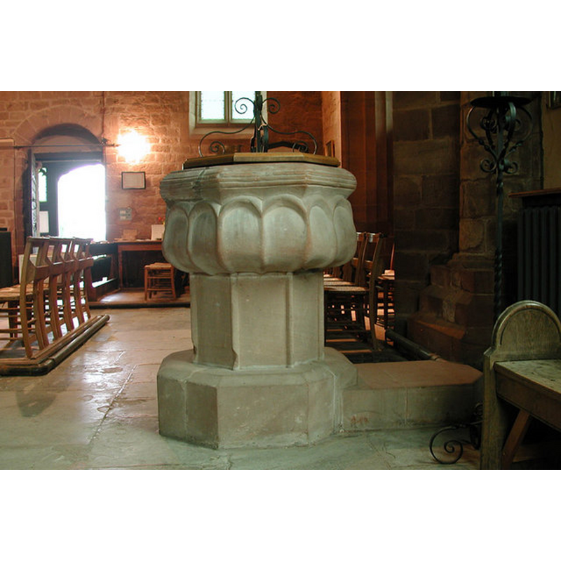
Image copyright © John Salmon, 2000
CC-BY-SA-3.0
Results: 6 records
view of font and cover in context
Scene Description: north aisle, towards the west end -- definitely not Norman
Copyright Statement: Image copyright © John Salmon, 2000
Image Source: digital photograph taken 4 September 2000 by John Salmon [www.geograph.org.uk/photo/2235833] [accessed 17 July 2014]
Copyright Instructions: CC-BY-SA-3.0
design element - patterns - ribbed - concave
Scene Description: looking like a blind arcade of round arches
Copyright Statement: Image copyright © John Salmon, 2000
Image Source: digital photograph taken 4 September 2000 by John Salmon [www.geograph.org.uk/photo/2235833] [accessed 17 July 2014]
Copyright Instructions: CC-BY-SA-3.0
design element - motifs - moulding - parallel
Scene Description: several, all around the uppe rim
Copyright Statement: Image copyright © John Salmon, 2000
Image Source: digital photograph taken 4 September 2000 by John Salmon [www.geograph.org.uk/photo/2235833] [accessed 17 July 2014]
Copyright Instructions: CC-BY-SA-3.0
view of church exterior - southwest view
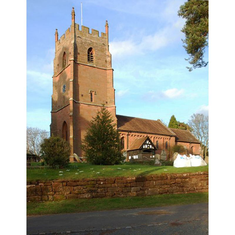
Scene Description: Photo caption: "The church dates from Norman times, probably mid-12th century. The aisle was rebuilt and widened in 1837-8, and there was a major restoration with substantial alterations in the very early years of the 20th century. Currently the church is fund raising for essential works. The church was originally built as the church for a Benedictine priory which was attached to the Abbey of St. Taurin near Rouen in France. As an "alien" foundation, the priory was suppressed in 1414, over a hundred years before King Henry VIII closed all the other remaining religious houses. Fortunately the church survived and contains a number of interesting monuments."
Copyright Statement: Image copyright © P L Chadwick, 2014
Image Source: digital photograph taken 16 February 2014 by P L Chadwick[www.geograph.org.uk/photo/3855997] [accessed 17 July 2014]
Copyright Instructions: CC-BY-SA-3.0
view of church interior - nave - looking east
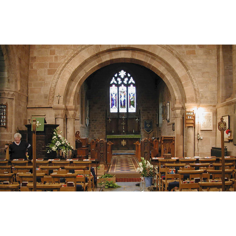
Copyright Statement: Image copyright © John Salmon, 2000
Image Source: digital photograph taken 4 September 2000 by John Salmon [www.geograph.org.uk/photo/2235829] [accessed 17 July 2014]
Copyright Instructions: CC-BY-SA-3.0
design element - motifs - piping
Scene Description: forming the arrises of the pedestal base
Copyright Statement: Image copyright © John Salmon, 2000
Image Source: digital photograph taken 4 September 2000 by John Salmon [www.geograph.org.uk/photo/2235833] [accessed 17 July 2014]
Copyright Instructions: CC-BY-SA-3.0
INFORMATION
Font ID: 13127AST
Object Type: Baptismal Font1
Font Century and Period/Style: 12th century / 15th century [basin only], Medieval [composite]
Church / Chapel Name: Parish Church of St. Peter
Font Location in Church: Inside the church, at the W end of the N aisle
Church Patron Saint(s): St. Peter
Church Address: Astley Mill Road, Astley, Worcestershire, DY13 0RJ
Site Location: Worcestershire, West Midlands, England, United Kingdom
Directions to Site: Located off (E) the A451, 12 km SW of Kidderminster, 20 km WNW of Worcester
Ecclesiastic Region: Diocese of Worcester
Historical Region: Hundred of Doddingtree
Additional Comments: disappeared font? (the one of the church reported in the Domesday survey)
Font Notes:
Click to view
There is entry for this Astley [variant spelling] in the Domesday survey [http://domesdaymap.co.uk/place/SO7867/astley/] [accessed 17 July 2014]; it reports a priest and a church in it; this often means that the church existed before the Conquest. A baptismal font here is noted in Tymms (1834) as being decorated "with Norman ornaments". Miller (1890) reports: "The font is octagonal, probably 14th century." The Victoria County History (Worcester, vol. 4, 1924) notes on this church: "The chancel and nave were built towards the end of the first half of the 12th century, a north aisle, since rebuilt, was added c. 1180, while the tower and north chapel date from the 15th century, when the chancel was probably lengthened eastwards"; and on the font: "The sandstone font dates from the 12th century; its bowl, which has a cauldron-like outline, is octagonal, and has two round-headed panels on each side divided by large beads, those at the angles being continued down the stem, which is also octagonal and has plain panels. The upper edge of the bowl is moulded. The base, which has a plain chamfered upper edge, is probably of later date." Pevsner (1968), however: "Very odd and certainly not Norman, as the VCH says. The eight sides have each a big rising tulip petal, as it were, is the top is heavily moulded. It is probably Perp[endicular], though unusual." Ditto in Brooks & Pevsner (2007).
COORDINATES
Latitude & Longitude (Decimal): 52.30610, -2.31352
Latitude & Longitude (DMS): 52° 18′ 21.96″ N, 2° 18′ 48.68″ W
MEDIUM AND MEASUREMENTS
Material: stone
Font Shape: octagonal, mounted
Basin Interior Shape: round
Basin Exterior Shape: octagonal
REFERENCES
- Victoria County History [online], University of London, 1993-. URL: https://www.british-history.ac.uk.
- Brooks, Alan, Worcestershire, New Haven; London: Yale University Press, 2007, p. 114
- Miller, George [Revd.], The Parishes of the Diocese of Worcester, Birmingham: Hall & English, 1890, vol. 2: 26
- Tymms, Samuel, Family Topographer, being a compendious account of the antient and present state of the counties of England: vol. IV, Oxford circuit, London: Nichols & Son, 1834, p. 270 / [http://books.google.com/books?id=qcouAAAAMAAJ&pg=PA51&lpg=PA51&dq=kempsford+church+font&source=web&ots=h2yFXWCzVN&sig=wFjiUVbwBUazMXVSJwmmw5-jmlA] [accessed 23 September 2007]