Fretherne / Fridorne
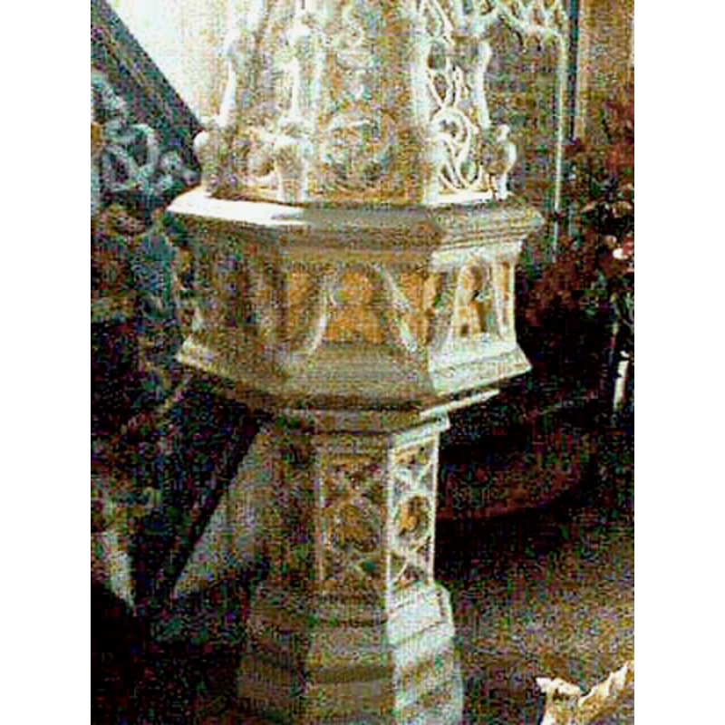
Image copyright © John Wilkes, 2007
Standing permission
Results: 2 records
view of font and cover
Scene Description: the modern font
Copyright Statement: Image copyright © John Wilkes, 2007
Image Source: digital photograph by John Wilkes, 2007 [www.allthecotswolds.com]
Copyright Instructions: Standing permission
view of church exterior
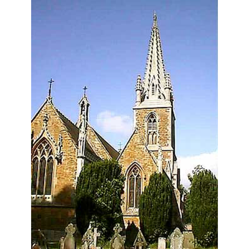
Copyright Statement: Image copyright © John Wilkes, 2007
Image Source: digital photograph by John Wilkes, 2007 [www.allthecotswolds.com]
Copyright Instructions: Standing permission
INFORMATION
Font ID: 13102FRE
Object Type: Baptismal Font1?
Font Century and Period/Style: 13th century, Medieval
Church / Chapel Name: Parish Church of St. Mary the Virgin
Church Patron Saint(s): St. Mary the Virgin
Church Address: Fretherne, Gloucestershire GL2 7JF, UK
Site Location: Gloucestershire, South West, England, United Kingdom
Directions to Site: Located 13 km SW of Gloucester. The church is located on the left side of the road from Frampton-on-Severn to Arlingham, opposite the nurseries
Ecclesiastic Region: Diocese of Gloucester
Historical Region: Hundred of Whitstone -- Hundred of Bachelaue [in Domesday]
Additional Comments: disappeared font? (the one from the church documented by 1281)
Font Notes:
Click to view
There is an entry for Fretherne [variant spelling] in the Domesday survey [https://opendomesday.org/place/SO7309/fretherne/] [accessed 13 February 2019] but it mentions neither cleric nor church in it. The entry for this parish in the Victoria County History (Gloucester, vol. 10, 1972) informs: "The church of Fretherne existed by 1281 […] was entirely rebuilt in the mid 19th century and retains of its ancient fabric only three 13th-century coffinlids, which appear to be earlier than the first known documentary reference to the church in 1281", but was rebuilt in 1846-1847, a time at which the old font from the 13th-century church must have been disposed of [we have no information on its whereabouts]. Noted in Verey & Brooks (1999-2002): "Font of Painswick stone, octagonal, Dec[orated]-Perp[endicular] style, with pierced and crocketed cover." The entry for this church in Historic England [Listing NGR: SO7337209157] notes: "Anglican church. Rebuilt 1847, on site of C13 church, by Francis Niblett enlarged 1857-9 by J.W. Hugall [...] Elaborately carved wooden pulpit hood and stone font hood." Baptismal font consisting of an octagonal basin with deeply-carved neo-Gothic panels, raised on a slender octagonal pedestal base. Tall pyramidal cover, very ornate. Both pieces Victorian, probably contemporary with the church itself.
Credit and Acknowledgements: We are grateful to John Wilkes, of www.allthecotswolds.com, for the photographs of this church and modern font.
COORDINATES
UTM: 30U 542270 5736789
Latitude & Longitude (Decimal): 51.780376, -2.387267
Latitude & Longitude (DMS): 51° 46′ 49.36″ N, 2° 23′ 14.16″ W
LID INFORMATION
Date: 19th-century?
Notes: [cf. FontNotes]
REFERENCES
- Victoria County History [online], University of London, 1993-. URL: https://www.british-history.ac.uk.
- Verey, David, Gloucestershire, London: Penguin Books, 1999-2002, vol. 2: 385