Easingwold / Easingwaud / Easingwould / Eisicewalt / Eisinceuuald / Esingewald / Esyngwold / Hesingwald
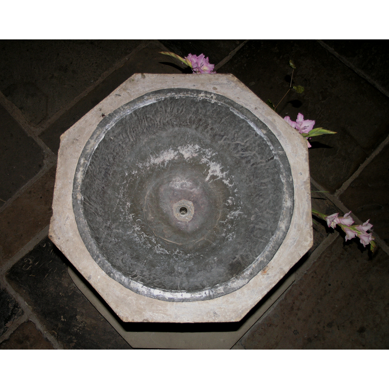
Image copyright © Colin Hinson, 2008
Standing permission
Results: 5 records
view of basin - interior
Copyright Statement: Image copyright © Colin Hinson, 2008
Image Source: digital photograph taken August 2007 by Colin Hinson [www.yorkshireCDbooks.com]
Copyright Instructions: Standing permission
design element - motifs - moulding - 2
![[cf. Font notes]](/static-50478a99ec6f36a15d6234548c59f63da52304e5/compressed/1070908028_compressed.png)
Scene Description: [cf. Font notes]
Copyright Statement: Image copyright © Colin Hinson, 2008
Image Source: digital photograph taken August 2007 by Colin Hinson [www.yorkshireCDbooks.com]
Copyright Instructions: Standing permission
view of church exterior - south view
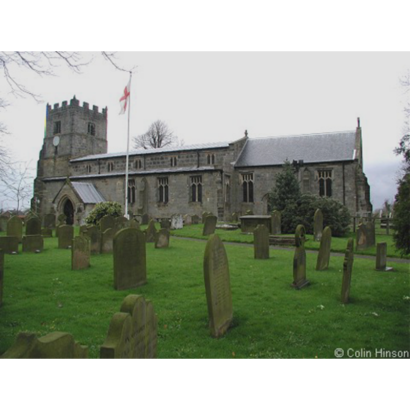
Copyright Statement: Image copyright © Colin Hinson, 2008
Image Source: digital photograph taken August 2007 by Colin Hinson [www.yorkshireCDbooks.com]
Copyright Instructions: Standing permission
view of font and cover in context
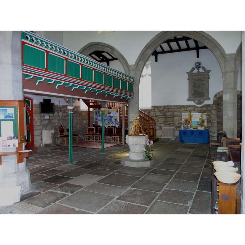
Scene Description: church interior: west end looking north
Copyright Statement: Image copyright © Colin Hinson, 2008
Image Source: digital photograph taken August 2007 by Colin Hinson [www.yorkshireCDbooks.com]
Copyright Instructions: Standing permission
view of font cover
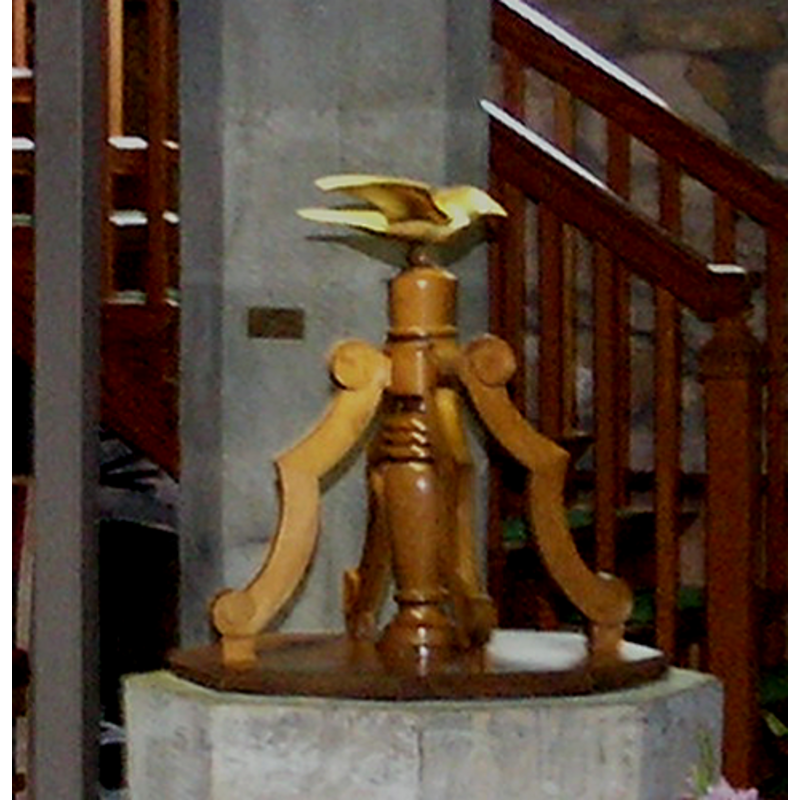
Copyright Statement: Image copyright © Colin Hinson, 2008
Image Source: digital photograph taken August 2007 by Colin Hinson [www.yorkshireCDbooks.com]
Copyright Instructions: Standing permission
INFORMATION
Font ID: 13088EAS
Object Type: Baptismal Font1
Font Century and Period/Style: 13th century [altered?], Early English [altered]
Church / Chapel Name: Parish Church of St. John the Baptist
Font Location in Church: Inside the church, in the W end of the nave
Church Patron Saint(s): St. John the Baptist
Church Address: Church Hill, Easingwold, York YO61 3JU, UK -- Tel.: +44 1347 821394
Site Location: North Yorkshire, Yorkshire and the Humber, England, United Kingdom
Directions to Site: Located E of the A19, 5-6 km NE of Alne, about 20 N of York
Ecclesiastic Region: Diocese of York
Additional Comments: altered font? (the present one appears to have been re-cut, perhaps in the 15thC) -- disappeared font? (the one from the Domesday-time church here)
Font Notes:
Click to view
The entry for Easingwold in the Domesday reports a church in it. The entry for this parish in the Victoria County History (York North Riding, vol. 2, 1923) notes: "There was a church with a priest at Easingwold at the time of the Domesday Survey [...] The north door is evidence of the existence of a church here in the 13th century, but it is not now in situ, and with the possible exception of the west end the church appears to have been completely rebuilt in the 15th century. [...] The font has an octagonal bowl, recut, and a circular moulded stem, and probably dates from the 13th century." Baptismal font consisting of an octagonal basin of plain vertical sides, the underbowl conical and plain but for a moulding at either end; the lower base is cylindrical; raised on a polygonal plinth. The wooden font cover consists of a flat octagonal platform on which stand four ribs around a central pivot and a dove finial.
Credit and Acknowledgements: We are grateful to Colin Hinson, of www.yorkshireCDbooks.com, for his photographs of church and font.
COORDINATES
UTM: 30U 617803 5998775
Latitude & Longitude (Decimal): 54.1236, -1.1974
Latitude & Longitude (DMS): 54° 7′ 24.96″ N, 1° 11′ 50.64″ W
MEDIUM AND MEASUREMENTS
Material: stone
Font Shape: octagonal, mounted
Basin Interior Shape: round
Basin Exterior Shape: octagonal
Drainage System: centre hole in basin
Drainage Notes: lead lining
LID INFORMATION
Date: modern
Material: wood
Apparatus: no
Notes: [cf. FontNotes]
REFERENCES
- Victoria County History [online], University of London, 1993-. URL: https://www.british-history.ac.uk.