Warter / Warte / Wartre
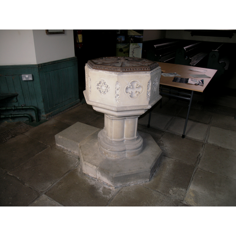
Image copyright © Colin Hinson, 2008
Standing permission
Results: 5 records
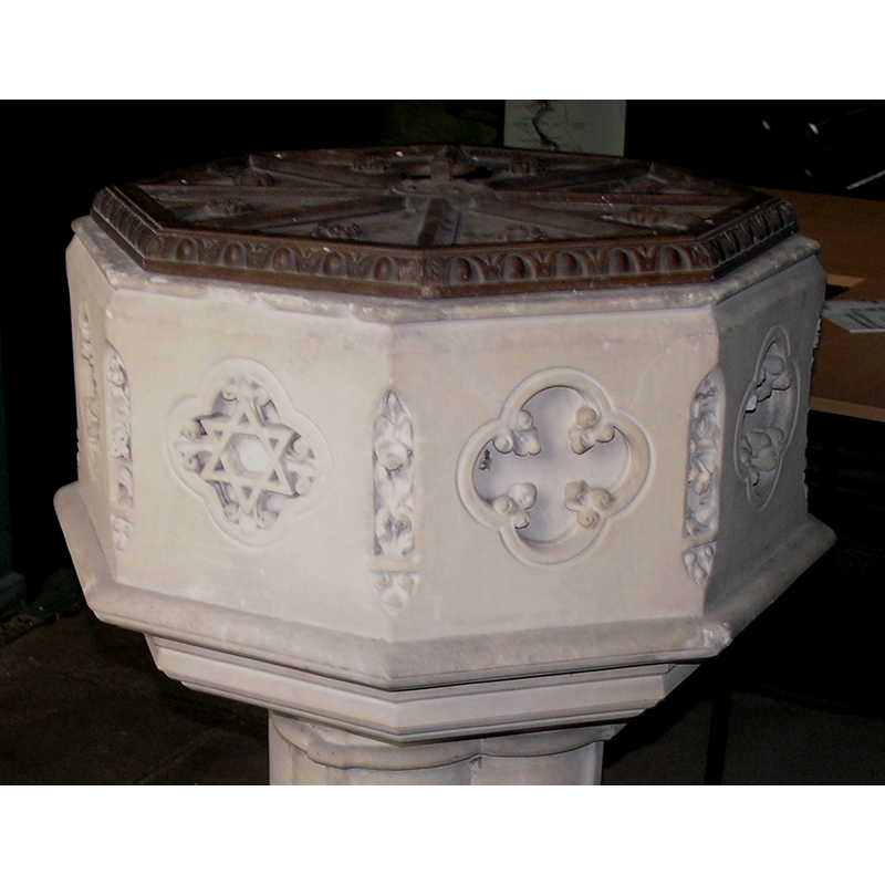
view of font and cover
Scene Description: the Victorian font
Copyright Statement: Image copyright © Colin Hinson, 2008
Image Source: digital photograph taken August 2007 by Colin Hinson [www.yorkshireCDbooks.com]
Copyright Instructions: Standing permission
view of basin - interior
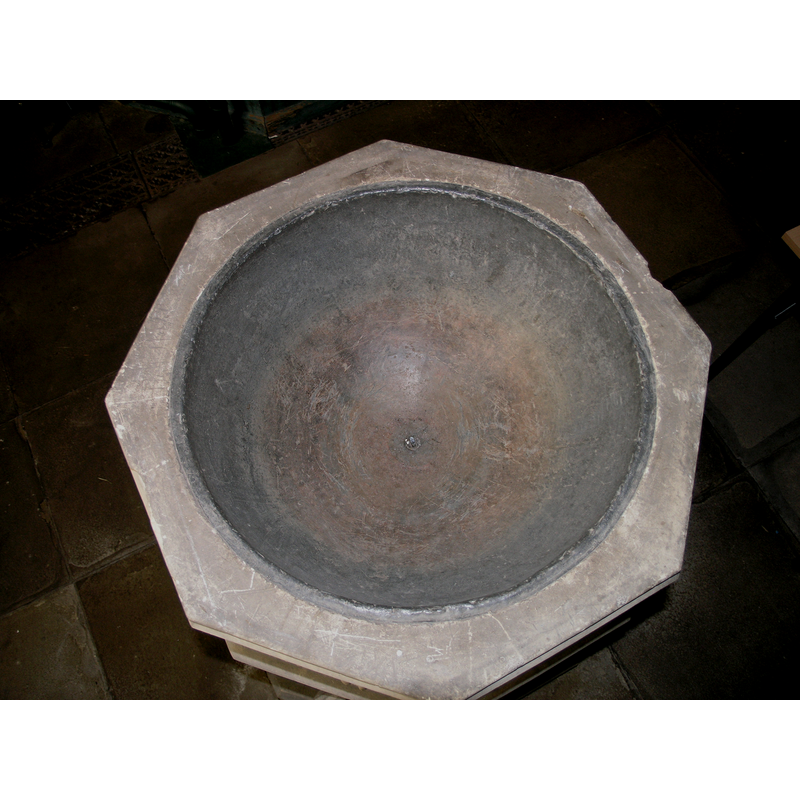
Scene Description: the Victorian font
Copyright Statement: Image copyright © Colin Hinson, 2008
Image Source: digital photograph taken August 2007 by Colin Hinson [www.yorkshireCDbooks.com]
Copyright Instructions: Standing permission
view of basin
Scene Description: the Victorian font
Copyright Statement: Image copyright © Colin Hinson, 2008
Image Source: digital photograph taken August 2007 by Colin Hinson [www.yorkshireCDbooks.com]
Copyright Instructions: Standing permission
view of church exterior - southwest view
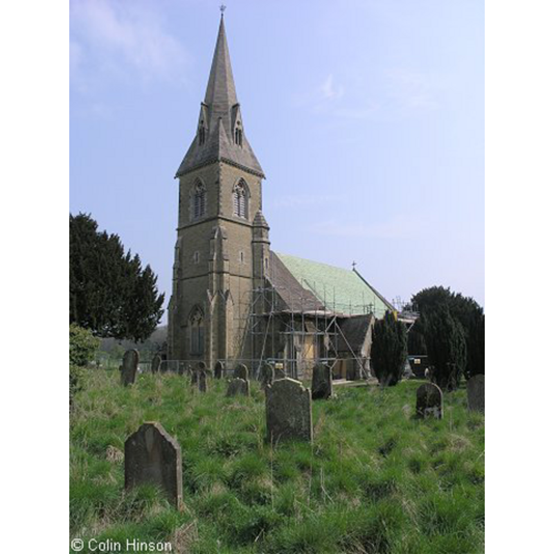
Copyright Statement: Image copyright © Colin Hinson, 2008
Image Source: digital photograph taken August 2007 by Colin Hinson [www.yorkshireCDbooks.com]
Copyright Instructions: Standing permission
view of font and cover in context
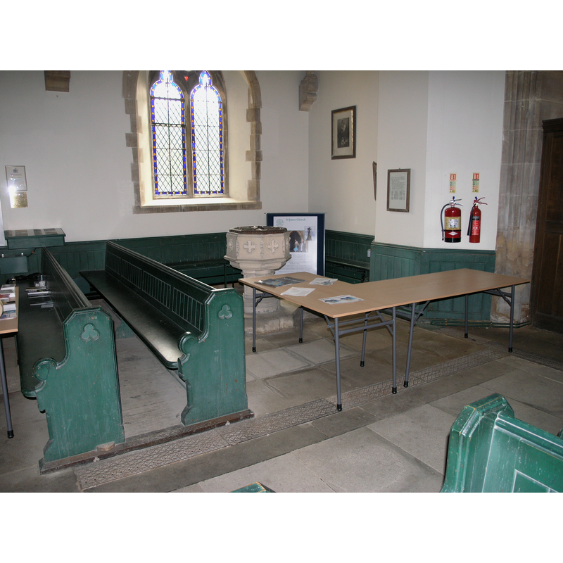
Scene Description: the Victorian font
Copyright Statement: Image copyright © Colin Hinson, 2008
Image Source: digital photograph taken August 2007 by Colin Hinson [www.yorkshireCDbooks.com]
Copyright Instructions: Standing permission
INFORMATION
Font ID: 13084WAR
Object Type: Baptismal Font1?
Font Century and Period/Style: 12th century, Late Norman
Church / Chapel Name: Augustinian Priory Church [cf. FontNotes]
Church Patron Saint(s): St. James?
Church Notes: the present 19thC church at Warter is said to have been built on the nave of the former priory church here; became redundant in 1990
Church Address: Warter, York YO42 1XW, UK
Site Location: East Riding of Yorkshire, Yorkshire and the Humber, England, United Kingdom
Directions to Site: Located off the B1246, 5-6 km ENE of Pocklington, 30 km E of York
Historical Region: Hundred of Warter
Additional Comments: disappeared font? two fonts? [cf. FontNotes]
Font Notes:
Click to view
There are two entries for Warter [variant spellings] in the Domesday survey [https://opendomesday.org/place/SE8650/warter/] [accessed 7 October 2019], one of which, the land of King William, reports a priest and and a church in it. Bulmer's History and Directory of East Yorkshire (1892) reports: "the font is octagonal, and rests on a shaft of four clustered pillars" [NB: this same source notes that the "church of St. James was re-built by the late Baron Muncaster in 1862-4", but does not record the font of the earlier church, nor whether or not there was an ancient font in the Augustinian Priory founded "in 1132, and dedicated it to St. James". The entry for the Augustinian priory here in the Victoria County History (York, vol. 3, 1974) notes; "The priory of Warter was founded in 1132, [...] by Geoffrey Fitz Pain, otherwise Trusbut, who conferred upon it the church of Warter and 6 bovates of land in the fields of that place. [...] There were ten canons at the Dissolution, and the priory and its entire property was granted in 1536-7 to Thomas, Earl of Rutland". The entry for this church in Historic England [Listing NGR: SE8699550434] notes: "Church. 1862", without a mention of the earlier church or a font in it. The entry for Warter Priory in the CRSBI (2019) notes: "W. H. St John Hope deduced from a Dissolution survey that the nave of the priory church was retained as the parish church: the survey describes the crossing, transepts and choir in terms of demolition value. The medieval parish church was replaced in 1864 by a new church on the same site. Consequently, the site immediately east of the present church was chosen to be excavated by St John Hope in 1899; he found 6 bays of the eastern end of the priory church. There were two walls 25 feet apart (7.7m) running east and west; a floor of chalk blocks; risers and an altar base. This was of the late 13th century. ‘There was a marked absence of architectural and indeed any other fragments or details, so thoroughly had the place been destroyed and spoiled’ (Hope, 1900, 50)." [NB: the priory appears to have had its own conventual church; the Domesday-time parish church of Warter was donated to the priory early on [cf. supra], therefore there would have been two medieval fonts in Warter: one in the parish church and another in the priory church -- we have no information on either of them].
COORDINATES
UTM: 30U 652521 5979650
Latitude & Longitude (Decimal): 53.94272, -0.67619
Latitude & Longitude (DMS): 53° 56′ 33.79″ N, 0° 40′ 34.28″ W
REFERENCES
- Victoria County History [online], University of London, 1993-. URL: https://www.british-history.ac.uk.
- Bulmer, T., History and Directory of East Yorkshire, 1892, [http://www.genuki.org.uk/big/eng/YKS/ERY/Warter/Warter92.html] [accessed 4 September 2007
- Corpus of Romanesque Sculpture in Britain and Ireland, The Corpus of Romanesque Sculpture in Britain and Ireland, The Corpus of Romanesque Sculpture in Britain and Ireland. URL: http://www.crsbi.ac.uk.