Reading No. 3 / Rading / Reding / Redinges / Redynges
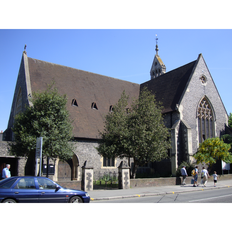
Image copyright © [in the public domain]
Released by the author into the public domain
Results: 3 records
view of church exterior - northeast view
Copyright Statement: Image copyright © [in the public domain]
Image Source: digital photograph taken 22 May 2010 by John Armagh [http://en.wikipedia.org/wiki/File:ReadingGreyfriars.jpg] [accessed 29 November 2011]
Copyright Instructions: Released by the author into the public domain
view of font and cover

Copyright Statement: Image copyright © Oxfordshire Church Illustrations, 2007
Image Source: detail of a photograph in Flicker, with original from Oxfordshire Church Illustrations [http://flickr.com/photos/oxfordshire_church_photos/513175933/] [accessed 22 July 2007]
Copyright Instructions: PERMISSION NOT AVAILABLE -- IMAGE NOT FOR PUBLIC USE
view of font and cover in context
Copyright Statement: Image copyright © Oxfordshire Church Illustrations, 2007
Image Source: photograph in Flicker, with original from Oxfordshire Church Illustrations [http://flickr.com/photos/oxfordshire_church_photos/513175933/] [accessed 22 July 2007]
Copyright Instructions: PERMISSION NOT AVAILABLE -- IMAGE NOT FOR PUBLIC USE
INFORMATION
Font ID: 13061REA
Object Type: Baptismal Font1?
Font Date: ca. 1285?
Font Century and Period/Style: 13th century (late?), Medieval
Church / Chapel Name: Greyfriars
Font Location in Church: Inside the church
Church Address: Friar St., Reading, Berkshire, RG1 1EH
Site Location: Berkshire, South East, England, United Kingdom
Directions to Site: On Friar St., Reading town centre
Ecclesiastic Region: Diocese of Oxford
Historical Region: Hundred of Reading [in Domesday]
Additional Comments: disappeared font? (the one from the medieval church?)
Font Notes:
Click to view
There are three entries for Reading [variant spelling] in the Domesday survey [http://opendomesday.org/place/SU7173/reading/] [accessed 28 April 2015], one of which parts, in the lordship of the Abbey of St. Martin's, Battle, mentions a church in it. The Victoria County History (Berkshire, vol. 3, 1923) notes: "The nave, aisles, and foundations of the south transept [of this church] date from the early 14th century. This is fixed approximately by the will of Alan de Baunebury, who died at Reading in 1311", but does not mention a font in it. The present baptismal font consists of an octagonal (?) basin executed in an imitation style of the late-Decorated and Early Perpendicular fonts, but raised on the favourite Victorian base, a cluster of marble colonnettes, and an octagonal lower base; it is located at the west end of the arcade that separates the nave from the south aisle. This modern font is probably dated to the 1860s restoration. [NB: the church itself dates from 1285, restored in the 1860s, but we have no information on the medieval font].
COORDINATES
UTM: 30U 640581 5702564
Latitude & Longitude (Decimal): 51.456772, -0.976533
Latitude & Longitude (DMS): 51° 27′ 24.38″ N, 0° 58′ 35.52″ W
LID INFORMATION
Date: Victorian? / 19th century?
Material: wood
Apparatus: no
Notes: [cf. ImageArea]
REFERENCES
- Victoria County History [online], University of London, 1993-. URL: https://www.british-history.ac.uk.