South Leigh No. 1
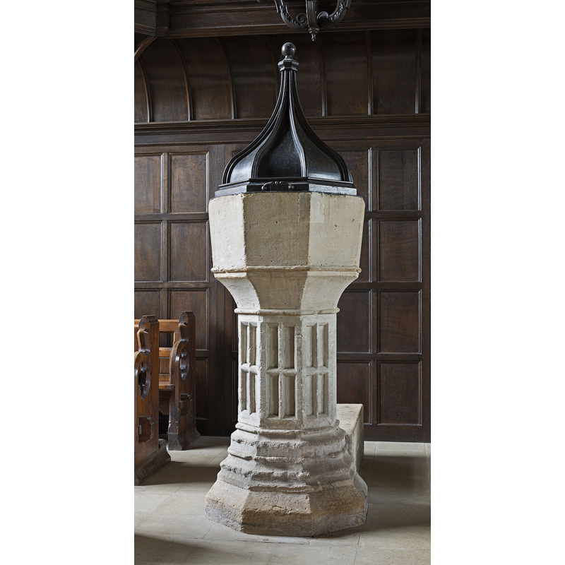
Image copyright © saffron100_uk, 2012
CC-BY-SA-3.0
Results: 5 records
view of font and cover
Scene Description: Source caption: "The 15th cent. font. In the 19th.cent. it was coverless. The cover was designed by Sebastian Comper in 1948."
Copyright Statement: Image copyright © saffron100_uk, 2012
Image Source: digital photograph taken 7 April 2012 by saffron100_uk [https://commons.wikimedia.org/wiki/File:South_Leigh,_Oxfordshire,_St._James_the_Great.jpg] [accessed 28 November 2017]
Copyright Instructions: CC-BY-SA-3.0
view of church exterior - south view
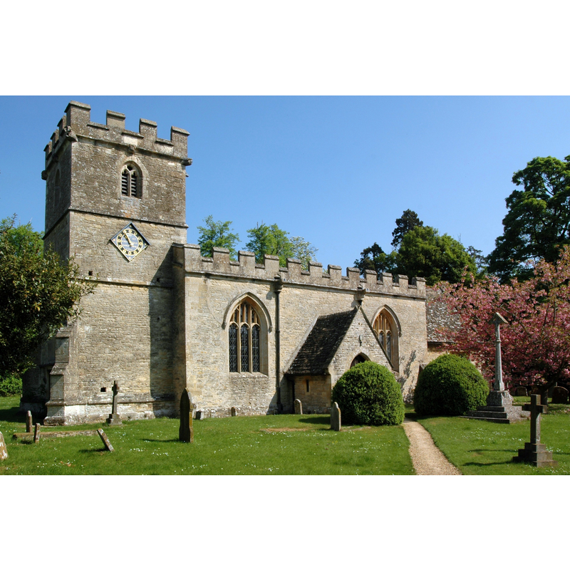
Copyright Statement: Image copyright © Motacilla, 2011
Image Source: digital photograph taken 25 April 2011 by Motacilla [https://commons.wikimedia.org/wiki/File:SouthLeigh_StJames_south.JPG] [accessed 28 November 2017]
Copyright Instructions: CC-BY-SA-3.0
view of church interior - piscina
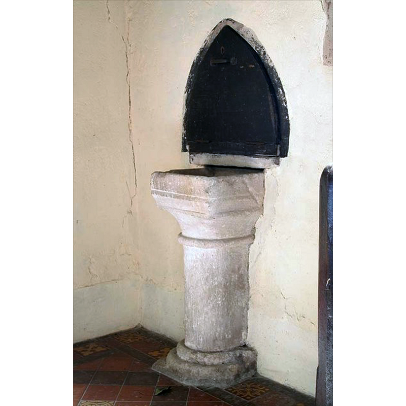
Copyright Statement: Image copyright © John Salmon, 2009
Image Source: digital photograph taken 24 August 2004 by John Salmon [www.geograph.org.uk/photo/1623936] [accessed 28 November 2017]
Copyright Instructions: CC-BY-SA-2.0
view of font and cover in context
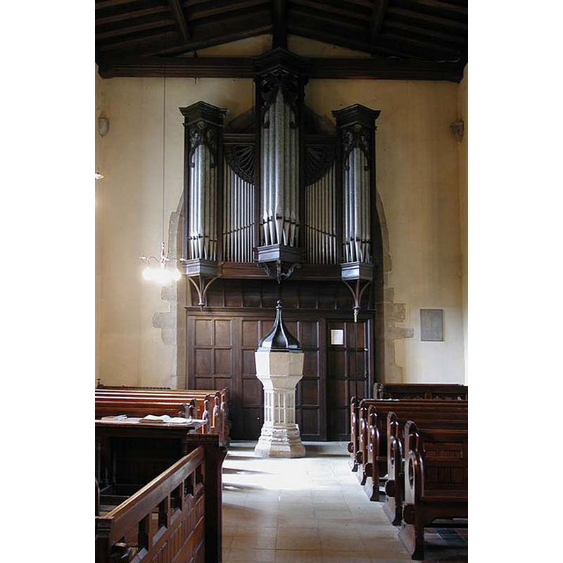
Scene Description: organ and 15thC font
Copyright Statement: Image copyright © John Salmon, 2009
Image Source: digital photograph taken 24 August 2004 by John Salmon [www.geograph.org.uk/photo/1623924] [accessed 28 November 2017]
Copyright Instructions: CC-BY-SA-2.0
view of church interior - nave - looking northeast
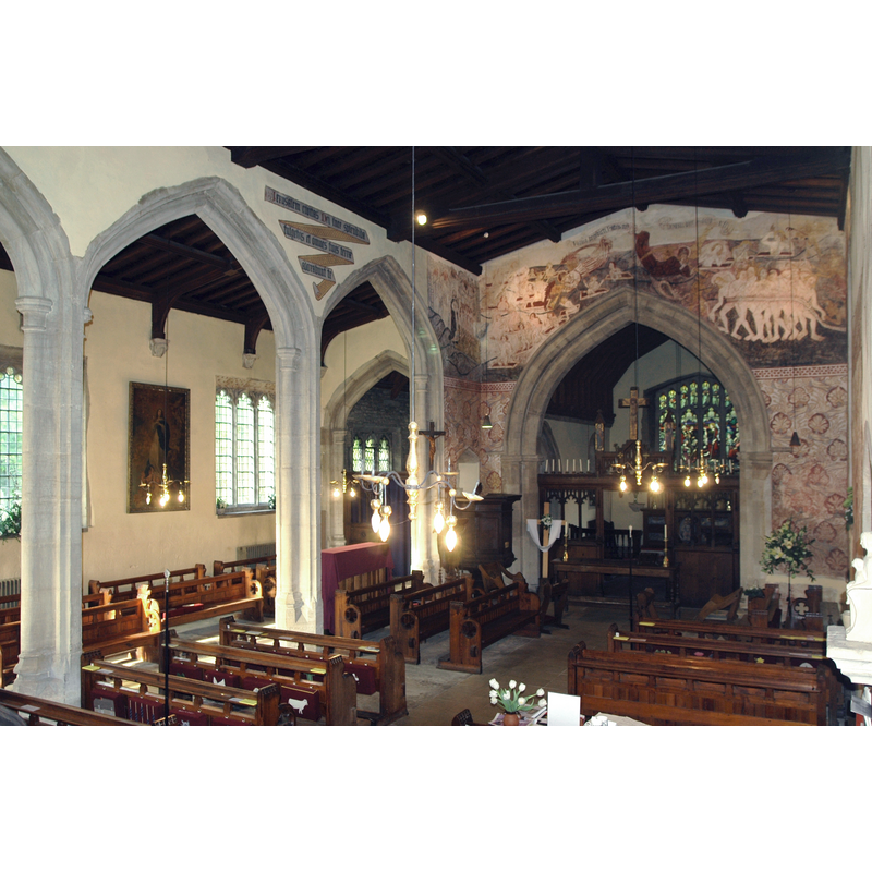
Scene Description: Source caption: "Church of England parish church of St James the Great, South Leigh, Oxfordshire: interior showing chancel arch, doom painting and part of north arcade."
Copyright Statement: Image copyright © Motacilla, 2011
Image Source: digital photograph taken 25 April 2011 by Motacilla [https://commons.wikimedia.org/wiki/File:SouthLeigh_StJames_interior.JPG] [accessed 28 November 2017]
Copyright Instructions: CC-BY-SA-3.0
INFORMATION
Font ID: 13036LEI
Object Type: Stoup
Font Century and Period/Style: 12th - 13th century, Norman? / Transitional?
Church / Chapel Name: Parish Church of St. James the Great
Font Location in Church: In the porch
Church Patron Saint(s): St. James the Greater [aka James the Great, James the Elder]
Church Address: Church End, South Leigh, Oxfordshire, OX29 6US, UK
Site Location: Oxfordshire, South East, England, United Kingdom
Directions to Site: Located off (S) the A40, 4 km ESE of Witney, 13 km WNW of Oxford
Ecclesiastic Region: Diocese of Oxford
Historical Region: Hundred of Wootton
Additional Comments: fragment
Font Notes:
Click to view
Kelly's Directory of 1911 reports: "the porch contains the remains of a stoup" [NB: Kelly's (ibid.) notes that the earlier parts of the building date to the Norman and Transitional periods]. [cf. Index entry for South Leigh No. 2 for a baptismal font of the Perpendicular period inside the church]
COORDINATES
UTM: 30U 608297 5737605
Latitude & Longitude (Decimal): 51.778825, -1.430161
Latitude & Longitude (DMS): 51° 46′ 43.77″ N, 1° 25′ 48.58″ W
MEDIUM AND MEASUREMENTS
Material: stone
REFERENCES
- Kelly, Kelly's Directory of Oxfordshire, London: Kelly's Directories Ltd., 1911, p. 144 / [http://www.historicaldirectories.org/hd/d.asp] [accessed 3 July 2007]