Horley nr. Banbury / Hornelie
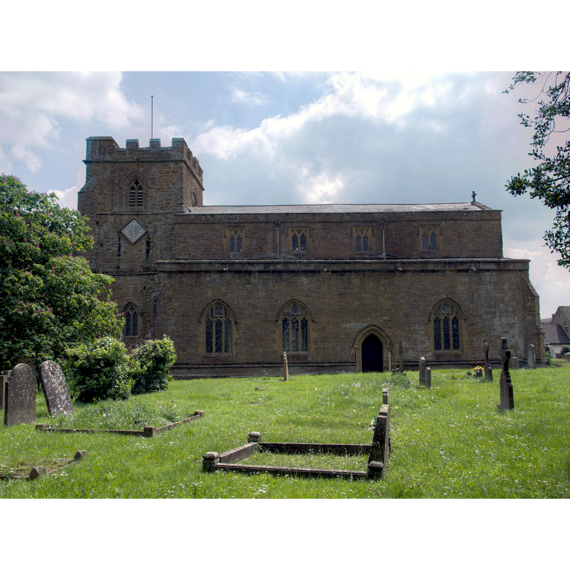
Image copyright © David P Howard, 2013
CC-BY-SA-2.0
Results: 6 records
view of church exterior - north view
Scene Description: Source caption: "Church of St Etheldreda, Horley. The north side of this very old church dating from the 12th. century."
Copyright Statement: Image copyright © David P Howard, 2013
Image Source: digital photograph taken 31 May 2013 by David P Howard [www.geograph.org.uk/photo/3488088] [accessed 15 December 2015]
Copyright Instructions: CC-BY-SA-2.0
view of church exterior - southeast view
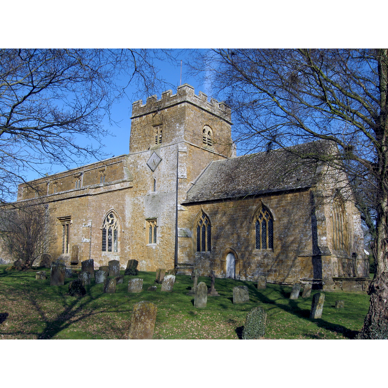
Scene Description: Source caption: "St Etheldreda’s Church Horley Oxfordshire. The central tower and chancel survive from the Late Norman church of 1180. For a small, out of the way village, it is an imposing monument. The nave and North aisle were built and subsequently renovated in the 13th and 15th century respectively."
Copyright Statement: Image copyright © Richard Rogerson, 2010
Image Source: digital photograph taken 13 May 2010 by Richard Rogerson [www.geograph.org.uk/photo/1771691] [accessed 15 December 2015]
Copyright Instructions: CC-BY-SA-2.0
view of church interior - nave - looking east
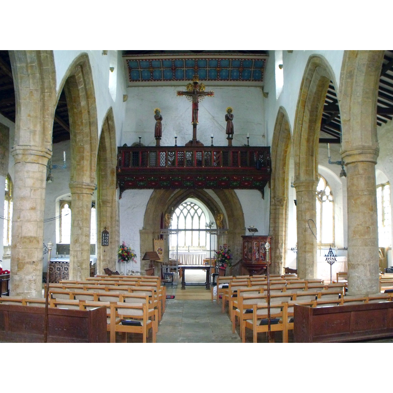
Scene Description: Source caption: "St Etheldreda's, Horley. The church has a superb interior matching the exterior. The fixtures and fittings are superb and colourful. There is a lot of light in the church even on a dull day. We were grateful that the church is kept open."
Copyright Statement: Image copyright © Nick Macneill, 2013
Image Source: digital photograph taken 18 September 2013 by Nick Macneill [w1151215021] [accessed 15 December 2015]
Copyright Instructions: CC-BY-SA-2.0
view of church interior - plan

Scene Description: the font is located at the west end of the arcade that separates the nave from the north aisle
Copyright Statement: Image copyright © University of London & History of Parliament Trust , 2009
Image Source: church interior plan [http://www.british-history.ac.uk/image.aspx?compid=101918&filename=fig12.gif&pubid=1127] [accessed 14 March 2009]
Copyright Instructions: PERMISSION NOT AVAILABLE -- IMAGE NOT FOR PUBLIC USE
design element - architectural - arcade
![[cf. Font notes]](/static-50478a99ec6f36a15d6234548c59f63da52304e5/others/image_not_available.jpg)
Scene Description: [cf. Font notes]
![[cf. Font notes]](/static-50478a99ec6f36a15d6234548c59f63da52304e5/bsi-testing-site/others/image_not_available.jpg)
design element - motifs - rope moulding
Scene Description: [cf. Font notes]
INFORMATION
Font ID: 13033HOR
Object Type: Baptismal Font1
Font Date: ca. 1180?
Font Century and Period/Style: 12th century (late?), Late Norman
Church / Chapel Name: Parish Church of St. Etheldreda
Font Location in Church: Inside the church, in the W end of the nave [cf. FontNotes]
Church Patron Saint(s): St. Etheldreda [aka Audrey, Æðelþryð, Æþelðryþe, Æthelthryth, Ediltrudis]
Church Address: Church Lane, Horley, Oxfordshire OX15 6BJ, United Kingdom -- Tel.: +44 1295 730344
Site Location: Oxfordshire, South East, England, United Kingdom
Directions to Site: Located 6 km SW of Cropredy, 6-7 km NW of Banbury
Ecclesiastic Region: Diocese of Oxford
Historical Region: Hundred of Bloxham
Additional Comments: altered font / repaired font / moved font (where was it originally if it was moved to the west end? perhaps closer to the south entranceway?)
Font Notes:
Click to view
There are three entries for this Horley [variant spelling] in the Domesday survey [http://opendomesday.org/place/SP4143/horley/] [accessed 15 December 2015], none of which mentions cleric or church in it. Kelly's Oxford Directory of 1911 reports: "the Norman tub-shaped font was restored in 1854 and placed at the west of the nave". Noted in the Victoria County History (Oxford, vol. 9, 1969): "Architectural evidence shows that both Horley and Hornton churches were in existence by the late 12th century. In 1115 Henry I granted land in Horley, and the church of King's Sutton (Northants.), which Ranulf Flambard held of him, to augment the prebend which Ranulf and his son Elias held in Lincoln. [...] The tower dates from the late 12th century [...] The existing chancel, though remodelled in the 14th century, appears to date substantially from c. 1200 and was probably built at approximately the same date as the tower. [...] The tubshaped font (restored in 1855) [...] may date from the late 12th or early 13th century. [...] cylindrical font with an arcade of interesting arches and a base moulding of cables", and mentions in a footnote a drawing of it at the Bodleian Library: "MS. Top. Oxon. a 67, no. 338". The church interior plan in the VCH source above shows the font located behind the last column of the arcade that separates the nave from the north aisle.
COORDINATES
UTM: 30U 610108 5772546
Latitude & Longitude (Decimal): 52.092511, -1.392749
Latitude & Longitude (DMS): 52° 5′ 33.04″ N, 1° 23′ 33.89″ W
MEDIUM AND MEASUREMENTS
Material: stone
Font Shape: tub-shaped
Basin Interior Shape: round
Basin Exterior Shape: round
REFERENCES
- Victoria County History [online], University of London, 1993-. URL: https://www.british-history.ac.uk.
- Kelly, Kelly's Directory of Oxfordshire, London: Kelly's Directories Ltd., 1911, p. 132 / [http://www.historicaldirectories.org/hd/d.asp] [accessed 2 July 2007]