Lower Heyford / Esforde / Hesford / Heyford-at-Bridge / Heyford Bridge
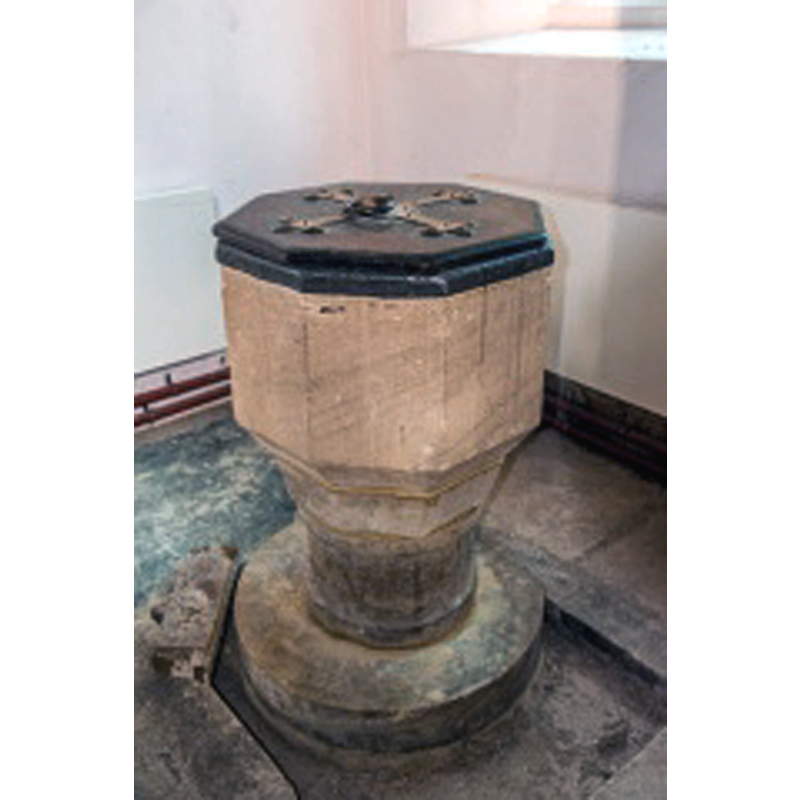
Image copyright © David Ross & Britain Express Ltd, 2016
Standing permission
Results: 2 records
view of font and cover
Copyright Statement: Image copyright © David Ross & Britain Express Ltd, 2016
Image Source: digital photograph taken by David Ross, of Britain Express [www.britainexpress.com/counties/oxfordshire/churches/lower-heyford.htm] [accessed 12 December 2016]
Copyright Instructions: Standing permission
view of church exterior - southeast view
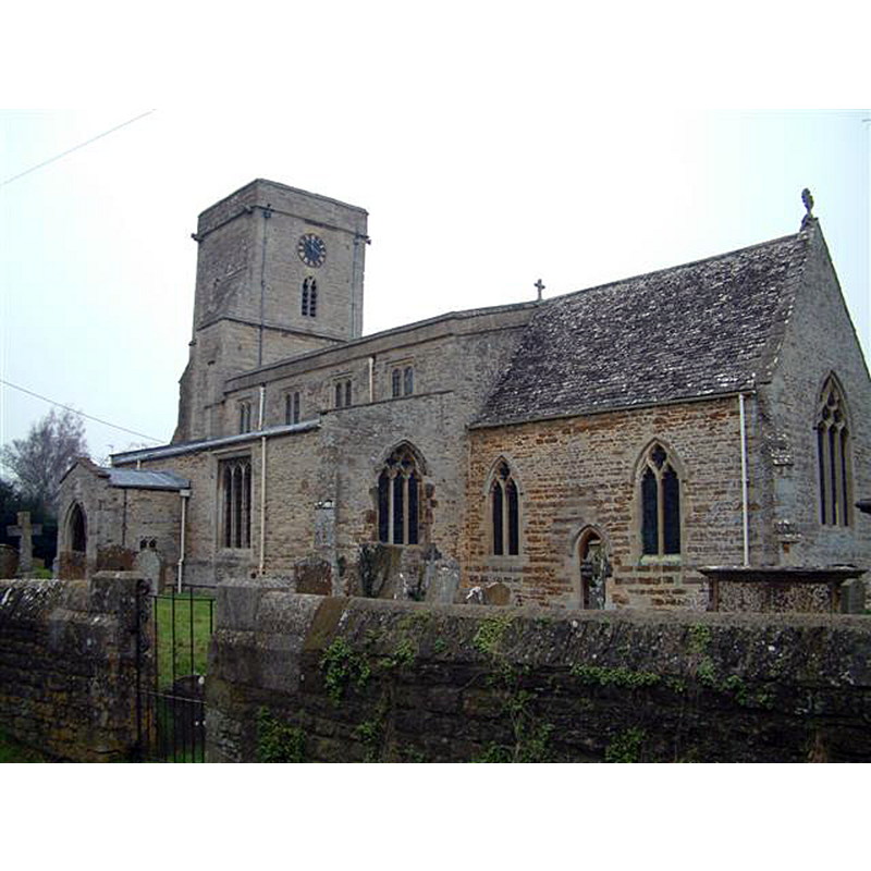
Copyright Statement: Image copyright © Colin Bates, 2006
Image Source: digital photograph taken 23 January 2006 by Colin Bates [www.geograph.org.uk/photo/114091] [accessed 12 December 2016]
Copyright Instructions: CC-BY-SA-2.0
INFORMATION
Font ID: 13032HEY
Object Type: Baptismal Font1
Font Century and Period/Style: 13th century [base only?] [restored in the 17th century] [composite font], Medieval [composite]
Church / Chapel Name: Parish Church of St. Mary
Font Location in Church: Inside the church
Church Patron Saint(s): St. Mary the Virgin
Church Address: Church Lane, Lower Heyford, Oxfordshire OX6 3NZ
Site Location: Oxfordshire, South East, England, United Kingdom
Directions to Site: The two Heyfords (Lower and Upper) are located off (N) the B4030, 11 km WNW of Bicester
Ecclesiastic Region: Diocese of Oxford
Historical Region: Hundred of Hirtlington [in Domesday] -- Hundred of Ploughley
Additional Comments: restored font / altered font (date of its restoration to the church added) -- disappeared font? (the one from the 11thC church here)
Font Notes:
Click to view
There are three entries for [Lower and Upper] Heyford [variant spelling] in the Domesday survey [http://opendomesday.org/place/XX0000/lower-and-upper-heyford/] [accessed 12 December 2016], none of which mentions cleric or church in it. Kelly's Oxford Directory of 1911 reports a "font dated 1662" [NB: the church itself goes back to the Early English period according to Kelly's (ibid.)] The Victoria County History (Oxford, vol. 6, 1959) notes: "The church was dedicated in the mid11th century by Wulfwig, Bishop of Dorchester (1053–67) [...] During most of the Middle Ages the living was divided into two parts and there were two rectors. This arrangement probably began in the 12th century, when Peter de la Mare and his son Robert between the years 1168 and 1173 granted half the church to Eynsham Abbey [...] Eynsham held the advowson of its rectory until the 15th century, when the two rectories were united [...] The only remains of 13th-century work are the built-up responds of a former south arcade [...] The octagonal font is inscribed 1662, although the base is probably medieval". The VCH refers to a "drawing by J. Buckler in MS. Top. Oxon. a 67, f. 323." [i.e., the collection at the Bodleian Library, Oxford]. Sherwood & Pevsner (1974), however, note: "Font. Octagonal, medieval, but dated 1662, when it was restored."
COORDINATES
UTM: 30U 617170 5753570
Latitude & Longitude (Decimal): 51.920519, -1.296196
Latitude & Longitude (DMS): 51° 55′ 13.87″ N, 1° 17′ 46.31″ W
MEDIUM AND MEASUREMENTS
Material: stone
Font Shape: octagonal, mounted
Basin Interior Shape: round
Basin Exterior Shape: octagonal
Drainage Notes: lead-lined
INSCRIPTION
Inscription Language: numbers
Inscription Text: [1662]
Inscription Notes: [cf. FontNotes]
Inscription Source: [cf. FontNotes]
LID INFORMATION
Date: modern?
Material: wood, oak?
Apparatus: no
Notes: octagonal and flat, with metal decoration and ring handle
REFERENCES
- Victoria County History [online], University of London, 1993-. URL: https://www.british-history.ac.uk.
- Kelly, Kelly's Directory of Oxfordshire, London: Kelly's Directories Ltd., 1911, p. 127
- Pevsner, Nikolaus, Oxfordshire, Harmondsworth: Penguin Books, 1974, p. 693