Hethe / Hedham / Heath
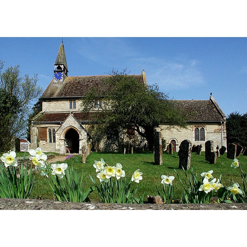
Image copyright © Motacilla, 2011
CC-BY-SA-3.0
Results: 2 records
view of church exterior - south view
Copyright Statement: Image copyright © Motacilla, 2011
Image Source: digital photograph taken 25 March 2011 by Motacilla [https://commons.wikimedia.org/wiki/File:Hethe_SSEdmund%26George_south.JPG] [accessed 12 December 2016]
Copyright Instructions: CC-BY-SA-3.0
view of font

Copyright Statement: Image copyright © The Corpus of Romanesque Sculpture in Britain and Ireland, 2016
Image Source: digital image of a photograph taken by Janet Newson, in the CRSBI [www.crsbi.ac.uk/site/3824/] [accessed 12 December 2016]
Copyright Instructions: PERMISSION NOT AVAILABLE -- IMAGE NOT FOR PUBLIC USE
INFORMATION
Font ID: 13031HET
Object Type: Baptismal Font1
Font Century and Period/Style: 11th - 12th century, Norman
Church / Chapel Name: Parish Church of St. Edmund and St. George
Font Location in Church: Inside the church, W end, S aisle
Church Patron Saint(s): St. Edmund the Martyr [aka Edmund of East Anglia] and St. George
Church Address: Main Street, Hethe, Oxfordshire OX6 9ES
Site Location: Oxfordshire, South East, England, United Kingdom
Directions to Site: Located off the A421, 5 km SW of Finmore, 7 km NNE of Bicester
Ecclesiastic Region: Diocese of Oxford
Historical Region: Hundred of Hirtlington [in Domesday] -- Hundred of Ploughley
Additional Comments: altered font? (the base appears to be a later addition)
Font Notes:
Click to view
There is an entry for Hethe [variant spelling] in the Domesday survey [http://opendomesday.org/place/SP5929/hethe/] [accessed 12 December 2016], but it mentions neither cleric nor church in it. Kelly's Oxford Directory of 1911 reports: "the font is ancient" [NB: Kelly's (ibid.) notes that the church is mostly in the Decorated style]. The Victoria County History (Oxford, vol. 6, 1959) informs: "The church of Hethe was in existence during the lifetime of Norman de Verdun (d. c. 1154), if not earlier [...] The church is in origin a 12th-century structure. Of this Romanesque church there survive the west wall of the nave and the south wall of the chance [...] The plain font was perhaps part of an earlier church." Noted and illustrated in the CRSBI (2016): "Located in the S aisle, a plain tapered font of oolytic limestone, possibly Romanesque. It sits on a cylindrical shallow base of similar width, possibly original. Below, a later octagonal chamfered base. The lead lining extends on to the rim."
COORDINATES
UTM: 30U 627907 5758318
Latitude & Longitude (Decimal): 51.960829, -1.138385
Latitude & Longitude (DMS): 51° 57′ 38.98″ N, 1° 8′ 18.19″ W
MEDIUM AND MEASUREMENTS
Material: stone, limestone (Oolytic)
Font Shape: tub-shaped, mounted
Basin Interior Shape: round
Basin Exterior Shape: round
Drainage Notes: lead-lined
Rim Thickness: 7 cm [Calculated]
Diameter (inside rim): 60 cm*
Diameter (includes rim): 74 cm*
Height of Basin Side: 49 cm*
Basin Total Height: 60 cm*
Notes on Measurements: * CRSBI (2016)
REFERENCES
- Victoria County History [online], University of London, 1993-. URL: https://www.british-history.ac.uk.
- Corpus of Romanesque Sculpture in Britain and Ireland, The Corpus of Romanesque Sculpture in Britain and Ireland, The Corpus of Romanesque Sculpture in Britain and Ireland. URL: http://www.crsbi.ac.uk.
- Kelly, Kelly's Directory of Oxfordshire, London: Kelly's Directories Ltd., 1911, p. 127