Hampton Poyle / Hantone
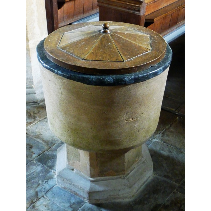
Image copyright © John Ward, 2009
Standing permission
Results: 2 records
view of font and cover
Copyright Statement: Image copyright © John Ward, 2009
Image Source: digital photograph taken 16 March 2009 by John Ward [http://www.flickr.com/photos/oxfordshirechurches/3360575761/] [accessed 1 May 2009]
Copyright Instructions: Standing permission
view of church exterior - south view
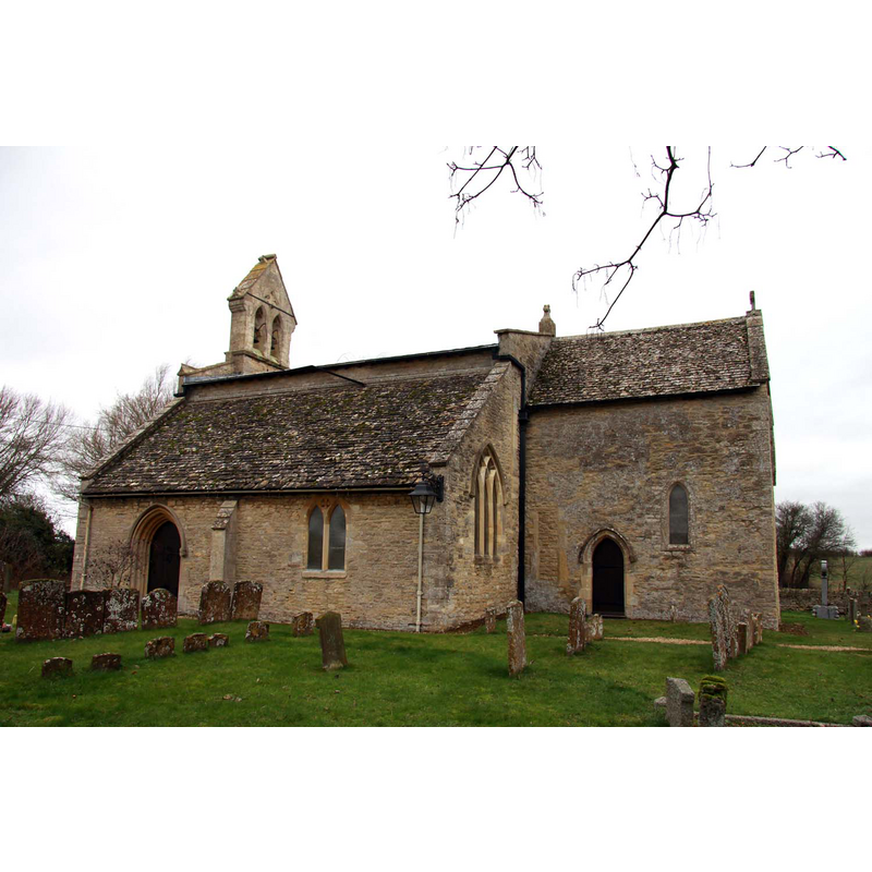
Copyright Statement: Image copyright © Steve Daniels, 2012
Image Source: digital photograph taken 25 January 2012 by Steve Daniels [www.geograph.org.uk/photo/2793877] [accessed 12 December 2016]
Copyright Instructions: CC-BY-SA-2.0
INFORMATION
Font ID: 13028HAM
Object Type: Baptismal Font1
Font Date: ca. 1225?
Font Century and Period/Style: 13th century [basin only] -- 19th century [base only], Medieval [composite]
Church / Chapel Name: Parish Church of St. Mary the Virgin
Font Location in Church: Inside the church
Church Patron Saint(s): St. Mary the Virgin
Church Address: Church Lane, Hampton Gay and Poyle, Oxfordshire OX5 2QF
Site Location: Oxfordshire, South East, England, United Kingdom
Directions to Site: Located 2.5 km from Kidlington, 10 km N of Oxford
Ecclesiastic Region: Diocese of Oxford
Historical Region: Hundred of Kirtlington [in Domesday] -- Hundred of Ploughley
Font Notes:
Click to view
There is an entry for Hampton [Gay and Poyle] [variant spelling] in the Domesday survey [http://opendomesday.org/place/XX0000/hampton-gay-and-poyle/] [accessed 12 December 2016], but it mentions neither cleric nor church in it]. There is no font mentioned in Kelly's Oxford Directory of 1911 in this Early English church, but the "register of baptisms dates from the year 1540", which denotes the presence of a font in the church by that date. The Victoria County History (Oxford, vol 6, 1959) notes: "No record of the church at Hampton Poyle has been found before about 1225, when the rector Simon witnessed a charter for the lord of the manor, William de Hampton. [...] From the first recorded presentation in 1247 or 1248 until the 17th century the descent of the advowson usually followed that of the manor. Much of the church dates from the 13th century [...] The church was considerably altered in the 14th century [...] An extensive restoration began in 1844 [...] About 1870 there was a more general restoration (architect G.E. Street) [...] The font is low and circular, with an octagonal base." Not mentioned in Sherwood & Pevsner (1974).
Credit and Acknowledgements: We are grateful to John Ward, of Oxfordshire Churches [http://homepage.mac.com/john.ward/oxfordshirechurches], for his photograph of this font
COORDINATES
UTM: 30U 618699 5744189
Latitude & Longitude (Decimal): 51.835888, -1.277197
Latitude & Longitude (DMS): 51° 50′ 9.2″ N, 1° 16′ 37.91″ W
MEDIUM AND MEASUREMENTS
Material: stone
Font Shape: bucket-shaped, mounted
Basin Interior Shape: round
Basin Exterior Shape: round
Drainage System: centre hole in basin
Drainage Notes: lead-lined
LID INFORMATION
Date: modern
Material: wood, oak?
Apparatus: no
Notes: round, with slightly raised pyramydal centre ending in tiny knob handle
REFERENCES
- Victoria County History [online], University of London, 1993-. URL: https://www.british-history.ac.uk.
- Kelly, Kelly's Directory of Oxfordshire, London: Kelly's Directories Ltd., 1911, p. 113